




SUUNTOブログ


登山で道迷いを防ぐには?地図・コンパス・GPSウォッチを使ったナビゲーションの基本
登山やトレイルランニングでは、目的地に向かって進むだけでなく、「今どこにいるのか」「次にどちらへ進むのか」を常に把握することが大切です。
山では、分岐の見落とし、天候の変化、視界不良、スマートフォンの電池切れなどによって、思っていたルートから外れてしまうことがあります。よく整備された登山道でも、少しの油断が道迷いにつながることがあります。
道迷いを防ぐには、GPSやスマートフォンだけに頼るのではなく、地図、コンパス、地形を読む力、そしてオフラインマップやGPSウォッチを組み合わせて使うことが重要です。
この記事では、登山やトレイルランで道迷いを防ぐために知っておきたい、山のナビゲーションの基本を紹介します。
目次
登山で道迷いを防ぐには「現在地を把握する力」が大切
GPSだけに頼りすぎない
山で現在地を把握するための基本
地形図を読む練習をする
等高線を理解する
地図と実際の地形を照らし合わせる
コンパスの基本も身につけておく
GPSウォッチとオフラインマップを活用する
山でナビゲーション力を高める練習方法
Suuntoウォッチとコンパスで山のナビゲーションをサポート
まとめ|山では「現在地を知る力」とナビゲーションの準備が大切
登山で道迷いを防ぐには「現在地を把握する力」が大切
© Arc'teryx / Piotr Drozdz
山のナビゲーションで最も大切なのは、現在地を把握することです。
「いま自分がどこにいるのか」「どの尾根を歩いているのか」「次の分岐までどれくらいか」「周囲に見える山や谷は地図上のどこにあるのか」。こうした情報を意識しながら歩くことで、道を間違えたときにも早く気づきやすくなります。
現在地を把握する力は、単に地図上の一点を知ることだけではありません。周囲の地形、分岐、ピーク、沢、尾根、道の向きなどを観察しながら、「地図の情報」と「目の前の景色」を結びつける力です。
最初は難しく感じるかもしれませんが、歩きながら意識して確認する習慣をつけることで、少しずつ身についていきます。
GPSだけに頼りすぎない
GPSウォッチやスマートフォンの地図アプリは、登山やトレイルランニングでとても便利です。現在地、ルート、距離、標高、進行方向を手元で確認できるため、山での行動判断をサポートしてくれます。
一方で、デジタル機器だけに頼りすぎるのは避けたいところです。
スマートフォンの電池切れ、水濡れ、圏外、画面破損、操作ミスなどが起こる可能性があります。GPSウォッチも、バッテリー残量や設定、ルートデータの準備が不十分だと、必要なときにうまく使えないことがあります。
そのため、GPSやスマートフォンは便利なサポートツールとして活用しながら、地図やコンパスを読む基本も身につけておくことが大切です。
特にグループ登山では、ひとりだけがルートを把握している状態よりも、複数人が現在地や進行方向を理解している方が安心です。誰かに任せきりにするのではなく、自分でも「今どこにいるのか」を確認する意識を持ちましょう。
山で現在地を把握するための基本
現在地を把握するには、歩きながら周囲を観察する習慣が大切です。
チェックしたいポイントは以下です。
分岐や標識
尾根、谷、沢、ピーク
登り下りの変化
進行方向
歩いた時間と距離
周囲に見える山や建物
地図上の特徴的な地形
例えば、「次の分岐まであとどれくらいか」「今は登りなのか下りなのか」「地図上ではどの尾根を歩いているのか」を考えながら進むと、道を間違えたときに違和感に気づきやすくなります。
また、分岐を通過したら一度立ち止まり、標識や地図、GPSウォッチのルートを確認する習慣をつけるのもおすすめです。特に下山時は、疲れや安心感から分岐を見落としやすくなります。
「なんとなく進む」のではなく、現在地と次の目印を確認しながら歩くことが、道迷い防止につながります。
地形図を読む練習をする
© Arc'teryx / Piotr Drozdz
地形図は、登山やトレイルランニングでルートを理解するための基本です。
まずは、自分がよく知っている山や公園、ハイキングコースの地形図を見てみましょう。実際に歩いたことのある場所なら、地図上の道、ピーク、谷、川、建物などをイメージしやすくなります。
地形図を見るときは、いきなり難しいルートを読む必要はありません。まずは次のようなポイントを確認してみましょう。
登山道や分岐はどこにあるか
ピークや尾根はどこにあるか
谷や沢はどこにあるか
川や湖、建物などの目印はあるか
ルート全体で登り下りはどのくらいあるか
急な斜面やなだらかな場所はどこか
自宅で地図を眺めるだけでも、山の形をイメージする練習になります。実際に歩いたあとに地図を見返すと、「あの急登はここだったのか」「あの分岐はこの尾根の手前だったのか」と理解しやすくなります。
等高線を理解する
地形図で特に重要なのが、等高線です。
等高線は、同じ高さの地点を結んだ線で、山の形を読み取るための基本情報です。等高線の間隔が狭い場所は急斜面、広い場所は比較的なだらかな地形を示します。
等高線から読み取りたい代表的な地形は以下です。
地形
等高線の見え方
急斜面
等高線の間隔が狭い
なだらかな斜面
等高線の間隔が広い
ピーク
等高線が丸く閉じている
尾根
等高線が谷側へ張り出すように見える
谷・沢
等高線が山側へ食い込むように見える
鞍部
ピークとピークの間の低い部分
尾根、谷、ピーク、鞍部、急斜面などを等高線から読み取れるようになると、実際の地形を見たときに「地図上ではここにいるはず」と判断しやすくなります。
最初はすべてを正確に読む必要はありません。まずは、等高線の間隔を見て「急そうか、なだらかそうか」を予想することから始めてみましょう。
地図と実際の地形を照らし合わせる
地図を読む力は、家で眺めているだけでは身につきにくいものです。実際に山や公園、ハイキングコースで地図を見ながら歩くことで、地図上の情報と目の前の景色がつながっていきます。
練習するときは、まず安全でよく知っている場所を選びましょう。
練習方法
地図を北に合わせる
周囲の山、谷、川、道を確認する
地図上で現在地を推測する
分岐やピークごとに位置を確認する
歩いたルートを後から見返す
地図を北に合わせるとは、地図上の北と実際の北をそろえることです。コンパスを使うと、地図の向きと実際の地形を合わせやすくなります。
地図の向きが合っていると、目の前に見える尾根や谷、川、道の方向と、地図上の情報を照らし合わせやすくなります。
慣れてきたら、見晴らしの良い場所で周囲の山や谷を地図上で探してみるのもおすすめです。地図上のピーク、尾根、川、建物などを目の前の景色と結びつけることで、地形を読む感覚が少しずつ身についていきます。
コンパスの基本も身につけておく
登山やトレイルランニングでは、GPSウォッチやスマートフォンが便利ですが、コンパスの基本も知っておくと安心です。
コンパスは、進行方向や地図の向きを確認するための道具です。特に視界が悪いとき、分岐がわかりにくいとき、現在地と進行方向を確認したいときに役立ちます。
まず覚えておきたいのは、以下の3つです。
地図を北に合わせる
自分が進む方向を確認する
目印となる地形や方向を決める
コンパスを使うときは、地図とセットで考えることが大切です。コンパスだけを見て進むのではなく、地図上のルート、周囲の地形、現在地をあわせて確認します。
Suuntoには、登山やアウトドアで使いやすいコンパスもあります。GPSウォッチやスマートフォンと組み合わせて、アナログのナビゲーション手段を持っておくと、山での行動に安心感が生まれます。
▶︎Suuntoのコンパスを見る
GPSウォッチとオフラインマップを活用する
地図とコンパスの基本を身につけたうえで、GPSウォッチやオフラインマップを活用すると、山でのナビゲーションはさらに安心感が高まります。
対応するSuuntoウォッチでは、事前にルートを準備し、ウォッチ上でルートナビゲーションやオフラインマップを確認できます。スマートフォンを毎回取り出さなくても、手元で現在地や進行方向、ルートを確認しやすくなります。
GPXファイルを使ってルートを追加したい方は、Suuntoアプリのルートプランナーを使ってウォッチにルートを同期する方法も確認しておくと便利です。
▶︎関連記事:GPXルートをSuuntoウォッチに追加する方法|ルートプランナーを使った設定手順
登山やトレイルランでGPSウォッチを使うときは、出発前に以下を確認しておくのがおすすめです。
ルートデータを準備しているか
必要なエリアのオフラインマップを保存しているか
ウォッチのバッテリー残量は十分か
ナビゲーションやGPS設定を確認したか
スマートフォンや紙の地図などのバックアップを用意したか
GPSウォッチは、現在地やルートを手元で確認できる便利な道具です。ただし、あくまでナビゲーションをサポートするツールです。バッテリー残量、設定、地図データ、ルートの事前準備を確認し、紙の地図やコンパスなどのバックアップも用意しておきましょう。
ルート上の登り下りを事前に確認したい方は、Suuntoクライムガイダンスも便利です。
▶︎関連記事:登山・トレイルランのルートナビゲーション|Suuntoクライムガイダンスの便利な使い方
山でナビゲーション力を高める練習方法
山のナビゲーションは、知識として読むだけでなく、実際に使ってみることで身についていきます。
最初から難しい山域で練習する必要はありません。よく知っている山、公園、低山、ハイキングコースなど、安全に歩ける場所で少しずつ試してみましょう。
1. よく知っている場所の地図を見る
まずは、自分がよく歩く場所の地図を用意します。
地図上で、知っている道、分岐、建物、川、ピーク、広場などを探してみましょう。実際の景色を思い出しながら地図を見ることで、地図記号や等高線の意味が理解しやすくなります。
2. 歩いたルートを地図で振り返る
最近歩いた山やハイキングコースがあれば、どこを通ったか地図上でたどってみましょう。
登りがきつかった場所、下りが長かった場所、分岐で迷いそうになった場所を地図上で確認すると、実際の体験と地図の情報がつながります。
3. 現地で地図と地形を見比べる
安全な場所で、地図を北に合わせ、周囲の景色と照らし合わせてみましょう。
「見えている尾根は地図上のどこか」「この谷はどの方向に伸びているか」「次の分岐はどのくらい先か」を考えながら歩くと、現在地を把握する感覚が身につきやすくなります。
4. 見晴らしの良い場所で地形を読む
展望のある場所では、周囲の山、谷、川、街、建物などを地図上で探してみましょう。
地図と実際の景色を見比べることで、等高線や地形の理解が深まります。
5. 仲間と現在地を確認し合う
グループで歩く場合は、現在地や次の分岐を仲間と確認し合うのも良い練習になります。
「今どの尾根にいるか」「次はどちらへ進むか」「地図上ではどこにいるか」を声に出して共有することで、ひとりにナビゲーションを任せきりにせず、グループ全体の安心感にもつながります。
Suuntoウォッチとコンパスで山のナビゲーションをサポート
Suuntoは、登山、トレイルランニング、アドベンチャーなど、アウトドアで使えるナビゲーションツールを展開しています。
対応するSuuntoウォッチでは、GPS記録、ルートナビゲーション、オフラインマップ、標高、気圧、コンパス、日の出・日の入りなど、山での行動判断に役立つ情報を確認できます。
オフラインマップ対応ウォッチ
オフラインマップ対応のSuuntoウォッチは、登山やトレイルランニングで現在地や周辺地形を確認したい方に向いています。事前に必要な地図を保存しておくことで、スマートフォンの電波が不安定な場所でもウォッチ上で地図を確認しやすくなります。
▶︎オフラインマップ対応ウォッチはこちら
高度・気圧・コンパスをシンプルに確認したい方へ
Suunto Coreは、気圧計、高度計、コンパスを備えたアウトドアウォッチです。GPSやオフラインマップは搭載していませんが、天気や気圧、高度、方角をシンプルに確認したい方には選択肢になります。
▶︎Suunto Coreを見る
アナログコンパスもバックアップに
デジタル機器を活用する場合でも、紙の地図やアナログコンパスをバックアップとして持っておくと安心です。特に長時間の山行、電波が不安定な場所、天候が変わりやすい場所では、複数の確認手段を用意しておくことが大切です。
▶︎Suuntoのコンパスを見る
登山やトレイルで天気を確認する方法については、こちらの記事も参考にしてください。
▶︎関連記事:登山やトレイルで天気を確認する方法|Suuntoウォッチで気圧・日没・ストームアラームを活用
まとめ|山では「現在地を知る力」とナビゲーションの準備が大切
登山やトレイルランニングで道迷いを防ぐには、現在地を把握する力が大切です。
GPSウォッチやスマートフォンは便利なナビゲーションツールですが、それだけに頼りすぎず、地図、コンパス、地形を読む力も身につけておくと安心です。
まずは、よく知っている場所の地形図を見て、実際の景色と照らし合わせることから始めてみましょう。等高線、尾根、谷、ピーク、分岐などを少しずつ理解できるようになると、山での行動判断がしやすくなります。
対応するSuuntoウォッチのオフラインマップやルートナビゲーション、そしてコンパスや紙の地図を組み合わせながら、自分の現在地と進む方向を確認する習慣をつけていきましょう。
山をもっと安心して楽しむために、ナビゲーションの基本を日々の登山やトレイルランで少しずつ身につけてみてください。
▶︎Suuntoのアウトドア・登山ウォッチを見る

運動する人のための食事・栄養ガイド|パフォーマンスを支える6つの基本原則
運動のパフォーマンスや回復を支えるうえで、日々の食事はトレーニングと同じくらい大切です。しかし、栄養に関する情報は多く、「糖質を減らすべき?」「プロテインは必要?」「運動前後に何を食べればよい?」と迷うこともあるでしょう。
大切なのは、特定の食品や厳格なルールに頼ることではなく、自分の運動量と生活に合った食事を継続することです。本記事では、ランニング、サイクリング、登山、トライアスロンなどに取り組む人が意識したい栄養の6つの基本原則を紹介します。
目次
食事を楽しむ
できるだけ質のよい食材を選ぶ
糖質を適切に摂る
たんぱく質で回復を支える
良質な脂質を取り入れる
水分補給を習慣にする
SUUNTOで運動と補給を振り返る
まとめ
1. 食事を楽しむ
最初の原則は、食事を楽しむことです。栄養素やカロリーだけに意識が向くと、食事が義務のようになり、続けることが難しくなります。家族や仲間と食卓を囲むこと、旬の食材を味わうこと、自分で料理することも、健やかな食習慣の一部です。
一度の食事だけでコンディションが決まるわけではありません。完璧を求めすぎず、数日から数週間の全体的なバランスで考えましょう。運動量の多い日は十分に食べ、休養日には空腹感や活動量に合わせて調整するなど、身体の反応に目を向けることが大切です。
2. できるだけ質のよい食材を選ぶ
食事の土台には、野菜、果物、穀類、いも類、豆類、卵、魚、肉、乳製品など、加工度の低い多様な食品を選びます。こうした食品からは、エネルギー源となる栄養素だけでなく、ビタミン、ミネラル、食物繊維も摂取できます。
毎食、主食・主菜・副菜をできる範囲でそろえる
色の異なる野菜や果物を組み合わせる
忙しい日は冷凍野菜、缶詰、ヨーグルトなども活用する
特定の「スーパーフード」だけに頼らず、食材の種類を増やす
競技や健康のための食事は、特別な食材だけで作るものではありません。入手しやすく、無理なく続けられる食品を中心に組み立てることが現実的です。
3. 糖質を適切に摂る
糖質は、ランニングやサイクリングなどの運動で重要なエネルギー源になります。運動強度が上がるほど糖質への依存度も高まりやすいため、活動量の多い人が必要以上に糖質を避けると、トレーニングの質や回復に影響する場合があります。
ごはん、パン、麺類、オートミール、いも類、果物などを、運動量や予定に合わせて取り入れましょう。長時間または高強度の運動前には、消化しやすく食べ慣れた糖質源を選ぶと準備しやすくなります。運動中の補給が必要かどうかは、運動時間、強度、気温、個人差によって変わります。
糖質や脂質が運動中にどのように利用されるかは、身体を動かす3つのエネルギー供給機構でも詳しく解説しています。
4. たんぱく質で回復を支える
たんぱく質は、運動によって負荷を受けた筋肉や組織の修復を支えます。肉や魚だけでなく、卵、乳製品、大豆製品、豆類など、さまざまな食品から摂ることができます。
一度の食事に偏らせるより、朝・昼・夕の食事や必要に応じた間食に分けて摂ると、日常の食事へ組み込みやすくなります。トレーニング後は、糖質とたんぱく質を含む食事を摂ることで、使ったエネルギーの補充と身体の回復を同時に支えられます。
おにぎりと卵、魚、鶏肉、豆製品
パンとヨーグルト、牛乳、果物
うどんと卵、肉、野菜
プロテイン製品は便利な選択肢ですが、すべての人に必須ではありません。まずは普段の食事で必要量を満たせるかを考えます。
5. 良質な脂質を取り入れる
脂質はエネルギー源になるほか、細胞やホルモンの材料となり、脂溶性ビタミンの吸収にも関わります。運動する人にとっても必要な栄養素であり、極端に避ける必要はありません。
魚、ナッツ、種子、アボカド、オリーブオイルなどを食事に取り入れ、食品の種類を分散させましょう。ただし、脂質は消化に時間がかかるため、運動直前に大量に摂ると胃の重さにつながる人もいます。運動前の食事は、開始までの時間と自分の消化のしやすさに合わせて調整してください。
6. 水分補給を習慣にする
水分は体温調節や身体機能を保つために欠かせません。必要量は、気温、湿度、運動時間、強度、体格、発汗量などで変わります。全員が同じ量を飲むのではなく、日常の水分摂取に加え、運動時の環境と自分の発汗傾向を把握することが重要です。
運動前からこまめに水分を摂り、直前に大量に飲まない
長時間の運動や発汗量が多い日は、食事や飲料から電解質も補う
練習前後の体重や飲水量を記録し、自分の傾向を確認する
水分を過剰に摂り続けない
水分は「多いほどよい」わけではありません。運動中に水分を過剰摂取すると、運動関連低ナトリウム血症につながる可能性があります。のどの渇き、発汗量、天候、運動時間を踏まえて調整してください。
SUUNTOで運動と補給を振り返る
軽量でランニングの記録や水分・栄養補給のリマインダーに対応するSuunto Run
食事は、運動の内容と一緒に振り返ることで改善しやすくなります。運動時間、強度、心拍数、疲労感と、その日の食事や水分補給を簡単に記録し、「後半に力が出なかった」「暑い日に水分が足りなかった」といった傾向を探してみましょう。
Suunto Runには、運動中の水分・栄養補給を促すリマインダーがあります。長時間のランニングなどで補給を忘れやすい場合に役立ちます。また、対応するSUUNTOウォッチでは、SuuntoPlus Storeから栄養補給に関連するスポーツアプリやガイドを利用できる場合があります。対応状況はモデルやソフトウェアによって異なるため、Suuntoアプリで確認してください。
ウォッチの記録やリマインダーは、自分の習慣を整えるための道具です。数値だけを追うのではなく、空腹感、胃腸の状態、疲労、睡眠、翌日の回復も含めて判断しましょう。
まとめ:完璧な食事より、続けられる習慣を
運動する人の食事では、食事を楽しみ、多様な食材から糖質、たんぱく質、脂質、水分をバランスよく摂ることが基本です。競技種目や運動量、目標、体質によって必要な内容は異なるため、誰かの食事法をそのまま再現する必要はありません。
まずは毎日の食事と運動後の体調を振り返り、自分に合う方法を少しずつ見つけてください。持病、食物アレルギー、摂食障害の既往がある場合や、強い疲労、体重減少、月経異常、繰り返す胃腸症状などがある場合は、医師またはスポーツ栄養の資格を持つ専門家に相談してください。
毎日の運動とコンディションを記録しよう
トレーニングの記録や補給リマインダーに対応するSUUNTOスポーツウォッチをチェックしてください。
SUUNTOスポーツウォッチを見る

Fuelling the engine: talking nutrition with Greg Hill
Record-breaking ski mountaineer, adventurer and Suunto ambassador Greg Hill has always been a foodie. Eating well is about enjoyment, which also serves his nutritional needs. He approaches it in that order, not vice versa.
“Nutrition has always been important but more so because I really enjoy eating great food,” he explains. “Yet I also understand that the fuel we put in our bodies determines how well it runs. Much like an engine, if you put bad gas into it, it will run poorly.”
Photo by Angela Percival/ Arcteryx
Fresh colors
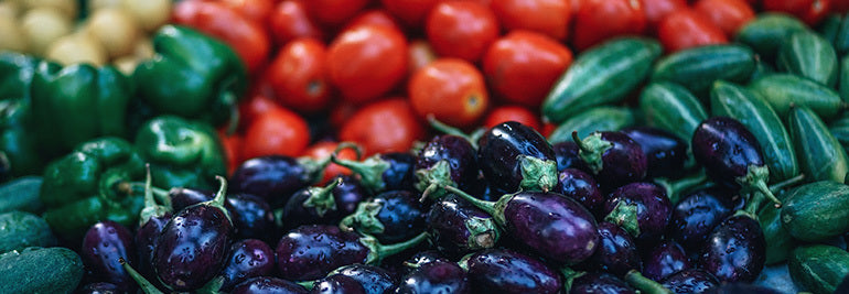
Greg tries to eat fresh vegetables with a variety of colors, which he says indicates nutritional richness. Whenever possible, he also cooks with food from local sources. “I do grow a small garden every year, with tomatoes, potatoes, garlic, carrots, broccoli, beets, just your basics,” he says. “It’s so nice to go and grab them directly from my yard.”
Week day diet
Greg and his family are following the “week day vegetarian diet”, meaning they only meat on the weekends. This contributes to personal health and reduces their impact on the planet. “The personal health side is pretty clear, there are so many articles about reducing red meat in your diet and the benefits involved, from a reduced potential for cancer to lower cholesterol, to living longer,” he says.
“One of the simplest way to decrease my family’s carbon footprint was to decrease our meat intake; livestock farming is responsible for 20-50 per cent of the greenhouse gases, so this was an easy way to become better earth dwellers. If you ever look into livestock it is amazing the deforestation involved, the extreme water usage and over un-sustainability of it.
Photo by Angela Percival/ Arcteryx
Healthy balance
While the Hills like to keep it fresh, they also allow themselves to indulge in a fast food meal once a week, like ordering a pizza on Friday movie night. Perfection is not the goal, Greg says, just as long as the the bulk of their diet is fresh, healthy food.
“Like every family we have certain meals that are staples, enchiladas, lasagna, salad rolls, pad thai, pizza on friday nights, and my favourite – the glory bowl,” he says.
Tofu glory bowl
In the bowl
2 cups cooked brown rice1/2 cup grated beetroot1/2 cup grated carrots1/2 cups almonds, toasted1/2 cups spinach leaves1 cup tofu, cubed
Dressing
1/4 cup tahini1/4 cup apple cider vinegar1/2 cup nutritional yeast flakes2 gloves garlic3 tablespoons tamari1 tablespoon maple syrup1/4 cup olive oil1/4 cup water
Instructions
Prepare the brown rice and set aside.Fry tofu cubes in a pan.Add dressing ingredients into a blender to prepare the dressing. Add oil in a steady stream. Taste, and thin with water if required.Assemble the bowls by placing cooked brown rice into two bowls, top with beets, carrots, spinach leaves, almonds and fried tofu cubes.Drizzle bowls with dressing.
Lead image: Photo by Fancycrave on Unsplash.
Click below to read articles in our Fuelling the Engine series:
Fuelling the engine: talking nutrition with Lucy Bartholomew
Fuelling the engine: talking nutrition with Emelie Forsberg
Fuelling the engine: a commonsense approach to nutrition
Fuelling the engine: talking nutrition with Ryan Sandes
Fuelling the engine: talking nutrition with Ultracycling Man
Fuelling the engine: talking nutrition with Mel Hauschildt
D.I.E.T (disaster imminent every time), and three unchanging principles of nutrition for athletes


7 principles to help you find the flow
If there’s one way to get athletes talking, it’s to ask them about their flow experiences. They sit up, smile, and recall incredibly vivid experiences they will cherish for the rest of the lives. In many ways, flow states are the big reward that keep us going. Kind of like the panoramic view at the top of a mountain that makes the arduous climb worthwhile.
Flow states are a basic human potential. They are available to all of us, not only elite athletes, musicians and artists. With a little knowledge, dedication and practice, we can increase the likelihood of having a flow state experience.
According to mental coach Markus Arvaja, flow states are thoroughly immersive experiences. In his work with top ice hockey, football and tennis players, he tries to put in place the conditions that make flow states, when performance becomes almost effortless, more likely. Markus is a certified sports psychology consultant and senior lecturer in coaching at Finland’s Haaga-Helia University of Applied Sciences.
Click here to read our article explaining the science flow states!
No challenge, no flow
“First,” Markus says, “you need to have a feeling of being challenged, but that you have the competency and self confidence to handle it.” It’s a delicate balance. If the challenge is too great, and you feel out of your depth, lacking the skills for an activity, then it’s unlikely you will experience a flow state. There’s simply too much mental activity happening.
On the other hand, if the task is too easy, and the challenge is too low, then you are likely to be bored, also making flow state unlikely. The sweet spot is somewhere in the middle. So consider what might be a reasonable challenge for you, one that you feel confident in your skills and ability to take on.
Feel positive
The next essential condition for flow state experiences is motivation. “It helps if you can achieve your optimal arousal,” Markus explains. “You need to feel that you are really into the activity.” There’s another balance here. One extreme is boredom, the other is being too excited, almost nervous with anticipation. In the middle is relaxed enthusiasm. One way to achieve this is to remember the reasons you love your sport, what it gives you, a few minutes before you perform. Or maybe listening to music motivates you.
Automate the skill set
The reason top athletes and musicians experience flow is because they have put in the countless hours necessary to master their chosen activities. Whatever your sport, you need to have automated the skills required to experience flow. The action should come naturally from the body without any need for thinking or assesment. “If you don’t trust your technique, it’s hard to achieve the flow,” Markus says. “It’s important you train so much that you are well prepared and can get let go and let it happen. The moment you start to think too much, it’s hard to be in the flow.”
One thought at a time
Did we mention that thinking too much might obstruct a flow state? In the mindfulness movement, teachers talk about the “monkey mind”. Like we often jump from one thought to another, a monkey jumps from branch to branch incessantly. Constant thinking is tiring and distracting. “One good thing to do is to shift your focus to the activity at hand,” Markus says. “For example, if you are a tennis player, you could totally concentrate on moving your feet. It helps to concentrate on one or two things only. If you can do that, you might start to notice the flow. Just play the game and enjoy!”
Have a plan
Having a plan is very helpful, Markus says. For example, if you’re going to run a trail race, the plan might include having your own guidelines for pace, fuelling and heart rate. Well before the race, you might study the course, even train on it to get familiar, so on race day you know when to push and when to take it easy. “Make a plan at home,” Markus says. “That’s what we do in team sports. The less you think on the day, the better you perform.”
Practice mindfulness
“Mindfulness certainly helps,” Markus says. “If your mind is free of worry, and unnecessary thoughts, you can stay in the present moment. It’s good to learn to quiet the mind, to turn off the inner critic. Learn to simplify and focus on one thing.”
Play!
Yes, it’s important to have goals, to have a plan, to automate skills, and to be motivated. But if we get too serious, we risk getting too severe with ourselves and then the sport we once loved can feel like a strain. “Just play!” Markus always tells his clients. “It helps when you are positive and having fun. You can’t force the flow!”


Red Bull X-Alpsとは?徒歩とパラグライダーでアルプスを越える究極の冒険レース
山を登り、風をつかんで飛び、飛べなければ再び歩く。Red Bull X-Alps(レッドブル・エックスアルプス)は、徒歩とパラグライダーだけでアルプスを進む「ハイク&フライ」のアドベンチャーレースです。
必要なのは体力や飛行技術だけではありません。天候、地形、空域、疲労を読みながら、いつ飛び、どこに着陸し、どこから再び離陸するかを判断し続けます。本記事では大会の仕組みを解説し、2019年に発表された1,138kmのルートから、そのスケールと難しさを振り返ります。
目次
Red Bull X-Alpsとは?
なぜX-Alpsは過酷なのか
2019年大会は1,138km・13ターンポイント
2019年ルートを象徴する難所
個人競技に見えて、チームで挑むレース
Suuntoが支えた2019年の挑戦
まとめ:一歩と一度の飛行をつなぐ冒険
Red Bull X-Alpsとは?
Red Bull X-Alpsは、世界各地から選ばれたトップクラスのパラグライダーパイロット兼アドベンチャーアスリートが、アルプスを横断するレースです。2003年に始まり、原則として2年ごとに開催されています。
選手が前へ進む手段は、自分の足とパラグライダーのみです。まず飛び立てる場所まで歩いて登り、上昇気流や風を利用して距離を伸ばします。飛行条件が整わないときや着陸後は、パラグライダーを含む装備を背負って再び徒歩で進みます。このスタイルが「ハイク&フライ」です。
要素
X-Alpsで求められること
徒歩
装備を背負い、離陸地点やターンポイントまで長距離・大きな標高差を進む
飛行
風、上昇気流、雲、地形、空域を読み、安全に飛行・着陸する
ルート判断
飛行距離だけでなく、着陸後の登り返しや次の離陸地点まで考える
回復
限られた休息時間で食事、睡眠、身体のケアを行う
コースやターンポイント、細かな競技規則は開催年ごとに変わります。観戦ではGPSによるライブトラッキングを通じて、選手が歩いているのか飛んでいるのか、どのルートを選んだのかをリアルタイムで追えることも大きな魅力です。
なぜX-Alpsは過酷なのか
パラグライダーなら徒歩より速く進めるように見えます。しかし、飛べるかどうかは天候と地形に左右されます。雨、強風、低い雲、雪に覆われた山では、上昇気流を利用できないことがあります。飛行を断念すれば、選手は装備を背負い、谷から次の山へ何時間も歩かなければなりません。
着陸地点の選択も戦略です。進行方向へ少しでも遠く飛ぶことだけを考えると、深い谷に降りて大きく登り返す場合があります。次に飛び立てる斜面、道路、気象の変化まで読み、空と地上をひとつのルートとして組み立てる必要があります。
さらにアルプスには、氷河、高峰、複雑な谷、飛行制限空域があります。長時間の持久力に加え、疲労した状態でも安全に関わる判断の質を落とさないことが重要です。X-Alpsは専門的な飛行技術と山岳経験を持つ選手のための競技であり、一般の登山やパラグライダーで再現できる挑戦ではありません。
2019年大会は1,138km・13ターンポイント
ここから紹介するのは、2019年に開催された第9回大会のルートです。オーストリアのザルツブルクからモナコまで、直線距離で1,138km。32人の選手が13のターンポイントを通過しながら、オーストリア、ドイツ、イタリア、スイス、フランスの5か国を進みました。
前年大会よりターンポイントが大幅に増え、アルプスを南北に5回横断するジグザグのルートでした。距離だけを見ても長大ですが、実際の移動距離は選手が選ぶ飛行経路や徒歩ルートによって変わります。2019年当時、ベテラン選手のポール・グシュルバウアーは、残雪が多い山域では上昇気流が発達せず、標高2,500m付近を徒歩で越える可能性にも触れていました。
2019年大会の数字距離:1,138km/選手:32人/参加国:20か国/ターンポイント:13地点/通過国:5か国
これらは2019年大会の情報です。現在の大会も徒歩とパラグライダーで進む基本コンセプトを受け継いでいますが、距離、ルート、参加人数、競技規則は開催年によって異なります。
2019年ルートを象徴する難所
序盤:空港周辺の制限空域を避ける
ザルツブルクをスタートした選手は、パラグライダーを背負って標高1,288mのガイスベルクへ登ります。その後の区間では山を越えながら、ザルツブルク空港周辺の制限空域を避ける必要がありました。最短距離だけでは決められない、X-Alpsらしいルート判断が序盤から始まります。
ドイツからイタリアへ:雪、氷河、強風
アシャウからイタリアのクロンプラッツへ向かう区間では、雪に覆われた山々や氷河、ドロミテの地形、強風が選手を待ち受けます。着地点を誤って谷へ降りれば、標高2,275mのターンポイントまで長い登り返しが必要です。飛行技術と、その後の徒歩区間を見通す判断が一体になります。
ティトリス周辺:飛べなければ高所まで歩く
スイスのティトリスへ向かう区間は、悪天候の影響が大きい場所でした。飛べない場合は徒歩で高所のターンポイントへ向かわなければならず、主催者が定めたアクセス条件によってルート選択も複雑になります。
アイガー、モンブラン、モンテ・ヴィーゾ
後半には、アルプスを代表するアイガーやモンブランを通過します。山頂へ立つのではなく、GPSで指定された仮想シリンダーを通過したり、定められた側から山を回り込んだりする課題が設定されました。さらにイタリアのモンテ・ヴィーゾ周辺では、複雑な山と谷を読みながら進む必要がありました。
フィニッシュ直前:低い山にも潜む落とし穴
計時上の最終地点は、標高709mのフランス・ペイユ。これまでの高峰と比べれば低く見えますが、手前には丘が連なり、上昇気流を読み違えると着陸して徒歩へ切り替えることになります。その先、モナコの地中海に浮かぶフロートが2019年大会のセレモニアルフィニッシュでした。
個人競技に見えて、チームで挑むレース
実際に歩き、飛ぶのは選手自身ですが、X-Alpsは一人だけで完結する競技ではありません。各選手には公式サポーターがつき、気象とルートの情報整理、戦略、食事、移動、身体とメンタルのケアなどを支えます。
選手は上空や山中で刻々と変化する状況を見ながら、サポートチームから得た情報と現地の感覚を照合します。速く進むルートが、必ずしも最後まで進み続けられるルートとは限りません。翌日の天候、補給、睡眠、身体の状態まで含めて選択する点に、アドベンチャーレースとしての奥深さがあります。
ライブトラッキングでは、同じターンポイントを目指す選手が別々の谷や尾根を選ぶ場面も見られます。単純な順位だけでなく、「なぜそのルートを選んだのか」を想像しながら追うと、観戦のおもしろさが増します。
Suuntoが支えた2019年の挑戦
2019年大会に合わせて登場したSuunto 9 Baro Red Bull X-Alps Limited Editionは、当時のルート距離にちなみ1,138本が用意された限定モデルでした。これは2019年当時の製品であり、現在のモデルではありません。
長大な山岳ルートでは、現在地、予定ルート、標高、行動時間を把握し、記録を途切れさせないことが重要です。ただし、GPSウォッチは天候、地形、飛行可否を自動的に判断するものでも、安全を保証するものでもありません。競技では専門機器、公式情報、サポートチーム、選手自身の経験を組み合わせて判断します。
現在の長距離アウトドアでは、Suunto Vertical 2がオフラインマップ、ルートナビゲーション、長時間のGPS記録に対応しています。地図とルートは役割が異なるため、出発前に必要な地図エリアと予定ルートの両方を準備しておくことが大切です。操作方法は「Suunto Verticalシリーズでオフラインマップを使う方法」と「SUUNTOの地図・ナビゲーション画面の見方」で詳しく紹介しています。
まとめ:一歩と一度の飛行をつなぐ冒険
Red Bull X-Alpsは、徒歩とパラグライダーを交互に使うだけのレースではありません。山を読み、空を読み、疲労と向き合い、サポートチームとともに次の一手を決め続ける冒険です。
2019年の1,138kmルートは、制限空域、雪と氷河、強風、複雑な谷、着陸後の登り返しを組み合わせ、ハイク&フライの厳しさとおもしろさを鮮明に示しました。大会ルートが変わっても、自分の足で高度を稼ぎ、風に乗り、また歩き始めるというX-Alpsの本質は変わりません。
山での長時間行動では、事前のルート計画と現地での確認を重ねることが基本です。Suuntoのアウトドアウォッチは、オフラインマップ、ナビゲーション、標高、行動記録をひとつの手元で確認し、次の判断に必要な情報を整理する助けになります。
長い冒険を支えるSuunto Vertical 2
オフラインマップ、ルートナビゲーション、長時間バッテリーを備えたアウトドアGPSウォッチを確認してください。
Suunto Vertical 2を見る


