


SUUNTOブログ

Finding the flow
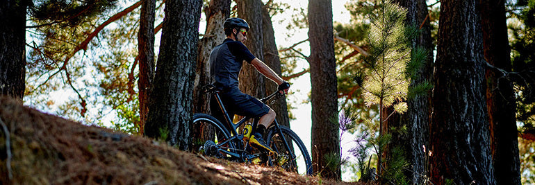
Photo by Alex Gorham on Unsplash
Studies on flow states show when athletes are experiencing them the thinking part of their brain is offline. “The less you think, the better you perform,” quips Markus Arvaja, a certified sports psychology consultant and senior lecturer in coaching at Finland’s Haaga-Helia University of Applied Sciences. “We’ve studied athletes, the best of the best, studied their brains when they perform, and they have less brain activity in their prefrontal cortex. Which means they have automated their skills so they can purely enjoy their sport.”
When he’s not teaching at university, Markus, himself an ice hockey, football and tennis player, works as a mental coach for Finland’s national women’s ice hockey team and the national youth tennis team. He’s a board member of the Finnish Society of Sports Psychology. He’s passionate about people performing at their absolute best.
“Studies show peak flow states are intrinsically motivating experiences,” he says. “People become so involved in an activity that they are on automatic pilot, totally absorbed in that experience. It’s a merging of action and awareness. Thing is, you can’t force yourself to go into flow. But their are elements that help you enter into the flow space.”
Flow states, peak performance, being in the zone, runner’s highs; these are all interchangeable terms describing the transcendent experiences athletes, artists, musicians and creatives report having. Maybe you’ve experienced one yourself. Time slows down, you become totally immersed in the task at hand, it feels effortless, maybe the world seems more vivid, and you have sense of mastery. They are when athletes have their best performances and, according to Mihaly Csikszentmihalyi, who wrote a seminal book on the topic, they are a key aspect of human happiness. It’s something we can all experience, not only elite athletes and artists.
Neuroscience has revealed much about what’s happening in the brain during a flow state. Brain waves change from beta, more rapid waves underlying waking consciousness, to somewhere between alpha and theta waves, where we daydream and first enter into sleep. This is when many people have their best ideas. Neurochemicals associated with pleasure and performance – endorphin, serotonin, dopamine, norepinephrine and anandamide – are the raw ingredients of flow. Perhaps the most interesting fact is how different regions of the brain respond during flow; for example, studies have found the prefrontal cortex, the area of the brain associated with self monitoring – and also self criticism – goes offline during flow. Instead of constantly analysing and evaluating, we do things spontaneously.
“Sometimes coaches can interrupt the flow happening for athletes by giving too much information for the athletes’ minds,” Markus says. “It’s better to say only one or two things.
“For flow, your mind should be free of worry and unnecessary thoughts. Stay in the present moment by quieting the mind and turning off the inner critic. Mindfulness certainly helps with this.”
Stay tuned for the next article in our series on flow: the ingredients of flow.

Chasing meters: top stories from Vertical Week 2019
The fourth annual Suunto Vertical Week is coming to a close and we have selected three winners of the week’s photo contest on Instagram. Each of them will receive a powerful Suunto 9 to record their efforts! We received many other inspiring images and stories (#verticalweek) – thanks to everyone for their contributions! Keep climbing!
Baby in tow in Norway
We were very impressed by Hilde Hoff Nordskar in Norway. She climbed 3246 m in a week, while towing her seven-month-old baby boy, who slept through it all. Some have it easy! Well done, Hilde!
“Vertical Week was overall very hard and fun and brought some new inspiration to my maternity leave,” Hilde says. “We live close to a forest and my daily goal was to summit the top of a nearby peak called 'Solobservatoriet' (580 m). With my seven-month-old son in the wagon behind, I started every morning skinning up the hill no matter the weather. The highlights was to experience the uphill in all these different winter wonderland conditions and finish every session with a big smile on my face and a very rested kid.”
View this post on Instagram
Punta di Terrarossa 🏔 3246 meters climbing in a week 🎿👶🏻 #VerticalWeek #Suuntoapp @suunto_norge @suunto @thule #thulebringyourkids #dæhlie
A post shared by hildehoffnordskar (@hildehoffnordskar) on Mar 9, 2019 at 8:48am PST
Big training block in California
Eric Triplett in sunny California enjoyed a big week, climbing 3500m. This beautiful shot of sunrise from Mount Wilson illustrates the motivation behind the call to scale peaks; massive rewards for our hard work.
“Suunto Vertical Week was the perfect way to finish up a three month training block for my upcoming race,” Eric says. “The race features 3000 m of climbing over 56 km so my primary goals for Vertical Week were to simulate the amount of gain relative to the distance of my race and to accumulate at least 3000 m of gain. I’m happy to say I was able to complete 3500 m for the week including a 33 km run with 2100 m of vertical. Thanks to Suunto for putting on this motivating celebration of vertical!”
View this post on Instagram
The sun rises on the last day of #VerticalWeek 2019 // It’s been a while since I’ve cracked 11,000ft of gain in a week so I made it a goal given both Vertical Week and that 9 Trails is coming in just two weeks. Admittedly going beyond 10,000ft seems to bring on the sore knees and other random leg pain but that only serves to highlight what to work on in the future // Been super excited about getting my hands on “Training for the Uphill Athlete” by House, Johnston and Jornet. I think it’s going to help take things next level. // I’m also very happy with where @Sagerunning training has taken me in the last 3 months. I’ve never thought I could maintain the kind weekly mileage that I have for so long. I was always afraid to put intervals into 20mi+ runs but I survived. It hasn’t been easy but listening to my body and making small adjustments has got me through. // #utlrarunning #trailrunning #runinrabbit #borntorunfree #rabbitTrail #RADrabbit #gotailwind #timetoplay #salomon #suunto #salomonrunning #9T #NineTrails #sagerunning #SanGabrielSunday #longrun #ANF
A post shared by Eric Triplett (@fleshymutant) on Mar 10, 2019 at 9:08pm PDT
New season in Finland
Janne Korpela in Finland has begun a new training block now spring has nearly arrived. It hasn’t been in a walk in the park, either, on some days finding himself waist deep in snow. Keep going, Janne!
“Vertical Week was surprisingly good, since it was only the third proper training week of the year for me with 19 hours of training,” he says. “The highlight of the week was the first day, when a six hour session was surprisingly easy. And last Sunday was a beautiful spring day!
“The goal was 8000m in eight days, but we pushed it a bit yesterday to climb the height of Everest (8848 m)! I did all the climbing on an old ski slope close to my home. One lap is about 35 meters of climbing!”
View this post on Instagram
A post shared by Juosten (@juosten_) on Mar 10, 2019 at 6:02am PDT
Lead image: © Dylan Totaro / Suunto
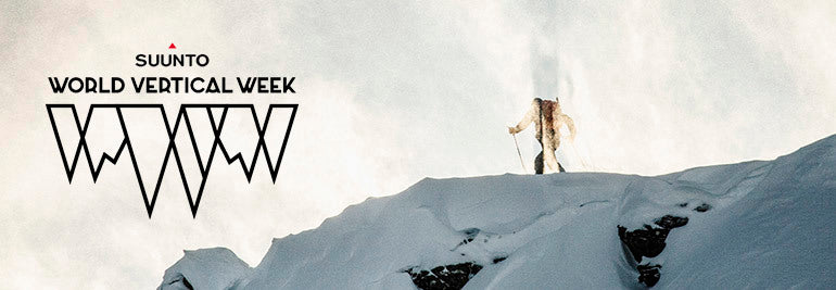

Suunto World Vertical Week 2019
For some of us a climb is a challenge, an obstacle to overcome. With training we get stronger and can climb the same hill easier – or faster. But it usually does not last long before we set our eyes on even bigger or faster or more challenging climbs.
For others a climb is an adventure, a promise that once we reach the top, col or ridgeline new horizons will open up and broaden our views and, on the way down, we will get to play with gravity.
Whatever your motivation, Suunto’s annual Vertical Week is here again!
Suunto World Vertical Week 2019 starts on Sunday, March 3rd and ends on Sunday, March 10th.
Put on your running shoes, hop on your bike or release your heels and start skinning up the hill. Track your adventures with your Suunto watch, upload your activities to Suunto app and, by the end of the week, we’ll know who climbs the most in a week. And it’s not only about individual performances: we want to see which country averages most vertical during the week and which activity takes you up the biggest climbs.
To participate, join the challenge in Suunto app!
SHARE YOUR EXPERIENCE AND WIN A SUUNTO 9
Share your Suunto World Vertical Week experiences on Instagram using Suunto app’s photo sharing with data overlays and use tag #VerticalWeek. Three of the most inspiring posts will win Suunto 9 watches.
Terms and conditions apply. Read them here.
Learn how to share your activities using Suunto app
Don’t have Suunto app yet? Get it now!

Fuelling the engine: talking nutrition with Emelie Forsberg
For an increasing number of people today nutrition isn’t only a question of what food we eat, it’s also about where that food has come from and how it’s been produced.
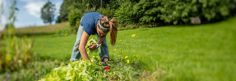
When she's not in the mountains, you can find Emelie in her garden or preparing delicious meals. © Matti Bernitz
Eating seasonally
For Swedish mountain running champion Emelie Forsberg sustainability plays an important role in her decision making around diet. For this reason Forsberg eats seasonally. “In the winter, for example, I try not to buy fruit or anything transported from far away places,” she says. “For me, the seasons are something to go through.”
Fall, she says, is a time to begin spending more time indoors, thinking, reading and reflecting, slowing down after the summer. Winter, Forsberg says, is a time for taking care of oneself, resting, and recharging. Spring is a time of awakening, coming out of hibernation, and using more energy. Summer is a time of fun and intensity.
Forsberg eats different foods during each season. “I really enjoy eating in the winter,” she says. “For breakfast, I eat porridge with berries on top. I’m living in Scandinavia, and we have many berries and greens, and a lot of herbs. In the winter we eat a lot of potatoes. The best is eating potatoes with olive oil and salt! In summer, we have smoothies, more salads, and colder foods.”
Straight from the earth
Forsberg is also an avid gardener. Her dream is to become as self sufficient as possible. Leafy greens, beans, potatoes, berries, carrots, you name it, Forsberg is growing it. Gardening, working with the earth, being in harmony with the seasons, is a form of spirituality for Forsberg. She believes the fresher it is the better.
© Kilian Jornet
Relaxed eating
Listening to her body is a big part of how she eats, rather than following meal plans. “I never have a meal plan,” she says. “In the beginning you need to get into a routine, but now I don’t even think about it anymore. You just need to use your imagination. Some people get obsessed about eating healthy. I’m not like that. I’m relaxed in the way I’m eating.”
Bean power
She is a big fan of beans, and admits to eating them at least once a day. “Even bean cakes and bean cookies,” she laughs. “Like, everything beans – 10 different types of beans, five different types of lentils! When you are vegetarian it’s important to know where you are getting your protein from.”
Easy, go-to meals
Forsberg stores a lot of food in her freezer, including bean burger patties. If it’s going to be a busy week she’ll make a big meal on Monday and store it to have again later in the week. “I like to have back up meals.
“I also make pesto out of everything, any type of green, even the tops of carrots,” she says. “A bit of garlic, olive oil, sun seed flower, nuts and seeds, and I eat it with pasta. I was eating it with bean pasta just now!
Salad with carrot and lentil patties
Salad (green salad, rocket, carrots, beets, brussels and onion from the garden)
Patties: 3 carrots, grated4 dl of red lentils; slightly cooked, can be a bit hard.1/2 an onion2 tbsp spoon of tahinia little parsleychili, salt and black pepperMix it all together and fry, or bake them in the oven!
Lead image: Photo by Blair Fraser on Unsplash.


