SUUNTOブログ

Was this MTB adventure actually a MTB adventure?
Sure, they had their mountain bikes with them. But with terrain so tough it’s hard to even hike it, what to speak of riding it, the question of what to call this madcap adventure arises.
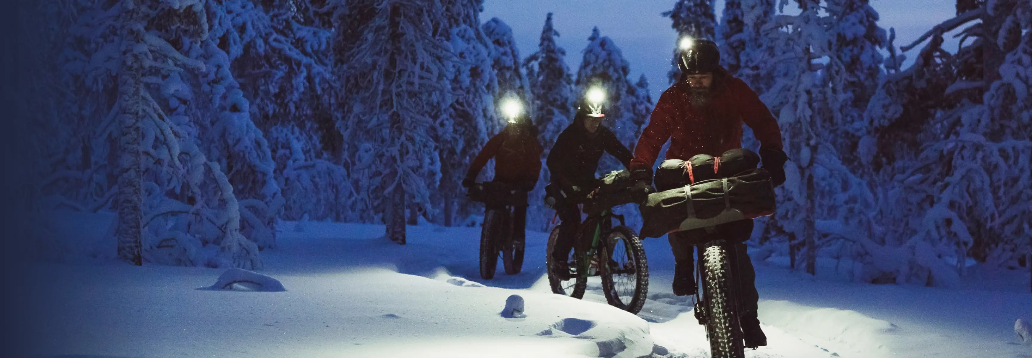
The ragtag group of riding buddies consisting of Kevin Landry, JF Newton, Margus Riga, Kenny Smith, and Peter Wojnar set off on a freeriding adventure deep into British Columbia’s wild and rugged Chilcotin mountain range in search of new freeride lines.
The word expedition suits it better than adventure and 'challenge' doesn’t really do it justice. Watch the video below and read the report from the film crew below and maybe you’ll reach a satisfying way to define it.
One thing is for sure, hardcore!
So Far… We’ve Made It This Far
“No sympathy for the devil; keep that in mind. Buy the ticket, take the ride...and if it occasionally gets a little heavier than what you had in mind, well...maybe chalk it up to forced consciousness expansion: Tune in, freak out, get beaten.”― Hunter S. Thompson, Fear and Loathing in Las Vegas
Niut Valley // North Chilcotins // British Columbia, CanadaLat/long = 51.5900° N, 124.6917° WDay #4 of 810:90 Biking to Hiking Ratio [so far…]
“There may as well have been fucking cows grazing over there and it was the hardest shit ever,” Kenny says, looking back at the snarled mess of terrain we’d spent the last two days traversing through, over and around.
He was bang on, as compared to the convoluted mess of sheer granite, talus fields, and ancient glaciers that lay before us; where we had come from really did look like an idyllic pasture, one that cows could be happily grazing – and it really was the hardest shit ever. We’d ridden our bikes less than 10 % of the time, pushing or carrying them for the other 90… great bike riding trip.
This wasn’t our ‘first rodeo’ as they say but looking down into the ‘venus fly trap’ valley this was the first time we’d contemplated changing our route because the terrain was too complex. Maybe we are getting smarter, realistically we’re just getting softer older. The steady decline in barometric pressure coupled with a few ‘storm warnings’ from our Suunto 9 watches helped to justify our decision while preserving a fraction of our collective egos.
“Stuck in the bottom of the flytrap on a sunny day would be soul-crushing, add 20 centimeters of snow, and hell we might still be there.”
The route, as planned by Captain Kenny from the comfort of his office back in Campbell River BC would wind its way through approximately 200 km, over eight days through the Niut Valley, a remote northern section of the infamous Chilcotins. The Niut, is where the Coast Range meets the Chilcotin Plateau but unlike the ‘Chill’cotins it has no trail network and rarely sees even the most intrepid hikers let alone mountain bikers. I’m not saying we were the first, but I’d bet we’ll be the last [mountain bikers] to that zone.
Since 2016/2017 our little ragtag crew has been refining this style, colloquially referred to as ‘freeride bike packing, by our friend Brice Minnigh. A weird chimera of big mountain MTB riding, ski touring, thru-hiking, bike packing, and mountaineering. The route is usually a point-to-point attempting to link up ridable ridgelines and chutes while minimizing any travel at valley bottom where one must contend with soul-crushing bush.
This brings us back to the siren song of the Venus flytrap, which became easier to ignore as the rain’s tempo crescendo picked up outside our shelters. Turning around the way we came was not an option, it was hard enough once, and would only be harder dragging our tails between our legs. It was becoming clear our only option was to head over the pass at the head of the valley we were currently camped in and attempt to link back up with our original route.
As the crow flies, this was a ‘shortcut’, but not without its own unique challenges. Specifically, a glacier, which fed into an unstable talus field, immediately leading into a few pitches of grade five scrambling. One hand to balance your bike on your pack, one hand on the rock at all times steep. Topping out we were greeted with sideways rain, and a fresh cutting wind no longer sheltered by the lee side. At least this was the easy way I mused.
At the most reductionist, trips in the mountains either work out or they don’t, it's binary once you get down to it. While we didn’t know it yet – the four of us were still shivering in Fraser’s tent at ridgetop – this trip was about to work out. Waiting for us just outside the tent was a phenomenal descent into a valley framed wall to wall with chutes just begging to be lapped. I won't bore you with the details, but we set base camp up for two days and methodically ticked off each one right to left. The weather was beautiful, the dirt was tacky, even went for a few swims in the lake by our camp. Of course, the fireside yarns always worked their way back around to the Venus Fly Trap.
Granted, at that time we didn’t know the mellow 15 km “trail” back to the trucks was actually a 25 km overgrown mess of pain and frustration. Bush so thick we had to remove our pedals just to punch through.
All images © Margus Riga

9 tips for getting into bikepacking
Bicycle sports, including bikepacking, have boomed since the beginning of the COVID-19 pandemic. With travel abroad mostly out of the question we’ve taken to exploring our own backyards. The urge to discover new territory cannot be quenched!
Bikepacking is the equivalent of backpacking only done on two wheels rather than two feet. It allows you to cover far greater distances in less time than ever possible with hiking. What’s not to like? Yes, flat tires suck. But master tire repair and the world is yours!
Maybe you’re considering buying a new bike so you can go on awesome multi-day bikepacking adventures. If yes, this article is for you. We talked to Suunto ambassadors Sami Sauri and Anton Krupicka – both seasoned bikepacking aficionados – and found out the essential things you need to know.
“I prefer to think of it as ‘bike camping’,” ultra runner, bikepacker and climber Anton Krupicka says. “You carry everything you need on your bike for one night or several nights of sleeping outside and riding your bike during the day. I love it for the same reasons I like doing anything outside – moving my body, and experiencing my natural surroundings.”
Sami's ongoing Into the Atlantic Islands project mixes bikepacking and surfing. © Sergio Villalba
Bikepacking vs. bicycle touring
Before we jump in, let’s look at the difference between bikepacking and biketouring. Bikepacking really became a thing just over a decade ago. It’s the young buck in the world of bicycle sports. Both involve travelling with bags on a bike. So what’s the difference?
In a nutshell, touring bikes are heavier, more robust, and designed for carrying heavier loads and for travelling further and primarily on paved surfaces (but not always). Think of it more as tourism by bike.
Bikepacking, on the other hand, synthesizes mountain biking and minimalist camping; it's the bike form of distance hiking or trekking. Bikepacking bikes are generally lighter, and designed for off-road excursions. The bags are usually smaller and more aerodynamic. It's more about outdoor advneture than tourism.
“The road is a comfortable place,” Spanish bikepacker and surfer Sami Sauri says. “It gets you to your destination faster and is easier, but the off paved or gravel roads are what I’m always searching for and trying to ride.”
Consider which – bike touring or bikepacking – is what you really want to do. Do you want to go travelling by bike, or do you want to get out in the hills and ride?
Anton is always devising epic bikepacking adventures. © Fred Marmsater
Test the water first
Before you pillage your savings, and impulsively click buy on a fancy five grand bike, take a breath, step back, and look at what you really need. “The best bike is the one you already have,” Anton says.
If you already have a mountain or trekking bike, Anton advises testing the water with that before making a big financial commitment. Rather than buying pricey bike bags, do a few overnight trips with your gear in your backpack, and see if it really is your cup of tea.
“For your first trip, it’s possible to strap simple stuff sacks to your handlebars and saddle and then perhaps carry the rest of what you need in a backpack,” Anton says.
Don’t break the bank, but choose quality
“I don’t think bikepacking HAS to cost a lot of money, but it does require a bike and some basic camping gear, such as a sleeping bag and mattress. In order to save money, the main thing you can compromise on is bikepacking bags,” Anton says.
Sami acknowledges a complete bikepacking setup isn’t cheap. Which is why she recommends investing in good quality gear. “If you buy good equipment you can have that for life,” she says. “The equipment you are going to use will probably be tested in harsh conditions so it’s better to buy good gear that can survive it and last longer than cheaper gear that will only work twice.”
Sami cycled and surfed Madeira Island, the first destination in her island hopping adventure. ©Sergio Villalba
What bike is best?
For beginners, Anton and Sami recommend choosing an allrounder. “I recommend a comfortable bike, suitable for all terrains and that allows you to put on nice and strong tires, a good saddle and a comfy handlebar,” Sami says. “Before doing a long bikepacking trip make sure to do a proper bike fit so you avoid injuries”
Anton recommends looking for a good deal on a gravel bike. “Right now the bike industry is in a bit of a renaissance where it is prioritizing very capable all-around bikes,” he says. “These are often referred to as ‘gravel bikes’, though that is a very broad categorization. Generally speaking, these bikes retain the efficiency of road bikes with drop handlebars while also having the ability to fit larger tires – say, 40-55mm – which increases their comfort and capability as off-pavement vehicles. I believe an all-around bike like this is the best bike for a beginner, because it is so versatile. But, again, if you already own a bike, you can probably make it work. Just fit it with the biggest tires you can, and go!”
Sami and Anton keep their adventures on track with Suunto 9 GPS watches. © Fred Marmsater
What other gear do you need?
There is a long list of helpful gear you could take with you. Firstly, a good helmet is a must. Then you need to decide on whether you want clip in or platform pedals. If you haven’t used clip in pedals before it’s good to start gradually by testing them on easier rides first. They take some getting used to. Water bottle mounts and water bottles are also essential.
“Test everything you will wear before taking them on a big trip,” Sami says. “Don’t wear a brand new bib short, for example, but one you’ve tested on previous rides and you know is perfect for you. And it’s the same with shoes; get used to them properly before you do a long trip with them.”
“A basic repair kit for your bike is essential,” Anton says. “Spare tubes, a tube patch kit, a small pump, tire levers, and a small multi-tool (allen keys, etc) are the bare necessities.”
Anton and Sami both track their adventures with Suunto 9 sport watches, which offer 120 hours of battery life. Then they can look back and see where and how far they’ve been.
Knowing how to do basic bike repairs is essential for bikepacking adventures. © Fred Marmsater
Skills to master
As mentioned up top, knowing how to repair a flat tire is crucial. You don’t want to be out in the hills, miles from shelter, with a flat and have to walk with your bike. “You should be comfortable repairing a flat tire,” Anton says. “These can be common, and, obviously, they are show-stoppers if they happen and you don't know how to fix it.”
Another important skill Sami recommends is learning how to pack minimally. “I used to overpack, but now I am more careful and go minimalist.”
For your first trip
Anton recommends doing a simple overnight trip first. “On a weekend you can pedal out a few hours from your home – even just a few miles if you're lucky enough to live near public land – make camp, pack enough food for dinner and breakfast, and then ride home in the morning,” he says. “It gives you the feel of riding a loaded bike, eating and sleeping outside, and then riding again without too much commitment if something goes wrong.
“I think the main thing to avoid on a first trip is planning for too big of miles,” Anton continues. “The idea is just to test out your camping and riding systems, not necessarily to cover a bunch of miles. The best way to take the fun out of it is to ride too many miles on any given day.”
Sami also suggests making your first trip one in warm weather. “Because it allows you to carry less gear, maybe instead of a tent, a hammock,” she says. “Instead of a sleeping bag, just a liner. Try to avoid doing a big journey if it’s too hot or too cold. Keep it short and easy.”
Use Suunto app and a Suunto 9 watch to guide you on the road. © Sergio Villalba
How to find cool routes?
To find awesome trails to ride, Sami uses the Komoot app. Another possibility is to use the heatmaps feature in Suunto app, and select the mountain bike overlay for awesome trails. Anton says www.bikepacking.com is an amazing resource.
“There are dozens and dozens of routes documented there that are almost all high quality and they range in length from a simple overnighter to thousands of miles,” he says. “However, my recommendation for a first trip would be to simply plan something for the nearest patch of public land –national forest – that allows camping, and plan a trip around that. Seek out the back roads – apps like Strava or RideWithGPS have heat maps that show you where people ride most commonly – and string them together in a logical way with convenient camp spots and/or resupply in surrounding towns.”
Tips for longer trips
Both Sami and Anton recommend doing a series of shorter trips before going on an epic one. “Start with shorter trips, testing and testing your set up, make sure you enjoy the journey and if you fall in love like I did, you’ll start doing multi day trips and then maybe weekly trips, and who knows, a month could be a thing too!”
Avoid these rookie mistakes
“Before you make a big investment in a brand new bike or expensive bags, just try out an overnighter with the gear that you already have,” Anton says. “I would say that in order to make sure you’re having fun as a beginner avoid doing too many miles and make sure you make camp early in the evening. It’s no fun setting up camp in the dark.”
Sami says another classic mistake is not checking the gear you’ll take works well beforehand, and then finding out deep in a trip it has issues. She also warns against overpacking, the curse of bikepacking!
Last words
“Bikepacking is for everyone, you, me, we all can do it,” Sami says. “Go out there and explore, it doesn’t need to be far or long, it can be in your backyard. You just need to go out and do it! Live for the moment!”
Lead images: © Sergio Villalba

How to use Karoo 2 bike computer with Suunto
First things first: connect your Karoo 2 with your Suunto account
To get started, connect your Suunto and Hammerhead accounts: Go to dashboard.hammerhead.io and select ‘Suunto’ under ‘Accounts’. Once connected, your rides are automatically synced from your Karoo 2 to Suunto app and the routes planned in Suunto app are synced to your bike computer for navigation. After connecting you will also get access to Suunto cycling heatmaps on your Karoo 2.
If you don’t have a Suunto account yet, download Suunto app from the App Store or Google Play and create one. If you need a Hammerhead account, go to dashboard.hammerhead.io
Learn step-by-step how to connect your Suunto and Hammerhead accounts
See the heatmap on your bike computer
Suunto heatmaps show the most popular rides near you – or at your travel destination. They are great for route planning in Suunto app and offer clear benefits out on your rides as well.
On a Karoo 2 bike computer you can see Suunto cycling heatmaps on the go. So, even without a pre-planned route you will find places to ride. The more the road glows, the more popular the ride has been amongst the Suunto community. And, once it is time to turn back, your Karoo 2 will help you navigate back home!
Learn how to get Suunto heatmaps on your Karoo 2.
Plan routes for your rides in Suunto app
Suunto app has advanced route planning functionalities that you can use even on the go.
When planning a route, toggle between different map layers, 2D and 3D maps and use heatmaps to get inspiration. As you create your route, the app will calculate the distance, vertical meters and estimated duration. That way you can keep track of how long and challenging your route might be.
Once saved the routes are synced to both your Karoo 2 and Suunto watch for navigation. That is super handy especially if you are on a multisport adventure; ride to the mountain navigating with Karoo 2 and continue the hike up with your Suunto watch.
Use the same heart rate belt with your bike computer and watch
The Suunto Smart Heart Rate Belt provides accurate heart rate data without compromising comfort. You can use the same belt with both your Suunto watch and your Karoo 2 bike computer. Just pair it with each device and once you are starting your activity, the belt will be connected. Note that the belt can communicate only with one device at a time. However, no pairing and re-pairing is needed.
See all your rides, runs, skis, climbs and all other activities in one place
You can review your rides recorded with Karoo 2 and all of your activities recorded with Suunto watches in the Suunto app. Your Karoo 2 rides are automatically synced after finishing the activity. Select the default privacy setting of your rides in Suunto app settings (private, your followers, public). You can also change this setting for each activity.
Analyse your progress
Suunto app’s long-term analysis view tracks your training load and helps you stay in balance – whether that means progress, maintaining your fitness or avoiding over-training. With long-term analysis tools powered by TrainingPeaks and all your Karoo 2 rides and Suunto activities in one place, you can now manage your training better than ever.
Learn more about managing your training load with Suunto app.
View your personal heatmap
As you collect data in Suunto app you are building a powerful navigation tool for yourself: My Tracks. My Tracks is a map layer that shows your own activities on the map. That is an awesome way to see where you have been or – when compared with the general heatmap – where you have yet to explore.
My Tracks is also a powerful tool to support your route planning. When re-visiting an area and planning new routes, it helps a lot that you can see your previous rides on the map as well.
View activities as 3D animations
In addition to planning and reviewing your tracks on a 3D map in Suunto app, you can even enjoy your adventures as 3D video animations: Simply go to your activity, hit the play button, and enjoy the views as you climb up mountains, go over passes and storm down winding roads. Share the link with your riding buddies and they will be able to see the 3D animation as well – even on a big screen.
Create an adventure logbook
Having all of your activities in Suunto app will enable you to build an adventure logbook. Add descriptions, photos and videos to your activities and find them later with the search tool.
You can also share the images added in your activities with data overlays: hit the share button, select an image, and customise the data fields to support your story!
Connect with hundreds of 3rd party services
Suunto is proud to have a wide array of partners it cooperates with. From route planning services to training and coaching platforms and more, you are likely to find a service that can enhance what Suunto app offers you. These partner services are now compatible with your Karoo 2 activities as well.
To learn more, go to your profile page in Suunto app and select ‘Partner services’.
Each new Suunto watch comes with a extensive Suunto Value Pack, a collection of benefits and treats offered by Suunto partners. Value Pack deals vary from premium trials to free training plans and discounts from partners like Strava and TrainingPeaks.
Learn more about Suunto Value Pack.
Celebrate Earth Day with us!
Starting this Earth Day, we have partnered with Hammerhead and Komoot to challenge you to #SeeTheAdventureAhead and share your natural wonder, however you explore.
Use the hashtag #SeeTheAdventureAhead when you share on Instagram, Facebook, and/or Komoot* before May 11th and we’ll plant a tree for every post, with the goal of planting 10,000 trees with Tree Nation.
Trees are key pillars of the world for both humans and the environment. They benefit us by purifying water, air and creating better social conditions. They benefit the environment by providing homes for various forms of life, cooling our climate and improving our soil.
To celebrate the wonders of our natural world, get out there and share your natural wonder. We'll plant trees through the VCS certified Eden project in Mozambique for each share!
*tag Suunto and Hammerhead when you share on Komoot
Find places to explore with Suunto heatmaps
Learn more about Tree Nation
Learn more about Suunto compatible cycling computer Hammerhead Karoo 2
Main image: @runningphotograph
Suunto joins the Golden Trail World Series
👉🏼 Follow Sierre-Zinal, the fourth race of the GTWS 2022 season, on Saturday 13th of August from 08:30am CET here or at goldentrailseries.com/gttv/
👉🏼 Follow Stranda Fjord Trail Race, the third race of the GTWS 2022 season, on Saturday 6th of August from 11:00am CET here or at goldentrailseries.com/gttv/
👉🏼 Follow Marathon du Mont Blanc, the second race of the GTWS 2022 season, on Sunday 26th of June from 7:00am CET here or at goldentrailseries.com/gttv/
👉🏼 Follow Zegama, the first race of the GTWS 2022 season, on Sunday 29th of May from 8:30am CET here or at goldentrailseries.com/gttv/
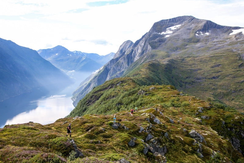
Suunto is proud to be an official partner of the Golden World Trail Series 2022 that’s kicking off on May 29 with the legendary Zegama-Aizkorri trail marathon in Spain, and is followed by five more high profile races around Europe and the US that culminate in a grand finale on the island of Madeira.
“We are thrilled to partner with the Golden Trail World Series and be part of the most exciting trail races of the summer,” says Antti Laiho, Suunto global brand marketing manager. “With the new SuuntoPlus Race guides we can also support the competitors in a new, helpful way.”
What makes it special
These iconic races are the ones every runner wants to experience. This, and a clear and simple format where each runner’s best three results from the six races count, make the series easier for the public to follow and get behind. Each year the Golden Trail World Series will choose a very special race for the Grand Final In 2022, the top 30 men and women from the overall ranking after the sixth race will be invited to the Madeira Ocean Trails stage race grand final. This guarantees epic action until the very last finish line.
Supported by Salomon, the series is special in many other ways. “In trail running nowadays there are many series, world championships, the European championship and so on so nobody really knows what is going on,” says Philipp Reiter, the Global Community Manager Salomon - Trailrunning.
“The Golden Trail World Series is different because it has the best athlete field in the world and supports athletes regardless of brand sponsor to join the competition, it pays travel expenses to get them to the races and there is equality between men and women in terms of prize money, visibility, media coverage, which is pretty unique. And the prize money is really high. The goal of the series is to bring trail running to a larger audience and to grow the sport, not just promoting it to the core community as is the case so often.”
The seven races
Tune in or sign up for the world’s biggest trail running show!
29th May: Zegama-Aizkorri, Spain
26th June: Marathon du Mont-Blanc, France
6th August: Stranda Fjord Trail Race, Norway
13th August: Sierre-Zinal, Switzerland
17th September: Pikes Peak Ascent, USA
25th September: Flagstaff Sky Peaks, USA
26th to 30 October: Grand Final, Madeira Ocean Trails®, Madeira.
Sign up and follow real-time race guidance during the GTWS races!
With the help of SuuntoPlus Guides, we will guide you through your Golden Trail World Series race. Before starting a trail running sport mode on the start line of the race, go down to exercise options and select the correct Race Guide in the SuuntoPlus Guides menu. Start the workout and you will see race course information like climbs, feed zones, control points and more in real-time during the race. Swipe left to see the guidance screen.
Learn more about SuuntoPlus Guides here.
All images: © Jordi Saragossa
7 nations, 7 highest summits, 5 days
Watch how Philipp and Adrian's project unfolded!
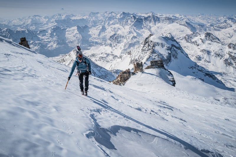
Reaching the summit of Mont Blanc took everything Philipp and Adrian had in the tank. They began their climb of the highest mountain in the European Alps at 01:30 AM and, even though they had worked on acclimatization, they suffered on their way up and faced icy conditions. The ski down, involving crossing crevasses, took a brutal three hours.
“When we arrived back at the car 11 hours and 30 minutes after we had set out we were both super done,” Philipp says. “We both had headaches and had to travel by car for two and a half hours to Zermatt, sleep for two to three hours and get up at 2 AM to start over again to climb Dufourspitze.
“It was crazy, because for many mountaineers just doing one of the highest summits in the Alps is a big achievement, but we climbed seven in five days. For me, it’s still unbelievable because it happened so quickly that it hasn’t really sunk in yet.”
The 7 summits project
They started their adventure on March 26 at 06:00 AM, first climbing Italy’s Gran Paradiso. The goal was to climb the highest summit in each of the seven alpine nations - Italy, France, Switzerland, Liechtenstein, Germany, Austria and Slovenia - in seven days. However, weather forecasts predicted snow and harsh conditions on the last two peaks, leaving Philipp and Adrian no choice but to do all seven summits in five days, in this order:
March 26: Gran Paradiso (4061 m), Italy. March 27: Mont Blanc (4807 m), France.March 28: Dufourspitze (4634 m), Switzerland.March 29: Vorder Grauspitz (2599 m), Liechtenstein.March 29: Zugspitze (2962 m), Germany.March 30: Grossglockner (3798 m), Austria.March 30: Triglav (2864 m), Slovenia.
The project was a year in the making and originally involved a team of four, but a sickness and a death in one of the team’s families meant two of the four had to withdraw at the last minute, leaving Philipp and Adrian to scramble to keep the project from collapsing. To avoid piling pressure on themselves, they decided to keep their goal quiet until they reached the summit of Liechtenstein’s Vorderer Grauspitz.
Battling the conditions and sleep deprivation
They realized they needed to climb all seven summits in five days rather than seven after climbing Vorder Grauspitz and seeing a weather forecast predicting snow in the Alps. At that point, it was full steam ahead, with little time for rest and recovery. They only slept 14 hours over the five days, which included napping in the car - with damp clothes and cold bones - while driving from one mountain to the next.
“We had to be really focused because of the route navigation,” Philipp says. “We followed the tracks on our Suunto watches. This helped a lot because it gave us confidence and saved time.”
The stats
187 km17,001 m 111h40m
All images: © Philipp Reiter


