


SUUNTOブログ


登山やアウトドア写真撮影に役立つSuuntoウォッチ活用術|日の出・日没・ナビゲーションを手元で確認
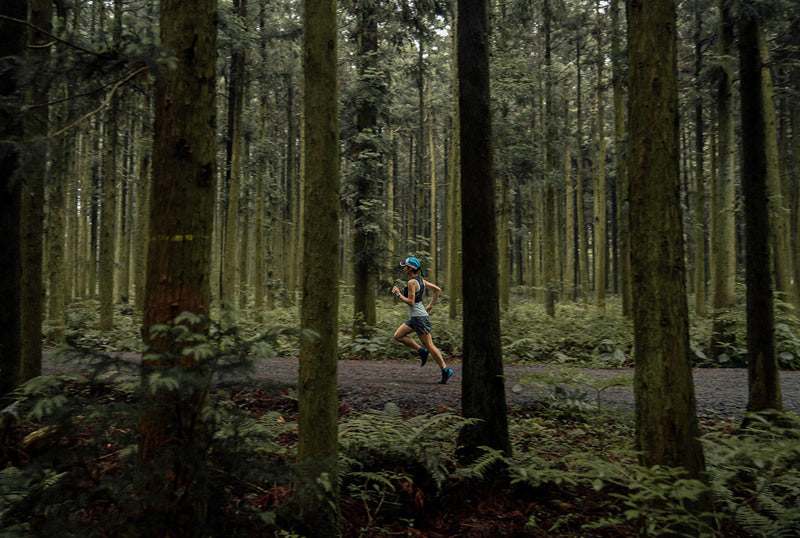
山での写真撮影では、タイミングがとても重要です。
同じ場所でも、日の出前の青い光、朝日が差し込む瞬間、雲の切れ間から差す光、日没前の柔らかな光では、写真の印象が大きく変わります。理想の1枚を撮るためには、撮影ポイントにいつ到着するか、どのルートで向かうか、日没までに戻れるかを事前に考えておくことが大切です。
Suuntoウォッチは、登山やアウトドアでの撮影計画をサポートするツールとしても活用できます。日の出・日の入り、月齢、ルートナビゲーション、高度、気圧、天気の変化などを手元で確認できるため、山やトレイルでの行動判断に役立ちます。
この記事では、アウトドア写真撮影でSuuntoウォッチを活用する方法を紹介します。
登山やアウトドア写真撮影で大切なのは「光」と「時間」
アウトドア写真では、光の状態が仕上がりを大きく左右します。
特に山では、太陽の高さ、雲の動き、霧、風、地形による影などによって、同じ場所でもまったく違う表情になります。良い光に出会うには、撮影技術だけでなく、撮影場所に到着するタイミングも重要です。
ゴールデンアワーとブルーアワーを意識する
日の出直後や日没前後は、光がやわらかく、山や風景を印象的に見せやすい時間帯です。一般的に、日の出後や日没前の時間帯はゴールデンアワー、日の出前や日没後の青みがかった時間帯はブルーアワーと呼ばれます。
山岳写真やトレイルでの撮影では、この時間帯に撮影ポイントへ到着できるかどうかが大切です。
撮影ポイントまでの移動時間を考えておく
理想の光の時間に合わせるには、撮影ポイントまでの移動時間を逆算しておく必要があります。
登山道では、距離だけでなく標高差や路面状況によって移動時間が変わります。暗い時間帯に出発する場合や、日没後に下山する可能性がある場合は、ルート確認と安全管理も重要です。
Suuntoウォッチがアウトドア写真撮影に役立つ理由
Suuntoウォッチは、スポーツや登山の記録だけでなく、撮影のタイミング管理にも役立ちます。
日の出・日の入り、月齢、ナビゲーション、気圧や高度など、アウトドアで必要な情報を手元で確認できるため、スマートフォンを何度も取り出しにくい状況でも行動判断をしやすくなります。
1. 日の出・日の入りを手元で確認できる
対応するSuuntoウォッチでは、日の出・日の入り時刻や、次の日の出・日の入りまでの時間を確認できます。たとえばウォッチのウィジェットでは、次の日の出または日の入りまでの時間を表示し、詳細画面で日の出・日の入り時刻と現在の月齢を確認できます。
朝焼けや夕焼けを狙う場合、手元で日の出・日の入りを確認できると、撮影ポイントへの到着時間や撤収の判断がしやすくなります。
2. 月齢を確認して夜景や星空撮影に活かせる
星空や天の川を撮影したい場合は、月の明るさも重要です。月が明るい夜は山や地形が照らされる一方で、星空は見えにくくなることがあります。反対に、月明かりが少ない日は、暗い夜空を撮影しやすくなります。
Suuntoウォッチで月齢を確認できると、夜間撮影の計画を立てるときの参考になります。
3. ルートナビゲーションで暗い時間帯の移動をサポート
朝日を狙う撮影では、まだ暗いうちに登山口を出発することがあります。夕景を狙う場合は、日没後に下山することもあります。
事前にSuuntoアプリでルートを作成し、対応するSuuntoウォッチに同期しておけば、暗い時間帯でも手元でルートを確認しながら行動できます。朝日を狙う撮影で夜明け前に登り始めるときや、夕景撮影のあとに下山するときも、ルートナビゲーションが行動をサポートします。
4. 気圧・高度・天気の変化を確認できる
山では、天候の変化も写真の仕上がりと安全に影響します。
気圧が下がる、雲が広がる、風が強くなる、気温が下がる。こうした変化を早めに把握できると、撮影を続けるか、場所を変えるか、下山するかを判断しやすくなります。
天気確認の詳しい使い方は、こちらの記事でも紹介しています。
▶︎関連記事:登山やトレイルで天気を確認する方法|Suuntoウォッチで気圧・日没・ストームアラームを活用
日の出・日の入りアラームで撮影タイミングを逃さない
アウトドア撮影では、「あと何分で日の出か」「日没までどれくらいあるか」を意識することが大切です。
対応するSuuntoウォッチでは、日の出・日の入りアラームを設定できます。Suunto Vertical 2では、日の出・日の入りアラームは位置情報に基づくアダプティブアラームで、固定時刻ではなく、実際の日の出・日の入りの何分前に通知するかを設定します。日の出・日の入り時刻はGPS情報に基づいて決まります。
日の出前の移動に役立つ
朝焼けや雲海を狙う場合、日の出のかなり前に行動を開始することがあります。
日の出アラームを設定しておけば、出発や準備のタイミングを考えやすくなります。暗い時間帯に行動する場合は、ヘッドライトや防寒具、予備バッテリーなども忘れずに準備しましょう。
日没前の撤収判断に役立つ
夕景や日没前の光を狙う場合、撮影に集中しているうちに時間が過ぎてしまうことがあります。
日の入りアラームを設定しておけば、撤収や下山のタイミングを意識しやすくなります。特に初めて歩くルートや標高差の大きい場所では、日没後の移動リスクも考えて余裕を持って行動しましょう。
▶︎関連記事:登山やトレイルで天気を確認する方法|Suuntoウォッチで気圧・日没・ストームアラームを活用
ルートナビゲーションで撮影ポイントまで安全に移動する
理想の写真を撮るには、撮影ポイントまで安全にたどり着くことが前提です。
撮影場所が登山道の途中にある場合や、初めて行くエリアの場合は、事前にルートを準備しておくと安心です。
Suuntoアプリでルートを作成する
Suuntoアプリでは、撮影したい場所までのルートを事前に作成できます。GPXファイルや外部サービスで作成したルートを活用することもできます。
ルートをウォッチに同期しておけば、登山中やトレイル上で現在地と進む方向を確認しながら移動できます。
▶︎関連記事:GPXルートをSuuntoウォッチに入れる方法|Routeplannerで山・トレランの準備をもっと簡単に
オフラインマップと組み合わせる
対応するSuuntoウォッチでは、オフラインマップを使って現在地や周辺の地形を確認できます。スマートフォンの電波が入りにくい山でも、事前に必要エリアのマップを準備しておくことで、行動中の安心感につながります。
オフラインマップやナビゲーション機能については、こちらの記事も参考にしてください。
▶︎関連記事:SUUNTO、マップ&ナビゲーション機能を大幅アップデート
クライムガイダンスで標高差と撮影までの行動時間を把握する
山での撮影では、距離だけでなく標高差も重要です。
地図上では近く見える場所でも、急な登りが続くルートでは思った以上に時間がかかることがあります。撮影したい時間に間に合うようにするには、ルート上の登り下りを事前に把握しておくことが大切です。
Suuntoのクライムガイダンスを使うと、ルート上の登り・下り・平坦区間を確認しやすくなります。撮影ポイントまでにどれくらい登るのか、帰りにどれくらい下るのかを把握しておくことで、行動時間や体力配分を考えやすくなります。
▶︎関連記事:登山・トレイルランのルートナビゲーション|Suuntoクライムガイダンスの便利な使い方
アウトドア写真撮影でSuuntoウォッチを活用するシーン
朝駆け登山で朝日や雲海を狙う
朝日や雲海を撮影するには、夜明け前から行動することが多くあります。
日の出時間、ルート、標高差、天気、気温を事前に確認しておけば、撮影ポイントへの到着時間を考えやすくなります。
夕景・日没前の光を狙う
日没前の柔らかな光は、山や風景を印象的に見せてくれます。
一方で、撮影後の下山時間も考える必要があります。日の入りアラームやルートナビゲーションを活用することで、撮影と安全管理のバランスを取りやすくなります。
星空・天の川を撮影する
星空撮影では、月齢、天気、雲の量、撮影場所の暗さが重要です。
Suuntoウォッチで月齢を確認しておくと、夜空の明るさを考えながら撮影計画を立てやすくなります。
トレイルランやファストハイク中に撮影する
トレイルランやファストハイクでは、軽い装備で移動しながら撮影することがあります。
ウォッチでルートや時間を確認できると、スマートフォンや地図を頻繁に取り出さずに、行動の流れを止めにくくなります。
撮影に使うSuuntoウォッチを選ぶポイント
アウトドア写真撮影でSuuntoウォッチを使うなら、撮影スタイルに合わせて機能を選びましょう。
日の出・日の入り、月齢を確認できるか
朝焼け、夕景、星空を撮るなら、日の出・日の入りや月齢を確認できる機能が役立ちます。
ルートナビゲーションとオフラインマップ
初めての撮影地や山岳エリアでは、ルートナビゲーションやオフラインマップがあると安心です。
気圧計・高度計・コンパス
天気の変化や現在地の把握には、気圧計、高度計、コンパスも役立ちます。
バッテリー持ち
撮影では、移動時間に加えて現地で待つ時間も長くなることがあります。長時間の登山や夜間撮影を考えるなら、バッテリー持ちも確認しておきたいポイントです。
▶︎関連記事:登山におすすめのGPSスマートウォッチとは?地図・バッテリー・アウトドア機能の選び方
Suuntoのアウトドアウォッチで、理想の撮影タイミングを逃さない
登山やアウトドア写真撮影では、光、時間、ルート、天気を把握することが大切です。
Suuntoのスポーツウォッチは、日の出・日の入り、月齢、ルートナビゲーション、オフラインマップ、気圧や高度など、アウトドアでの行動判断に役立つ機能を備えたモデルを展開しています。
撮影計画や登山、トレイルでの行動管理に活用したい方は、自分のスタイルに合うモデルをチェックしてみてください。
▶︎Suuntoのスポーツウォッチを見る
まとめ|Suuntoウォッチは、アウトドア写真撮影の計画と行動をサポートする
アウトドア写真撮影では、良いカメラやレンズだけでなく、良い光に出会うための準備が大切です。
日の出・日の入り、月齢、ルート、標高差、天気、気圧を確認できると、撮影ポイントへの到着時間や撤収タイミングを考えやすくなります。
Suuntoウォッチは、登山やトレイルでの移動をサポートしながら、撮影に必要な時間や環境情報を手元で確認できるツールです。
理想の1枚を撮るために、そして安全に帰ってくるために。
アウトドア写真撮影のパートナーとして、Suuntoウォッチを活用してみてください。
▶︎Suuntoの登山向けスポーツウォッチを見る

Celebrate Earth Day with us!
Starting this Earth Day, we have partnered with Hammerhead and Komoot to challenge you to #SeeTheAdventureAhead and share your natural wonder, however you explore.
Use the hashtag #SeeTheAdventureAhead when you share on Instagram, Facebook, and/or Komoot* before May 11th and we’ll plant a tree for every post, with the goal of planting 10,000 trees with Tree Nation.
Trees are key pillars of the world for both humans and the environment. They benefit us by purifying water, air and creating better social conditions. They benefit the environment by providing homes for various forms of life, cooling our climate and improving our soil.
To celebrate the wonders of our natural world, get out there and share your natural wonder. We'll plant trees through the VCS certified Eden project in Mozambique for each share!
*tag Suunto and Hammerhead when you share on Komoot
Find places to explore with Suunto heatmaps
Learn more about Tree Nation
Learn more about Suunto compatible cycling computer Hammerhead Karoo 2
Main image: @runningphotograph
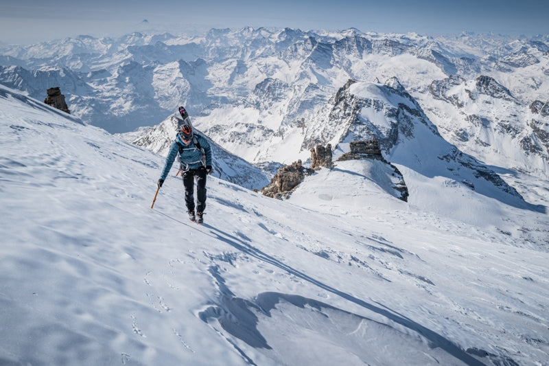

7 nations, 7 highest summits, 5 days
Watch how Philipp and Adrian's project unfolded!
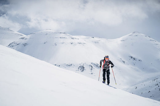
Reaching the summit of Mont Blanc took everything Philipp and Adrian had in the tank. They began their climb of the highest mountain in the European Alps at 01:30 AM and, even though they had worked on acclimatization, they suffered on their way up and faced icy conditions. The ski down, involving crossing crevasses, took a brutal three hours.
“When we arrived back at the car 11 hours and 30 minutes after we had set out we were both super done,” Philipp says. “We both had headaches and had to travel by car for two and a half hours to Zermatt, sleep for two to three hours and get up at 2 AM to start over again to climb Dufourspitze.
“It was crazy, because for many mountaineers just doing one of the highest summits in the Alps is a big achievement, but we climbed seven in five days. For me, it’s still unbelievable because it happened so quickly that it hasn’t really sunk in yet.”
The 7 summits project
They started their adventure on March 26 at 06:00 AM, first climbing Italy’s Gran Paradiso. The goal was to climb the highest summit in each of the seven alpine nations - Italy, France, Switzerland, Liechtenstein, Germany, Austria and Slovenia - in seven days. However, weather forecasts predicted snow and harsh conditions on the last two peaks, leaving Philipp and Adrian no choice but to do all seven summits in five days, in this order:
March 26: Gran Paradiso (4061 m), Italy. March 27: Mont Blanc (4807 m), France.March 28: Dufourspitze (4634 m), Switzerland.March 29: Vorder Grauspitz (2599 m), Liechtenstein.March 29: Zugspitze (2962 m), Germany.March 30: Grossglockner (3798 m), Austria.March 30: Triglav (2864 m), Slovenia.
The project was a year in the making and originally involved a team of four, but a sickness and a death in one of the team’s families meant two of the four had to withdraw at the last minute, leaving Philipp and Adrian to scramble to keep the project from collapsing. To avoid piling pressure on themselves, they decided to keep their goal quiet until they reached the summit of Liechtenstein’s Vorderer Grauspitz.
Battling the conditions and sleep deprivation
They realized they needed to climb all seven summits in five days rather than seven after climbing Vorder Grauspitz and seeing a weather forecast predicting snow in the Alps. At that point, it was full steam ahead, with little time for rest and recovery. They only slept 14 hours over the five days, which included napping in the car - with damp clothes and cold bones - while driving from one mountain to the next.
“We had to be really focused because of the route navigation,” Philipp says. “We followed the tracks on our Suunto watches. This helped a lot because it gave us confidence and saved time.”
The stats
187 km17,001 m 111h40m
All images: © Philipp Reiter
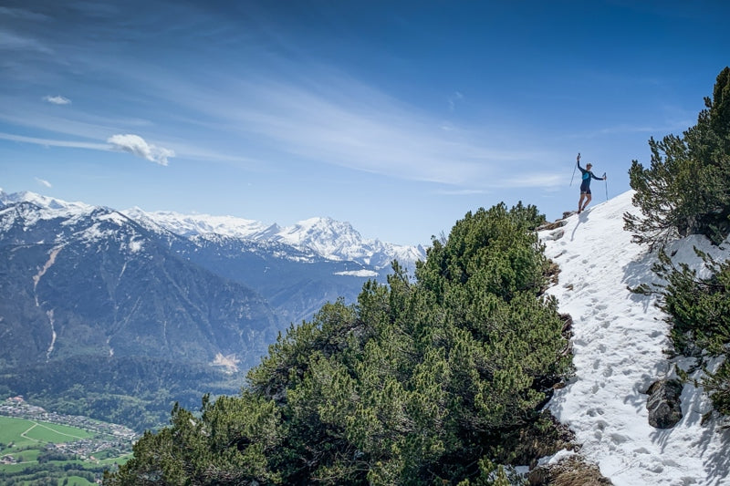

Vertical Week competition winners
One of the reasons we’ve continued pushing World Vertical Week every year since its inauguration in 2016 is because it brings out the best in our Suunto community. People get outside more and push themselves, and many do some truly big days.
The World Vertical Week competition captures some of the best of it. We look forward to scrolling through all the images the community shares and tags via #verticalweek. Thanks to everyone who participated in this spring 2022 edition.
As always, we selected three winners who will each receive a Suunto 9 Peak. Congratulations!
And the winners are …
Everesting the Bastille in Grenoble
You can’t get a much bigger day than what @danielott_atalps pulled off in Grenoble, France. He competed in the second edition of the Everstille 2022 and was one of four people who climbed the Bastille hill above the city 33 times, adding to 8848 m, the height of Mt Everest.
“I read about Suunto vertical week last year and was fascinated by the concept of trying to accumulate as much elevation as possible,” Daniel says. “I wanted to participate then, but it always fell on the week of my exams, so I couldn't participate. This year, I was thrilled that the Everstille, the everesting race I did, fell in the time frame of the vertical week, so I signed up immediately.
“Everestille is a race organized by Tri-Haut, an association based in Grenoble that aims to improve the waste management in the Khumbu Region below Everest. The goal of the race is to run the Bastille, as many times as possible.”
Love in the Swedish mountains
Mother Nature turned it on for @josefintrogen on a ski trip in the Sälen ski resort in Sweden. It was the first time she participated in World Vertical Week and probably won’t be her last.
“We went cross-country skiing and downhill-skiing and it was a perfect weekend with sunshine, snow and what we call ‘Sweden’s fifth season’ or ‘spring-winter’,” Josefin explains. “It basically means there’s still enough snow to go skiing without problems, but warm enough to ski in a base layer only (this weekend it was about +10°C). Every day we bought soup for lunch and made a couch in the snow to enjoy it out in the sun before continuing our tour.”
Passionate mum and daughter skimo team
Her first Vertical Week, @monivieregg took her six-year-old daughter out into the Bavarian mountains on a skimo tour. The ascent is always challenging because Monika has a small frame and pulling her 20 kg daughter up the mountain behind takes everything she’s got.
“We life very close to the Alps and the tour in the pic was at a former ski slope, called Blickner Alm at the Hochfelln,” Monika says. “My daughter really loves skiing uphill and she did a very, very good job downhill. At every carve she did I could hear a ‘hui’, ‘nice’ and ‘yipee’. She had a few falls, but after every one she got up and told me nothing happened, ‘keep going faster I want to ski on’. We both are really satisfied after a tour and we look forward to the next one.”

Big results from World Vertical Week 22
After the fall edition of World Vertical Week 2021, we were wowed by a 43% jump in participation, but now we are blown away again because we’ve had a 79% participation increase in this edition of World Vertical Week. That means there’s been a 155% increase over the last year. What’s going on people? Can’t get enough of those hills?
As we do after every edition of World Vertical Week, we have collected the data, drilled down into it, and looked at who climbed the most and what sports gained the most meters. Read on for the results!
Participation
This edition, 125,000 people participated. That’s up from 70,000 in the 2021 fall edition, and up from 49,000 in the 2021 spring edition. We’re really impressed by this and wonder if the big increase is because, post-pandemic, races are happening again and more of us have signed up and want to get back into focused training.
Big performances
We discovered 86 people in the Suunto community climbed more than 10,000 m of ascent over the week. That’s up from 59 in fall 2021, and only nine in spring 2022. Well done you hardcore vert chasers!
There were 301 activities recorded that involved more than 3,500 m of ascent. Those are big days out - nice work! During the 2021 fall edition there were only 218, and only 89 in spring 2021. The only way is up!
For activities with more than 2000 m of ascent there were 1,183 activities recorded and 7,287 activities recorded that involved more than 1000 m of ascent.
Number of activities with more than 1000 m of ascent by activity
Ski touring: 2197 (30%)Trail running: 1993 (27%)Cycling: 767 (11%)Running: 682 (9%)
Number of activities with over 2000m of ascent by activity
Trail running: 354 Ski touring: 290Running: 167Cycling: 134
Austria remains on the throne
Once again the alpine nation has come out on top for the highest average ascent per country. This time it’s average was slightly lower than previous edition, but still neck and shoulders above second place winner, Italy. Austria has held first place in this category for six of the last seven editions. It only lost its crown in 2019, falling to fifth place. It also deserves kudos for coming in the top five of five other categories!
Go Italy!
Italy deserves some love for coming in second place in seven different categories, including the highest average and total ascents per country. Ski touring, mountaineering, trail running, mountain biking, hiking and cycling - Italy recorded the second highest average ascent per country for all of these sports. Mama mia!
Average ascent per country
Total ascent per country
Spain
Italy
France
Austria
Average ascent by activity type
Top 5 nations in different activity types
Ski touring
The average ascent for all countries was 916 m.
Switzerland, 1102 m
Italy, 1015 m
France, 1003 m
Austria, 955 m
Germany, 950 m
Mountaineering
The average ascent for all countries was 645 m.
Austria, 839 m
Italy, 753 m
Germany, 734 m
Poland, 714 m
Japan, 676 m
Trail running
The average ascent for all countries was 437 m.
Japan, 978 m
Italy, 664 m
Portugal, 617 m
Malaysia, 590 m
Slovenia, 558 m
Mountain biking
The average ascent for all countries was 359 m.
Switzerland, 523,5 m
Italy, 523,1 m
Slovenia, 487 m
Austria, 476 m
Spain, 454 m
Hiking
The average ascent for all countries was 225 m.
Malaysia, 457 m
Italy, 434 m
Slovakia, 418 m
Croatia, 412 m
Japan, 382 m
Nordic skiing
The average ascent for all countries was 185 m.
Slovenia, 410 m
Czech Republic, 369 m
Austria, 291 m
Poland, 282 m
Germany, 264 m
Cycling
The average ascent for all countries was 181 m.
Spain, 406 m
Italy, 373 m
Portugal, 309 m
Switzerland, 276 m
Slovenia, 269 m
Running
The average ascent for all countries was 95 m.
Bulgaria, 202 m
Ireland, 180 m
New Zealand, 168 m
Switzerland, 154 m
Chile, 149 m
Lead image: © Philipp Reiter

10 Suunto features for vertical gain
From cycling to mountaineering, whatever your favorite outdoor sport, one thing we all have in common is the love and loathing of long, grueling ascents. They are immensely satisfying, give us a sense of achievement - and the incredible views that make it all worthwhile - and also smash us to pieces.
Suunto GPS watches come packed with intelligent features designed to help you on your long, arduous climbs. Read on for 10 features to support your vertical efforts.
Know your altitude
Suunto Vertical, Suunto Race, Suunto 9 Peak Pro, Suunto 9 Peak and Suunto 9 Baro use barometric pressure to measure altitude. To get accurate readings, you need to define an altitude reference point. This can be your current elevation if you know the exact value. Set your reference point from the settings under ‘Outdoor’.
Alternatively, you can use FusedAlti to set your reference point automatically. The FusedAlti™ provides an altitude reading that is a combination of GPS and barometric altitude. It minimizes the effect of temporary and offset errors in the final altitude reading.
Suunto 5 Peak and other GPS watches that don’t have a barometer use GPS to measure altitude. Under optimal signal conditions, eliminating potential errors typical in calculating GPS position, the GPS altitude reading should give a pretty good indication of your elevation. If you need good elevation readings, ensure your GPS accuracy is set to Best during the recording.
Follow your route’s altitude profile
If you are navigating a route that has altitude information, you can also navigate based on ascent and descent using the altitude profile display. While in the main navigation display (where you see your route), press the middle button to switch to the altitude profile display.
The altitude profile display shows you the following information:top: your current altitudecenter: altitude profile showing your current positionbottom: remaining ascent or descent
See your vertical speed
Vertical speed is a great way to measure your pace in the mountains. Set vertical speed as one of the data fields in your preferred sport mode in Suunto app. (Here’s how to customize your sport modes.)
Comparable to running pace on a flat surface, vertical speed takes into account only the altitude as a means of measurement. It’s a really useful performance indicator because it’s a direct measurement of how fast you’re going uphill.
Vertical speed is a great way to pace an effort in an uphill lap. This also helps you estimate how long the climb will take for you – if you know the total ascent. The vertical speed is shown as meters per minute or meters per hour (or alternatively ft/min or ft/hr).
Monitor your Normalized Graded Pace
The Normalized Graded Pace (NGP) feature calculates your pace based on GPS location information that takes into account the changes in grade and intensity. NGP really shines as a feature when applied to calculating your pace on undulating or hilly terrain. Like a cycling power meter, NGP tells runners or speed hikers how much power is going into their workout.
Boost your hill training with SuuntoPlus Climb
Hill repeats are an essential part of an outdoor athlete’s workout repertoire. To make the hard work pay off, pacing is key. SuuntoPlus™ Climb feature does just that: it gives you real-time insights on your effort and motivates you to keep going.
The same goes for longer hikes, too: once you learn what kind of ascent speeds are sustainable for you, you can use this feature to pace your way up accordingly.
To use SuuntoPlus™ features on the Suunto watch, activate them before starting an activity: Select your preferred activity type and – before hitting start – go down to the options menu and select your preferred SuuntoPlus feature, like Climb. The SuuntoPlus feature you chose, will be added and available as an extra screen during the session.
Watch your intensity zones
Achieving faster ascents takes dedication and patience. As sports scientist Susi Kraft explains here, the challenging thing about improving vertical speed is hill training usually maxes out our heart rate, reducing oxygen supply and taking us from aerobic to anaerobic exercise.
With Suunto’s intensity zones, you can monitor how hard you’re exerting yourself on a climb and when you should slow it down or even take a breather. There are five different zones, numbered 1 (lowest) to 5 (highest), defined by default as percentage ranges based on your maximum heart rate (max HR).
Learn how to define your personal heart rate zones here!
Your watch screen shows you which zone you are in as your exercise. Blue represents zone one, green is zone two, then yellow, orange and red, for zones three, four and five, respectively. When you stay in the first three zones, particularly zones one and two, you are doing aerobic exercise and training your base fitness. While in zones four and five you are moving into anaerobic exercise.
Before you set out on a big climb, consider the distance and likely duration of your planned exercise, including any return trip back down. Monitor your intensity zones on the climb and make sure you don’t overdo it too soon. Ensure you have enough fuel in the tank to get back down in good form.
Review your elevation gain with Suunto app
To see a profile of the elevation you gained in a particular activity, open the activity in Suunto app and click on the map. A graph will appear that profiles the ascent and descent. You can then select your heart rate or pace, as examples, to layer over it.
To analyze your workouts on a bigger screen, give Suunto app a go on an iPad or an Android tablet.
Plan your route with 3D maps
To get a better sense of the sort of vertical challenge a route might be when you’re planning it Suunto app, switch from 2D maps to 3D maps. Zoom in and move around to get a lay of the land and to design a route with as much elevation gain as you can handle!
View and share 3D animations
With 3D video animations in Suunto app, you can watch an activity as a short animation that gives a better sense of the terrain. Proud of your effort? Then share a link to the activity with friends or family and they will be able to see the 3D animation as well – even on the big screen. To share an activity, tap the sharing icon and select ‘Share link to activity’. Add a description and photos to enhance the experience and to tell the full story.
Have a backup with SuuntoPlus Safe - My Location
If you’re heading out into alpine or mountainous terrain, safety is paramount. Weather in the mountains can change abruptly and a relatively minor injury at altitude can present a serious risk of exposure.In the event something goes wrong up there, the SuuntoPlus Safe - My Location feature provides crucial information to rescue teams. It provides location info and the direct distance and altitude from the starting place. Consider it a back up.
Images by Philipp Reiter


