




SUUNTOブログ

Five adventure films to watch
Lost then found
When you lose a part of yourself you begin to question why you were holding onto it so much, to begin with, in a life where change is the only constant, how do we let go and focus on the things that bring us joy?
Lost then found is the introductory episode of Suunto ambassador Christian Meier’s year-long project exploring the transition from a professional cyclist to an ultra trail runner.
”This project is about stepping back to gain a better perspective on life’s highs, lows, and challenges, which make it beautifully complex,” says Christian.
Caught in an avalanche. Is freeriding worth the risk?
Suunto ambassador Antti Autti has just started his 20th season as a professional snowboarder and kicks it off with a new Arctic Lines episode called “Twenty”. Twenty is actually split in chapters one and two so there’s plenty to watch!
“I’m not going to say I want to celebrate the anniversary but I want to have a season where I am really going for it!” Antti says.
In Twenty Chapter 2, Antti gets in trouble and is taken down by an avalanche. He is forced to think hard about his approach to risk-taking while exploring.
”No matter what we do, accidents can happen. And when that happens, our greatest responsibility is to share the experiences honestly, even if it’s painful. That way, others can learn from our mistakes and make better decisions in the backcountry.”
Bikepacking the Arctic Post Road
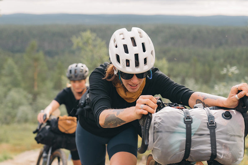
Adventure buddies and Suunto ambassadors Sami Sauri and Henna Palosaari went on a bikepacking trip way up above the Artic Circle over summer. Wild, vast open spaces, reindeer, kindly locals - they had a blast.
“Experiencing the simplicity of life up north and the local culture combined with the tranquility of the long wilderness sections creates a bikepacking experience that takes you miles away from the city hustle,” says Henna about the 430 km trip from Ylläs in Finnish Lapland to Alta, on the fjords at the top of Norway.
Read more about the Arctic Post Road
Turn it all off and come back to the present moment
"Present" follows Suunto ambassador Freya Orban and her friend and photographer Lukas Dürnegger as they go on a fast packing hut to hut trip in the mountains of Jämtland in central Sweden to rediscovering presence and the joy of running. Freya and Lukas left their smartphones at home and really tuned into the living world around them. Along the way they took time to stop a lot – and ate handfuls of juicy blueberries and cloudberries.
Read Freya’s 3 tips to find presence
So far… we have made it this far
Was this MTB adventure actually a MTB adventure? Sure, they had their mountain bikes with them. But with terrain so tough it’s hard to even hike it, what to speak of riding it, the question of what to call this madcap adventure arises.
The ragtag group of riding buddies consisting of Kevin Landry, JF Newton, Margus Riga, Kenny Smith, andPeter Wojnar set off on a freeriding adventure deep into British Columbia’s wild and rugged Chilcotin mountain range in search of new freeride lines.
The word expedition suits it better than adventure and 'challenge' doesn’t really do it justice. Watch the video above and read the report from the film crew and maybe you’ll reach a satisfying way to define it.


ENGO 2とSuuntoを連携|ランニングデータを視界に表示する方法
ランニングやサイクリング中、ペースや心拍数を確かめるために何度も手首を見るのが難しいと感じたことはありませんか。ENGO 2などのActiveLook対応スポーツグラスを使うと、対応するSuuntoウォッチが記録しているトレーニングデータを、レンズ内のヘッドアップディスプレイに表示できます。
この記事では、ENGO 2とSuuntoの連携でできること、役立つ場面、SuuntoPlus™ ActiveLookスポーツアプリを使った基本的な設定方法を紹介します。対応状況はウォッチやアプリの更新によって変わるため、購入前の確認方法もあわせて解説します。
目次
ENGO 2とActiveLookとは
視界に表示できるトレーニングデータ
どのような場面で役立つ?
SuuntoとENGO 2を連携する方法
購入前に互換性を確認する
まとめ
ENGO 2とActiveLookとは
ENGO 2は、持久系スポーツ向けのヘッドアップディスプレイを搭載したスポーツグラスです。レンズ内に小型ディスプレイを配置するActiveLook技術を採用し、対応デバイスから受け取った情報を視界の一部に表示します。
映像で視界全体を覆うタイプのARグラスとは異なり、目的はトレーニング中に必要な数値を簡潔に確認することです。進行方向から大きく視線を外さずにデータを見られるため、腕時計を確認しにくい運動中の情報取得を補助します。
この記事で扱うのは、Suuntoとの部分的な互換性が案内されているENGO 2です。ENGO 3を含むすべてのENGO製品がSuuntoに対応するという意味ではありません。
視界に表示できるトレーニングデータ
SuuntoPlus™ ActiveLookスポーツアプリは、ウォッチが計測しているデータを対応グラスへ送信します。利用できる項目はウォッチ、スポーツモード、グラス、アプリのバージョンによって異なりますが、代表的な情報には次のようなものがあります。
心拍数
ペースまたは速度
経過時間と距離
運動強度
対応センサーを使用したパワー
ナビゲーション中のウェイポイント通知
表示される数値は、トレーニングの判断材料です。常にすべての項目を追うのではなく、イージーランなら心拍数、ペース走なら現在のペース、サイクリングならパワーというように、その日の目的に合わせて情報を絞ると使いやすくなります。
どのような場面で役立つ?
ペースを保ちたいランニング
テンポ走やインターバルトレーニングでは、姿勢やリズムを崩さずにペースを確認したい場面があります。視界内のデータは、設定した強度から大きく外れていないかを確認する補助になります。
ハンドル操作に集中したいサイクリング
路面や周囲の状況へ注意を向けながら、速度、心拍数、パワーなどを確認できます。ただし、表示を見ること自体が注意散漫につながる可能性もあります。交通ルールを守り、安全な場所で表示位置や見え方に慣れてから使用してください。
足元が変化するトレイルランニング
岩や木の根があるトレイルでは、手首へ視線を落としにくいことがあります。必要な情報を視界内で確認できれば、走行リズムを保ちやすくなります。ただし、ディスプレイは安全確認や地図、標識の代わりにはなりません。難しい地形では立ち止まってルートを確認しましょう。
グローブを着用するクロスカントリースキー
腕時計を操作しにくい冬季スポーツでも、トレーニング中の情報確認を補助できます。低温環境では、ウォッチとグラス双方のバッテリー残量も事前に確認してください。
SuuntoとENGO 2を連携する方法
基本的な流れは次のとおりです。メニュー名や画面は、ウォッチおよびSuuntoアプリのバージョンによって異なる場合があります。
SuuntoウォッチとSuuntoアプリを最新の状態に更新します。
Suuntoアプリで、ペアリング済みウォッチの画面からSuuntoPlus™ Storeを開きます。
「デバイス」カテゴリーなどからActiveLookスポーツアプリを探し、ウォッチへ追加します。
ENGO 2の電源を入れ、ウォッチで使用するスポーツモードを開きます。
運動開始前のオプションからSuuntoPlus™を開き、ActiveLookを選択します。
接続と表示を確認してから、アクティビティの記録を開始します。
ウォッチは周辺にある対応グラスとの接続を試みます。複数のグラスが近くにある場合や接続できない場合は、他の機器との接続を切り、ActiveLookスポーツアプリを選び直してください。
購入前に互換性を確認する
SuuntoPlus™対応ウォッチであっても、すべてのスポーツアプリが全モデルで利用できるとは限りません。また、ENGO公式はSuuntoについて「部分的な互換性」と案内しています。旧記事に記載されていた対応機種情報を、そのまま現在の製品へ当てはめないよう注意してください。
購入前には、次の手順で確認することをおすすめします。
Suuntoアプリを最新バージョンに更新する。
使用するウォッチをSuuntoアプリと同期する。
SuuntoPlus™ StoreでActiveLookに「ウォッチへ追加」が表示されるか確認する。
ENGO公式サイトで、ENGO 2の最新の対応デバイス情報を確認する。
必要に応じて、購入店または各メーカーのサポートへ確認する。
ENGO製品の国内での販売形態、保証、返品条件、技術サポートは販売元によって異なります。海外販売店や並行輸入品を利用する場合は、送料、税金、保証の対象地域も確認してください。
まとめ:必要なデータを、必要な瞬間に
ENGO 2と対応するSuuntoウォッチをActiveLookで連携すると、心拍数やペースなどのトレーニングデータを視界内で確認できます。ランニング、サイクリング、トレイルランニング、クロスカントリースキーなど、手首を見にくい場面で情報確認を補助する選択肢です。
一方で、互換性や利用できるデータは機種とソフトウェアによって異なります。購入前にSuuntoPlus™ StoreでActiveLookを追加できることを確認し、安全な環境で表示に慣れてからトレーニングに取り入れましょう。対応する機能やモデルを検討したい方は、Suuntoのスポーツウォッチ一覧から現在のラインナップを確認できます。
Suuntoスポーツウォッチを見る
トレーニングやアウトドアで活用できる、現在のモデルを比較できます。
スポーツウォッチ一覧へ


Suuntoアプリの雪崩地形マップの使い方|バックカントリーのルート計画
バックカントリースキーやスノーボードでルートを計画するときは、距離や標高だけでなく「どんな斜度の地形を通るのか」を確認することが重要です。Suuntoアプリでは、Avalanche terrain(雪崩地形)レイヤーを表示し、斜面の傾斜を地図上で確認しながらルートを計画できます。
多くの雪崩は30〜45度程度の斜面で発生します。しかし、現在地が30度未満の緩斜面だからといって、安全とは限りません。
上部の急斜面から雪崩が流れ込む可能性や、離れた場所から雪崩を誘発する可能性も考える必要があります。
この記事では、Suuntoアプリで雪崩地形マップを確認する方法と、バックカントリーのルート計画でどう活用するかを紹介します。
目次
雪崩地形マップとは?
雪崩と斜度|30〜45度をどう考える?
Suuntoアプリで雪崩地形マップを表示する方法
色の濃さで斜面の傾斜を確認する
雪崩地形を見ながらルートを計画する
現在地だけでなく「上の斜面」を確認する
他のマップレイヤーと切り替えて確認する
作成したルートをSuuntoウォッチへ同期する
雪崩地形マップだけで安全は判断できない
Antti Auttiに学ぶ「雪崩地形への露出を減らす」考え方
まとめ|雪崩地形を避けるルート計画のために
関連記事
雪崩地形マップとは?
Avalanche terrain(雪崩地形)マップは、Suuntoアプリのマップで利用できる地図レイヤーのひとつです。
斜面の傾斜を色で可視化することで、バックカントリーのルートを計画するときに、急斜面がどこにあるのかを把握しやすくします。
雪の状態は日々変化しますが、山の地形そのものは変わりません。
そこで、出発前に地形を確認し、できるだけ雪崩地形への露出を減らすルートを考えるための情報として活用できます。
SuuntoアプリのAvalanche terrainレイヤーでは、斜面の傾斜を色で確認できます。
雪崩と斜度|30〜45度をどう考える?
雪崩地形を考えるうえで、まず知っておきたいのが斜度です。
多くの雪崩は、およそ30〜45度の斜面で発生します。
そのためSuuntoアプリのAvalanche terrainレイヤーでは、このような急斜面を地図上で把握しやすくしています。
ただし、これは「30度未満なら安全」「45度を超えたら危険」と単純に線引きできるものではありません。
雪崩の発生には、
積雪の状態
弱層
降雪
風
気温
斜面の向き
地形
など、さまざまな条件が関係します。
斜度は、その中の重要な判断材料のひとつです。
Suuntoアプリで雪崩地形マップを表示する方法
Avalanche terrainレイヤーは、Suuntoアプリのマップ画面から表示できます。
Suuntoアプリを開く
マップ画面を開く
マップレイヤーのボタンをタップする
Avalanche terrainを選択する
レイヤーを選択すると、斜面の傾斜に応じた色が地図上に表示されます。
この機能はルート作成時だけに限らず、地図を見ながら周辺の雪崩地形を確認するときにも利用できます。
色の濃さで斜面の傾斜を確認する
Avalanche terrainレイヤーでは、色が濃くなるほど斜面が急になるように表示されます。
ルートを計画するときは、線を引こうとしている場所だけを見るのではなく、周囲の斜面も広く確認します。
例えば、谷底を通るルート自体は緩やかでも、その両側に急斜面があれば、雪崩の影響を受ける地形になる場合があります。
「ルートの斜度」ではなく、「そのルートがどんな地形の中を通っているか」を見ることが重要です。
雪崩地形を見ながらルートを計画する
Suuntoアプリでは、Avalanche terrainレイヤーを表示した状態でルートを計画できます。
バックカントリーのルートを考えるときは、
急斜面をどこで通過するか
急斜面の下を通っていないか
谷や沢に入り込んでいないか
より雪崩地形への露出が少ない選択肢がないか
などを確認します。
最短距離だけを優先するのではなく、できるだけ雪崩地形に入る時間や距離を減らせるルートを探すという考え方が重要です。
Suuntoアプリでの基本的なルート作成方法はこちらの記事で詳しく紹介しています。
▶︎ Suuntoアプリでルートを作る6つの方法|GPX・ヒートマップも解説
現在地だけでなく「上の斜面」を確認する
雪崩地形マップを使うとき、特に重要なのが自分がいる場所だけを見ないことです。
雪崩は急斜面で発生した後、斜面下部や緩斜面まで流れ出すことがあります。
つまり、自分が立っている場所の斜度が低くても、上部に雪崩が発生し得る急斜面があれば、その影響を受ける可能性があります。
また、スラブ雪崩では、離れた場所から弱層の破壊が伝わり、急斜面で雪崩が発生する場合もあります。
「ここは緩斜面だから大丈夫」と判断するのではなく、上部斜面を含めた地形全体を見ること。
これが雪崩地形マップを使ううえで非常に重要です。
他のマップレイヤーと切り替えて確認する
Suuntoアプリでは、ルートを計画しながら複数のマップ表示を切り替えることができます。
例えば、
通常のアウトドアマップ
Avalanche terrain
スキーツーリングのヒートマップ
などです。
Avalanche terrainだけを見てルートを決めるのではなく、通常地図で地形や道を確認し、ヒートマップなども参考にしながら、複数の情報を組み合わせます。
ひとつの地図レイヤーに答えを求めるのではなく、それぞれの情報から地形を立体的に理解することが大切です。
作成したルートをSuuntoウォッチへ同期する
Suuntoアプリでルートを作成したら、対応するSuuntoウォッチへ同期して、現地でルートナビゲーションに利用できます。
例えばSuunto Vertical 2では、オフラインマップとルートナビゲーションを使い、行動中に現在地と予定ルートを手元で確認できます。
ここで注意したいのは、アプリのAvalanche terrainレイヤーそのものをウォッチへ転送するわけではないということです。
基本的な流れは、
Suuntoアプリで雪崩地形を確認する
地形を考慮してルートを作成する
作成したルートをウォッチへ同期する
現地ではウォッチでルートをナビゲーションする
となります。
ウォッチは、出発前に考えたルートを現地で確認するためのツールとして活用します。
雪崩地形マップだけで安全は判断できない
Avalanche terrainレイヤーは、雪崩の危険度そのものを表示するものではありません。
表示されているのは地形、特に斜面の傾斜に関する情報です。
実際にその日に雪崩が発生しやすいかどうかを判断するには、
最新の雪崩情報
積雪状態
降雪量
風
気温変化
現地での観察
雪崩に関する知識と経験
など、複数の情報が必要です。
また、バックカントリーではビーコン、プローブ、ショベルなどの装備と、それらを使うための訓練も重要です。
雪崩シーズン前に確認したい基本についてはこちら。
▶︎ バックカントリーに入る前に確認したい雪崩安全チェック8項目
バックカントリー全体の装備・ルート判断・行動についてはこちら。
▶︎ バックカントリースキーを安全に楽しむ14のポイント|装備・雪崩・ルート判断
Antti Auttiに学ぶ「雪崩地形への露出を減らす」考え方
Antti Autti studying the snowpack in Northern Norway. Images by Jaakko Posti.
バックカントリースノーボーダーでSuuntoアンバサダーのAntti Auttiは、ルートを計画するとき、できるだけ雪崩地形への露出を少なくすることを意識しています。
考え方はシンプルです。
雪崩地形に入らずに進める距離が長いほど、その選択肢を優先する。
これは「危険な場所を一度も通らない」という意味ではなく、複数のルート候補があるときに、雪崩地形へ入る時間や距離をできるだけ減らすという考え方です。
そしてAnttiが強調しているのは、アプリだけでは山での安全を確保できないということです。
雪や雪崩について学び続け、現地で自分自身がより良い判断をできるようにする。
Suuntoアプリの雪崩地形マップは、その判断をサポートするための情報のひとつです。
まとめ|雪崩地形を避けるルート計画のために
SuuntoアプリのAvalanche terrainレイヤーを使うと、斜面の傾斜を地図上で確認しながらバックカントリーのルートを計画できます。
活用するときのポイントは次の通りです。
SuuntoアプリのマップからAvalanche terrainを表示する
色の濃さから急斜面の位置を把握する
30〜45度の斜面だけを単純に「危険地帯」と考えない
現在地だけでなく上部の斜面も確認する
雪崩が流れ込む可能性のある地形も考える
通常地図や他のマップレイヤーと組み合わせる
できるだけ雪崩地形への露出が少ないルートを考える
作成したルートを対応するSuuntoウォッチへ同期する
そして最も重要なのは、雪崩地形マップが「安全なルート」を自動的に教えてくれるわけではないということです。
地形、雪、天候、雪崩情報、現地の状況を総合して判断し、必要であれば計画を変更したり引き返したりすることも含めて、バックカントリーのルート計画です。
関連記事
Suuntoアプリでルートを作る6つの方法|GPX・ヒートマップも解説
バックカントリーに入る前に確認したい雪崩安全チェック8項目
バックカントリースキーを安全に楽しむ14のポイント|装備・雪崩・ルート判断
登山ナビゲーションで身につけたい5つのスキル|山で迷わないための基本
登山で道迷いを防ぐには?|地図・コンパス・GPSウォッチを使ったナビゲーションの基本


GPSウォッチのナビゲーションとは?ルート案内・オフラインマップの活用方法
GPSウォッチで記録した軌跡が建物の間でずれたり、山あいで現在地の表示が安定しなかったりするのはなぜでしょうか。その背景を知る鍵が「GNSS」です。
GPSは、現在地を測るために使われる衛星測位システムの一つです。現在のSuuntoスポーツウォッチは、複数の衛星システムや周波数を活用することで、ランニングから登山まで、さまざまな環境で位置情報を捉えやすくなっています。
目次
GPSとGNSSの違い
GNSSで現在地が分かる仕組み
GPSウォッチの測位精度を高める技術
GPSウォッチの測位精度に影響する環境
GPSウォッチの測位精度を高める5つの準備
GPSの測位精度とバッテリーモードの関係
現行SuuntoウォッチのGNSSとナビゲーション機能
GPSウォッチを安全に使うために
GPSとGNSSの違い・測位精度のまとめ
GPSとGNSSの違い
GPSは米国が運用する衛星測位システム
GPSは「Global Positioning System」の略で、米国が運用する衛星測位システムです。日常会話では、衛星を利用して位置情報を測る仕組み全般を「GPS」と呼ぶこともあります。
GNSSは世界の衛星測位システムの総称
GNSSは「Global Navigation Satellite System(全球測位衛星システム)」の総称です。GPSのほか、欧州のGalileo、ロシアのGLONASS、中国のBeiDou、日本のQZSS(みちびき)などが含まれます。
一般にGPSウォッチと呼ばれる製品のなかにも、複数のGNSSを利用できるモデルがあります。つまり、GPSはGNSSの一つであり、GNSSは衛星測位システム全体を指す言葉です。
GNSSで現在地が分かる仕組み
複数のGNSS衛星との距離から現在地を計算する
GNSSの衛星は、軌道情報と非常に正確な時刻を含む電波を地上へ送っています。ウォッチの受信機は、複数の衛星から届く信号の時間差をもとに衛星までの距離を計算し、それらの情報を組み合わせて現在地や移動速度、時刻を推定します。
GNSSによる測位は、大きく次の3つで成り立っています。
宇宙部分:地球の周囲を回りながら信号を送る衛星
管制部分:衛星の軌道や時刻を監視・補正する地上設備
利用者部分:信号を受信して位置を計算するGPSウォッチやスマートフォン
GPSウォッチは携帯電話の圏外でも測位できる
GPSウォッチは衛星へ信号を送り返すのではなく、衛星から届く電波を受信して現在地を計算します。そのため、携帯電話の圏外でも、衛星信号を受信できれば位置情報を取得できます。ただし、地図データのダウンロードやルートの同期には、対応機能や事前準備が必要です。
下の図では、一般的なGPSウォッチと、複数の衛星システムに対応するGPSウォッチが利用できる信号の違いを示しています。
複数のGNSSに対応するGPSウォッチは、測位に利用できる衛星の選択肢が広がります。
GPSウォッチの測位精度を高める技術
複数の衛星システムを利用するマルチGNSS
受信できる衛星の選択肢が増えると、空の一部が建物や地形に遮られていても、位置計算に使える衛星を確保しやすくなります。高層ビルが並ぶ市街地、深い谷、急な斜面、樹木に覆われたトレイルなどでは、見通しのよい場所に比べて衛星信号が弱くなったり、反射した信号を受信したりすることがあります。複数のGNSSへの対応は、こうした環境で測位を安定させる助けになります。
ただし、対応する衛星システムの数だけで精度が決まるわけではありません。アンテナ設計、受信チップ、使用する周波数、ソフトウェア、装着状態、周囲の地形なども結果に影響します。
デュアルバンドGNSSが測位精度を高める仕組み
GNSS衛星は複数の周波数帯で信号を送っています。デュアルバンドGNSSは、L1とL5など2つの周波数帯を利用して位置を計算する仕組みです。
異なる周波数の信号を組み合わせることで、大気による遅延の影響を補正しやすくなります。また、建物や岩壁に反射して遠回りした信号を判別しやすくなるため、高層ビルの間や山岳地帯など、測位条件が難しい場所で軌跡の安定に役立ちます。
それでも、衛星測位の誤差がなくなるわけではありません。頭上の空が大きく遮られる場所では、デュアルバンド対応モデルでも一時的に軌跡がずれる場合があります。
GPSウォッチの測位精度に影響する環境
高層ビル・谷・樹林では衛星信号が遮られやすい
GPSウォッチの記録は、次のような環境で不安定になることがあります。
高層ビルが密集する市街地
急な谷や岩壁に囲まれた場所
密集した樹木の下
トンネルや建物の内部
ウォッチが衣服や装備で覆われている状態
GPS計測は空の開けた場所で開始する
空が遮られる場所では、受信できる衛星が限られたり、建物や岩壁に反射した信号が届いたりします。スタート地点がトンネル内や高い建物のすぐそばにある場合は、可能であれば空の開けた場所で測位を完了してから記録を始めましょう。
GPSウォッチの測位精度を高める5つの準備
1.Suuntoアプリと同期して衛星データを更新する
運動前にSuuntoアプリと同期し、衛星軌道の補助データを最新の状態にします。
2.GPSウォッチのソフトウェアを最新にする
利用可能なソフトウェアアップデートを確認し、ウォッチを最新の状態にしておきましょう。
3.屋外の開けた場所でGPS測位を待つ
スポーツモードを開いたら、衛星を捕捉したことを確認してから計測をスタートします。
4.GPSウォッチを手首の上側に正しく装着する
ウォッチを手首の上側に着け、本体が袖や装備で覆われないようにします。運動中に大きく動かない程度の強さで装着してください。
5.用途に合うGPSバッテリーモードを選ぶ
正確なルート記録を優先するのか、長時間の駆動を優先するのかを、行動時間と周囲の環境から判断します。
GPSの測位精度とバッテリーモードの関係
GPSウォッチは、測位精度を高く設定するほど衛星信号を頻繁に取得するため、一般的にバッテリー消費が大きくなります。一方、省電力を重視したモードでは記録間隔などが調整され、長時間のアクティビティを記録しやすくなります。
短時間のランニングや正確なルート記録を重視する場合は高精度の設定、ウルトラトレイルや長時間の登山では予定時間に合わせたバッテリーモードを選ぶなど、目的に応じた使い分けが大切です。利用できるモードと駆動時間は、モデル、設定、使用条件によって異なります。
各モードの違いや選び方、バッテリーを長持ちさせる設定については、「SUUNTOのGPSウォッチのバッテリーモードを解説|違い・選び方・長持ちさせる方法」で詳しく解説しています。
現行SuuntoウォッチのGNSSとナビゲーション機能
オフラインマップとルートナビゲーションを活用する
対応するSuuntoウォッチでは、事前に地図やルートを準備しておくことで、アクティビティ中に現在地や進行方向を手元で確認できます。オフラインマップは、携帯電話の電波が届きにくい山間部でも地図を確認したいときに役立ちます。
GPS・GNSSによる現在地情報と、事前に用意した地図・ルートを組み合わせてナビゲーションできます。
GNSSとオフラインマップに対応する現行モデル
現行のSuuntoラインアップでは、用途に応じてGNSSやナビゲーション機能を選べます。
Suunto Race 2:デュアルバンドGNSS、オフラインマップ、高度なトレーニング機能を備え、トレーニングからレースまで幅広く使いたい方に適しています。
Suunto Vertical 2:デュアルバンドGNSS、オフラインマップ、長時間のGPS記録に対応し、登山や長距離のアウトドア活動に向いています。
Suunto Race S:コンパクトなボディにオフラインマップとトレーニング機能を搭載し、ロードからトレイルまで楽しみたい方に適しています。
対応する衛星システム、周波数、バッテリーモード、地図・ナビゲーション機能はモデルによって異なります。購入前には各製品ページの最新仕様をご確認ください。
実際の地図表示、ターン案内、ウェイポイント、コースアウト時の確認方法は、「SUUNTOの地図・ナビゲーション画面の見方」で詳しく紹介しています。最新のマップ機能については、「SUUNTO、マップ&ナビゲーション機能を大幅アップデート」もご覧ください。
GPSウォッチを安全に使うために
GPSウォッチやオフラインマップは、現在地や進行方向を確認するための有用な補助ツールです。ただし、衛星信号、バッテリー、機器の状態などによって利用できない場合があります。登山や人里離れた場所では、ウォッチだけに頼らず、紙の地図、コンパス、予備電源、行動計画なども準備してください。表示されるルートと現地の状況が異なる場合は、通行規制や天候、地形を優先し、無理に進まないことが大切です。
GPSとGNSSの違い・測位精度のまとめ
GPSはGNSSを構成する衛星測位システムの一つです。複数のGNSSやデュアルバンドに対応するウォッチは、利用できる衛星と信号の選択肢を増やし、市街地や山岳地帯などでも位置を捉えやすくします。
測位精度を引き出すには、運動前のアプリ同期、最新ソフトウェアの利用、開けた場所での測位、適切な装着、用途に合うバッテリーモードの選択が重要です。仕組みを理解し、自分のフィールドと行動時間に合うモデルや設定を選びましょう。
GPS・GNSS対応のSuuntoスポーツウォッチを探す
GPS・GNSS、オフラインマップ、バッテリー性能を比較して、ランニングやアウトドアに合うモデルを選べます。
Suuntoスポーツウォッチを見る


Who’s having the most fun exercising? Here’s the answer – based on data!
Feeling is an excellent metric for recovery. If your feelings after exercise start to trend downwards, something is not right. You may be pushing too hard, not recovering well enough or might be getting sick. Consider taking a break or doing something different for a change.
But in addition to helping you track your recovery, feeling data reveals more. Here are six interesting findings about Suunto community, based on the data from Suunto app database.
1. Activity type does matter: The best feelings on average are recorded after dancing, downhill skiing, horseback riding, badminton and snowboarding.
2. Two activity types stand out as exceptionally poor: The feelings after running and trail running are clearly below other activity types.
3. Weather does not have a big impact on the feeling – unless it is a torrential downpour: The activity type, for example choosing cycling over running, has a much bigger impact.
4. Gender makes a difference: Women have more (or at least as much) fun as men in all other activity types except soccer.
5. Age does not matter: The age of the athlete did not have a correlation with the mood after exercise.
6. Country heavily impacts the mood: People exercising in Austria, China, Croatia, Poland and Serbia are generally feeling exceptionally well after a training session, while France, Italy, Japan, Spain and Sweden are in the opposite end of the list with much poorer feelings after working out.
In addition to fun facts, the data also reveals interesting trends: As an example, the feeling in cycling, swimming and walking rose to a new, higher level in March 2020 and has stayed on that higher level. Changes in other activity types since Covid pandemic started have not been as clear.
Happy adventures – and keep on tracking your activity feelings for your own wellbeing and our shared interest!
Lead image: Harald Wisthaler Bikewash image: Anthony Bonello


