




SUUNTOブログ

6 amazing training routes from Ryan Sandes
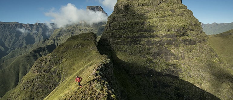
Ultra runner Ryan Sandes has traveled the world to run some of its sweetest single trail. Consider him, then, your go-to trail aficionado! Check out below the six trail running routes he picks as the cream of the crop! Coming from Cape Town, South Africa, ultra runner and Suunto ambassador Ryan Sandes is at home running on coastal trails by the ocean. But while his roots are in Cape Town's surf beaches and the trails above in its mountains, over time he has found more and more inspiration in alpine environments. This year, for example, he's been training in mountains in Californina and the French Alps.
Below, he shares his six favorite running routes from South Africa and the United States.
Read Ryan's tips about how to go the (ultra) distance!
San Fran 50 miler, San Francisco, USA
Distance: 78.78 km Time: 06h45m Ascent: 3125 m Decent: 3137 m Highest point: 554 m Why: The Marin Headland is really spectacular and the coastal running makes me feel like I am back at home in South Africa. The trails are really fast and runnable. The Headlands are always abuzz with runners, mountain bikers and dog walkers making for a great friendly atmosphere. There are some great coffee shops right next to the trail which is an added bonus.
Big Bear Mountain, California, USA
Distance: 52.14 km Time: 04h35m Ascent: 1104 m Decent: 1091 m Highest point: 2394 m Why: I spent six weeks in Big Bear earlier this year training for the Western States 100 miler. I really enjoyed my time there and developed a special bond with the mountains. The scenery is epic and there is a great variation of trails from open fire roads to really technical single track. This was one of my final long runs I did in preparation for the Western States.
Click here for Ryan's tips on how to recover like a pro!
Glacier Point, Yosemite National Park, USA
Distance: 17.76 kmTime: 02h09m Ascent: 1008 m Decent: 1031 m Highest point: 2195 m Why: The Yosemite National Park is one of the most beautiful places I have been to. Ha! I get itchy feet everytime I get to the National Park and just can't stop running. The run up to Glacier Point is a nice gradual climb and the views from the top are absolutely breath taking. This is the perfect recovery run to take it easy and enjoy the scenery.
Skyrun Route, Drakensberg, South Africa
Distance: 96.05 km Time: 12h36m Ascent: 4760 m Decent: 4579 m Highest point: 2674 m Why: The Skyrun is a 100 km self-navigational run across the Drakensberg Mountains. There are no proper trails to follow and you basically aim for the peaks and ridgelines ahead of you. It is a really remote area, at altitude and is the perfect place for me to train for big mountain races. Running in the Drakensberg Mountains makes me feel really small and it can be super humbling. © Kolesky/ Nikon/ Red Bull Content Pool
Lion's Head, Table Mountain, South Africa
Distance: 04.05 km Time: 0h29m Ascent: 370 m Decent: 372 m Highest point: 654 m Why: Lion's Head is an iconic mountain right next to Cape Town's city centre, with panoramic views of Cape Town and Table Mountain from the top. The trail starts off on an open fire road but as you climb up the mountain the trail gets more technical with ladders and chains towards the top. This is one of my shortest training sessions but I enjoy pushing myself on this run. It’s a real lung buster!© Nick Muzik/Red Bull Content Pool
Table Mountain Crossing, South Africa
Distance: 15.08 km Time: 02h02m Ascent: 1070 m Decent: 949 m Highest point: 1045 m Why: Table Mountain is an extension of my back garden and my favorite mountain to train on. I love being able to see the ocean from the summit and I feel really at home on this mountain. The Table Mountain Crossing trail is very technical with lots of scrambling and you have to keep an eye out for giant snakes in summer. The mountains inspire me to dream but the ocean is were my roots are. © Craig Kolesky/ Red Bull Content Pool

7 reasons to love running at night
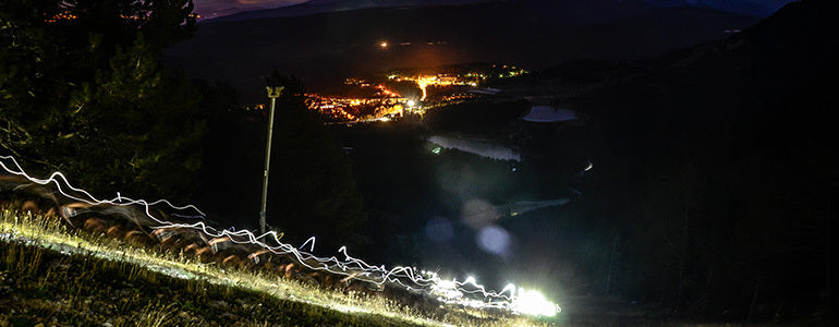
True, you may not get to enjoy the same distant views, but there are good reasons to love running at night, says elite trail runner Gediminas Grinius – who trains on top of his full time job. Here are his top 7 reasons to put on your headtorch and high visibility jacket and get out the door for a night run!
Aside from working full time, Gediminas is also a father of two. © Gediminas Grinius
Explore your wild side
At night your senses are more attuned says Gediminas. “With less of an emphsis on vision, you become more alert to your surroundings and that brings out your wild side, especially when alone. And that’s the best remedy after a long day in the office.”
Escape the heat
Running in warm temperatures isn’t all great, says this year’s Transgrancanaria winner. “Running at night lets you avoid the day’s heat,” he says, “which is better for training”.
Find new beauty
“Running at night breaks up the routine and you can find new beauty in the same trails – especially for those like me who don’t have a lot of hills to train on.”
Avoid the traffic
Turn your commute into training, says Gediminas. “That way you avoid the traffic and you beat the ‘no time for sport’ excuse. Commuting to the office in the winter months means running in the dark is unavoidable,” he adds.
Prepare for ultras
Use night running to prepare for an ultra. “Almost all 100 mile races have a night element in it,” he says. And for regular trail runners, most 100 km races have a night element as well!”
Improve your technical downhills
“While running at night you must trust your sixth sense more often,” says Gediminas. “Sometimes your feet are your only sensors on the ground and you have to turn your brain off and trust your feet to know where to step. This is exactly the same as when you have to run on technical terrain so running at night is a good way to make you better on super technical downhills.”
Unleash the dog!
“Zoro is my best running partner and the enjoys freedom as much as I do, but because of a lot of distractions during the day (people, other dogs) it's the best time to set him free at night.”

The road to Kona Ironman, Step two: rapid progress
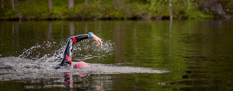
Last week we kicked off the first instalment of our four-part series following Suunto athlete Åsa Lundström as she prepares for the coming Ironman World Championship in Kona, Hawaii. After looking at step one last week, planning, this week Åsa tells us what progress, step two, looks like as her training intensifies.
There’s one crucial sign Åsa looks for to know she’s making progress in her training for the Kona Ironman: feeling unbeatable.“They don’t come very often, but every now and then, you should get that moment, if only for a moment, that you are unbeatable,” she says. “If I don’t ever get those ‘I’m on fire today!’ moments in my training periods, then something needs changing.“I don’t do tests or anything like that to check I’m in good shape, I just look for signs, a feeling, during the quality sessions I do – it’s the feeling of being immortal, unbeatable, strong.”
Click here to read more about Åsa Lundström, the unlikely Swedish triathlete
© Orca/Gines Diaz
Having planned her training with her coach Cliff English, it’s then time to make rapid progress, to push herself towards her personal best while also ensuring she has enough recovery time.Åsa’s training progresses through three stages: the first is getting into the rhythm of hard training; the second stage involves blocks of quality and quantity sessions; and the last is a tapering period of two weeks before race day. As Åsa moves through the three stages, her coach Cliff English tracks her performance and makes adjustments to her training as required. Understanding and trust between athlete and coach is essential here.
The longer Cliff works with an athlete, the more data he accumulates, which better helps him track the athlete’s performance and recognize when changes must be made. This means both he and Åsa must be sensitive to signs they’re pushing too hard or not hard enough.
Click here to read Åsa’s 8 open water swimming tips!
“If I start having trouble sleeping, or lose my appetite that could be a sign to back off a bit,” Åsa says. “On the other hand, if I never feel exhausted after a quality session, but have an unsatisfying feeling, that could be a sign of not pushing hard enough. “I am supposed to feel tired between the sessions more or less all the time.”As her training intensifies, Åsa also works on the mental side of her training by spending time visualizing the race, the potential scenarios that could happen and how she would respond to them. “As race day gets closer, I also stop meeting people who might be sick, or even just have a minor cold,” she says. “I skip junk food and unnecessary treats and I make sure I get enough sleep every night.”
Stay tuned for third installment of our four part series about Åsa as she makes progress on the road to the Ironman World Championship in Kona.


世界の絶景トレイル&山岳ルート6選|Emelie Forsbergが愛した場所
海を見下ろす北欧の森、モンブラン山群を望む尾根、雲の上へ続くアルプスの岩稜。ひと口に「山を走る」といっても、その地形と必要な技術は大きく異なります。
この記事では、スウェーデン出身のスカイランナー、Emelie Forsberg(エメリー・フォースベリ)が愛してきた6つの場所を手がかりに、世界のトレイルと山岳ルートの魅力を紹介します。距離を競うためのランキングではなく、「次はどんな景色の中を進みたいか」を考えるためのガイドです。
安全に関する注意:この記事には、一般的なトレイルランニングの範囲を超え、スクランブリング、ロープを使う登攀、露出感の強い岩稜を含むルートがあります。掲載データは2015年に紹介されたEmelieのアクティビティ記録であり、現在の公式登山ルートや推奨コースを示すものではありません。実際に訪れる場合は、現地の最新情報、天候、通行規制、自分の技術と装備を確認し、必要に応じて山岳ガイドを利用してください。
目次
6つのトレイル&山岳ルートを比較
Kebnekaise|北極圏に近いスウェーデンの高峰
Aiguillette des Posettes|モンブランを望む尾根
High Coast|森と海岸を結ぶ北欧トレイル
Dent Blanche|ランニングの枠を超えるアルパインルート
Glen Coe|荒々しい岩稜を越えるスコットランドの山岳地形
Jämtland Mountains|山小屋をつなぐ北欧のロングトレイル
海外のトレイルを走る前のルート計画
世界のトレイル&山岳ルート6選を比較
Emelieが選んだ場所には、走り続けやすい海岸沿いのトレイルから、ロープ確保を必要とする高峰までが含まれます。まずは同じ「山岳ルート」でも性格が異なることを確認しましょう。
場所原文の記録地形の特徴位置づけ
Kebnekaise/スウェーデン16.09km・上昇2,288m岩場、スクランブリング、易しい登攀上級者向け山岳ルート
Aiguillette des Posettes/フランス9.17km・上昇979m急勾配の登山道と眺望のよい尾根経験者向け山岳トレイル
High Coast/スウェーデン27.76km・上昇850m海岸、森、小さな丘区間を選びやすいロングトレイル
Dent Blanche/スイス4.42km・最高地点4,365m露出した岩稜、ロープ確保を伴う登攀アルパインクライミング
Glen Coe/スコットランド50.62km・上昇3,954m岩稜、ガレ場、露出したスクランブリング高度な山岳技術を要するルート
Jämtland Mountains/スウェーデン35.70km・上昇604m開けた山岳トレイルと山小屋長く動き続ける北欧トレイル
※距離・上昇量・最高地点は、2015年のSuunto原文で紹介されたEmelieの記録です。現行の標準ルート、往復距離、難易度を示すものではありません。
Kebnekaise|北極圏に近いスウェーデンの高峰
Kebnekaise(ケブネカイセ)は、スウェーデン北部ラップランドにそびえる同国最高峰です。氷河地形、岩の多い稜線、北極圏に近い広大な景観が、この山を特別な存在にしています。
Emelieが友人とたどった記録は、TouplagorniとKebnekaiseを越え、スクランブリングと易しいクライミングを含むものでした。これは、一般登山者向けの標準的な登頂ルートと同一とは限りません。Kebnekaiseには複数のルートがあり、氷河や高度な箇所を通る場合は知識、装備、ガイドが必要です。
この地域の魅力は、速く走ることだけではありません。足場の変化に合わせて走る、歩く、手を使うという動作を切り替えながら、仲間と長い山岳時間を共有することにあります。
Aiguillette des Posettes|モンブランを望む尾根
フランス・シャモニー谷の北側にあるAiguillette des Posettes(エギュイエット・デ・ポゼット)は、モンブラン山群、ル・トゥール氷河、周囲の谷を見渡せる尾根です。Emelieにとっては、朝の速いトレーニングにも、午後のリカバリーにも使える身近な山でした。
ただし、「短い距離=簡単」ではありません。現地観光局が案内するハイキングルートも急勾配の難しいコースに分類され、積雪や天候によって状況が変わります。原文の9.17km・上昇979mという記録も、平地の10kmとはまったく異なる負荷です。
尾根から広がる眺望と、限られた距離でしっかり標高を上げられることが、この場所の魅力。訪問前にはシャモニーの観光局や山岳情報機関で、積雪、リフト運行、登山道の状態を確認してください。
High Coast|森と海岸を結ぶ北欧トレイル
High Coast(ホーガ・クステン)は、Emelieが育ったスウェーデン東部の海岸地域です。小さな丘、深い森、岩の海岸、入り江が連続し、高山とは異なるリズムで長く走れます。
High Coast Trailの全体は約135kmで、9つのステージに分かれています。Emelieが紹介した27.76kmはその一部。全線を一度に進む必要はなく、11〜27kmほどの区間から、体力や滞在時間に合わせて選べる点が魅力です。
標高は高くなくても、岩場、木の根、起伏が積み重なると脚への負担は増えます。また、盛夏には水の確保が難しい区間もあります。区間ごとの水場、補給、交通手段を事前に確認し、森と海岸の変化を味わうペースで進みましょう。
Dent Blanche|ランニングの枠を超えるアルパインルート
スイス・ペナインアルプスのDent Blanche(ダン・ブランシュ)は、標高4,000mを超える鋭い岩峰です。Emelieは、走れる場所を走り、技術的な場所を登る一日を「マウンテン・デイ」の例として紹介しました。
ここはトレイルランニングコースではありません。原文でも登攀グレードAD、露出した地形、ロープによる確保が必要な場所として説明されています。標高4,000mを超える環境では、岩稜の技術に加え、高度順応、落石、雪氷、急変する天候への判断も求められます。
この記事を見て同じ軌跡を追うのではなく、Emelieの「山ではスピードより地形に合った動き方を選ぶ」という姿勢に注目してください。Dent Blancheへの登攀は、十分な経験を持つ登山者が、最新の山岳情報を確認し、必要に応じて認定山岳ガイドと計画する領域です。
Glen Coe|荒々しい岩稜を越えるスコットランドの山岳地形
スコットランド・ハイランド地方のGlen Coe(グレンコー)は、急峻な谷、草地、岩稜、変わりやすい天候で知られます。Emelieが紹介したのは、かつてのGlen Coe Skylineレースに由来する長大な記録です。
現在公開されている旧レースルートの説明でも、荒れた足元、岩屑の斜面、大きな上り下りに加え、Curved RidgeのGrade III、Aonach Eagach RidgeのGrade IIスクランブリングが含まれるとされています。場所によっては転落の危険があり、途中から容易に離脱できない区間もあります。
速く走れるトレイルと、慎重な三点支持が必要な岩稜が同じ一日の中に現れることが、Glen Coeの難しさです。距離やGPXだけで判断せず、スコットランドの山岳経験、ナビゲーション能力、悪天候への装備、緊急時の撤退計画まで含めて検討してください。
Jämtland Mountains|山小屋をつなぐ北欧のロングトレイル
Jämtland Mountains(イェムトランド山地)は、スウェーデン中部からノルウェー国境へ広がる山岳地域です。開けた高原状の地形と山小屋ネットワークがあり、軽い荷物で山小屋から山小屋へ長く移動するスタイルに向いています。
Emelieは山岳地帯で働いていた頃、比較的なだらかなトレイルを小さなバックパックで走っていました。紹介された記録は35.70km・上昇604m。急峻な高峰とは違い、一定のリズムで長く動き続けられることが魅力です。
一方、北欧の山は標高が低くても森林限界が低く、風雨や低温の影響を受けやすい環境です。山小屋の営業期間、予約の要否、渡渉、水や食料の補給、携帯電話の圏外区間を確認し、天候が崩れたときに自立できる装備を持ちましょう。
海外のトレイルを走る前のルート計画
知らない山域では、魅力的な写真や公開GPXだけで出発を決めないことが大切です。ルートの現在の通行状況、登山道の種類、獲得標高、最高地点、技術的な難所、エスケープルート、日照時間、現地の救助体制まで確認しましょう。
公式情報を優先する:観光局、国立公園、登山協会、山小屋、レース主催者の最新情報を確認する
原文の軌跡を標準ルートと思わない:アスリートの記録は私有地、廃道、登攀区間、季節限定区間を含む可能性がある
距離と標高をセットで見る:短いルートでも急登や岩場があれば行動時間は長くなる
地図を複数用意する:ウォッチやスマートフォンに加え、現地で推奨される地形図やコンパスも携行する
撤退基準を決める:時刻、天候、視界、疲労、仲間の状態に応じて引き返す条件を事前に共有する
これからトレイルランニング用のウォッチを選ぶ場合は、GPS精度、オフラインマップ、ルートナビゲーション、バッテリー持続時間、操作性などを、自分が走る距離や山域に合わせて比較することが大切です。詳しくは、トレランにおすすめのGPSスマートウォッチとは?必要な機能と選び方で解説しています。
GPXルートをSuuntoウォッチに入れる方法では、ルートの作成・確認・同期の流れを解説しています。地図上の線、ターン案内、ウェイポイントの読み方は、SUUNTOの地図・ナビゲーション画面ガイドも参考にしてください。
Suunto Vertical 2は、オフラインマップ、デュアルバンドGPS、クライムガイダンス、長時間バッテリーに対応し、長い山岳行動の計画と記録を支えます。ただし、ウォッチは安全を保証するものではありません。現地情報、判断力、適切な装備と組み合わせて活用してください。
Emelieが愛した6つの場所に共通するのは、速さではなく、その土地の地形に合わせて身体の使い方を変える楽しさです。海岸の森からアルプスの岩稜まで、自分の経験に合うフィールドを選び、準備そのものから次の冒険を始めましょう。
次のトレイルを計画しよう
オフラインマップとルートナビゲーションに対応するSUUNTOスポーツウォッチをチェックしてください。
SUUNTOスポーツウォッチを見る

The road to Kona Ironman, Step One: Planning for Success
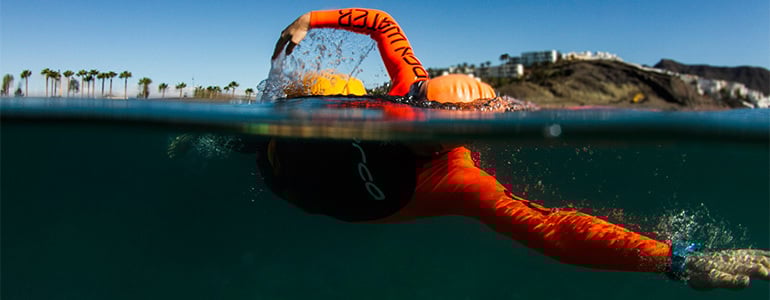
What does it take to train for the Ironman World Championship in Kona, Hawaii? Follow our four-part series about Suunto athlete Åsa Lundström as she prepares and find out!
For Swedish triathlete Åsa Lundström the next few weeks are everything.
Over the last month, the 30-year-old medical student and professional athlete has been preparing for the approaching Ironman World Championship in Kona, Hawaii on October 10th, 2015.
It’s the legendary Ironman that every triathlete dreams of competing in. That dream is about to become a reality for Åsa.
“Every sport has tales to tell of battles on the race course,” she says. “And with Ironman, we all hear stories of the legendary clashes of the triathlon titans at Kona.
“The best part is that we now have the opportunity to become one of those stories.”
Click here to read more about Åsa, the unlikely Swedish triathlete
Like all big projects, Åsa's road to Kona begins with the most important step: careful planning. She works closely with her professional triathlete coach, Cliff English, for this. When to intensify, where to train and when to go to Hawaii have all been planned well in advance.
Cliff updates Åsa’s training schedule week-by-week, always trying to find the right balance between the intensity and volume of her training and ensuring she gets enough recovery time.
“I’m constantly monitoring her sessions, looking at objective measurements, such as pace and power, as well as her subjective feedback on each session and on other factors including sleep quality, muscle soreness and freshness,” Cliff says.
During a normal training week, Åsa puts in between 20 and 25 hours. For Kona, that jumps to 35 hours every week. Her life becomes structured around training. In one week, she swims five or six times, cycles four or five times, runs five to six times and does strength and core training three times.
“Åsa typically trains two to three times per day,” Cliff says. “Some of the sessions are separate with a morning session then a midday session and typically a lighter active recovery session later in the day.
“I tend to prescribe one key session per day, however I also include combo sessions that include bike and run that are typically executed at race efforts.”
All this training might sound austere, like Åsa has no life, but she enjoys the process.
“When I have a big goal to work towards, it feels natural to focus on that, and to make choices adjusted to it,” Åsa says. “I don’t believe being disciplined means life cannot be fun at the same time.”
To keep things fun and to plan in a short term training goal, Åsa recently competed in the Tjörn Triathlon in Sweden and won the women’s division.
“It was a great boost,” she says, “and gave me proof that my training is going in the right direction.”
That’s important because she says it’s not always easy to tell if her build up is going well.
“When you are in a big training period, you feel tired and worn, and it’s hard to tell sometimes,” she explains. “However, when you feel tired, and you somehow manage to make the body do what you ask, then this is a good sign, especially if you were able to push yourself to a required pace or effort you didn’t think you could do.”
Åsa recently travelled to Fuerteventura in the Canary Islands to begin her final preparations. The warmer conditions are more similar to Hawaii than in Sweden, making it a good training ground.
Check out the second step, progress, of our four part series about Åsa as she continues on the road to the Ironman World Championship in Kona.

トレイルランニングの練習コースの選び方|登り・下り・距離を組み合わせるポイント
トレイルランニングの練習では、走る距離だけでなく、累積標高、登りの長さ、下りの路面、テクニカル区間の割合によって負荷が大きく変わります。大会に向けて準備するなら、「長く走る日」と「登りを鍛える日」を分け、目的に合うコースを選ぶことが大切です。
この記事では、山岳アスリートのキリアン・ジョルネが紹介した5つのトレーニングルートをヒントに、トレイルランニングの練習コースを組み立てる方法を解説します。海外の高難度ルートをそのまま再現するのではなく、登り、下り、距離、路面、標高という要素を、日本での練習へどう取り入れるかを見ていきましょう。
目次
練習コースを決める5つの要素
キリアン・ジョルネが選んだ5つのルート
目的別にコースを組み立てる方法
Suuntoアプリでルートと標高を確認する
山岳ルートを走る前の安全確認
まとめ
トレイルランニングの練習コースを決める5つの要素
同じ10kmでも、平坦な林道と急峻な山道では、必要な時間も身体への負荷も異なります。コースを比較するときは、距離だけで判断せず、次の5項目を確認しましょう。
確認項目
わかること
練習への活かし方
距離
行動時間と持久力の目安
短時間走とロング走を分ける
累積標高
登り下りの総量
目標レースに近い登坂量へ段階的に近づける
勾配と登りの長さ
走るか歩くか、筋力をどれほど使うか
短い急坂と長い緩斜面を使い分ける
路面と技術難度
足運び、バランス、下りの難しさ
安全に反復できる区間から慣れる
最高標高と環境
気温、風、酸素の薄さ、天候変化
高地は通常の練習と分け、無理に再現しない
とくに累積標高は、コースの厳しさを考える重要な手がかりです。ただし、同じ累積標高でも、長い登りが1本あるコースと、短いアップダウンを何度も繰り返すコースでは疲労の出方が変わります。高度プロファイルを見て、標高差がどこに集中しているかまで確認してください。
キリアン・ジョルネが選んだ5つのトレーニングルート
原文で紹介された5ルートには、それぞれ異なる山岳能力が求められます。以下の距離、時間、累積上昇、最高地点は2015年の記事に掲載された当時の参考値です。現在のコース状況や所要時間を保証するものではありません。
ルート
距離
記録時間
累積上昇
最高地点
練習要素
エルスフィヨルド・トラバース(ノルウェー)
18.09km
4時間49分
2,758m
1,093m
狭い稜線、スクランブリング、急な登り下り
エギーユ・ド・レム(フランス)
17.10km
3時間39分
1,782m
2,844m
ランニングと登攀を組み合わせる高難度ルート
モンブラン(フランス)
24.78km
5時間57分
3,808m
4,815m
長い登り、高所、雪氷を伴うアルパイン環境
ピック・カルリット(フランス・ピレネー)
21.30km
3時間12分
861m
2,633m
比較的走れる区間と持久力
グランド・ティトン(アメリカ)
19.27km
2時間54分
2,264m
4,197m
岩場、急峻な地形、高所での長時間行動
重要:これらのルートには、一般的なトレイルランニングを超える登攀、露出した稜線、雪氷、高所などが含まれます。キリアンの記録時間を目標にしたり、古いルート情報だけを頼りに入山したりしないでください。挑戦する場合は、最新の現地規制、登山道、天候、必要装備を確認し、十分な技術と経験を持つガイドや現地機関の判断に従ってください。
エルスフィヨルド・トラバースから学ぶ:テクニカル区間
狭い稜線とスクランブリングが続くこのルートは、スピードよりも足場を選ぶ力と全身の安定性が重要です。国内で応用するなら、危険な岩稜を選ぶ必要はありません。足元を安全に確認できる短い不整地で、歩幅を小さく保ち、重心を安定させる練習から始めます。
エギーユ・ド・レムから学ぶ:登りと走れる区間の切り替え
走れるトレイルと登攀が組み合わさるコースでは、運動強度が何度も変化します。登りで無理に走り続けず、パワーハイクへ切り替え、傾斜が緩んだら再び走る練習が実践的です。
モンブランから学ぶ:長い登りへの持久力
モンブランのような高所・雪氷ルートは、通常のトレイルランコースではありません。ただし「長い登りで一定の出力を保つ」という要素は、国内の安全な登山道や登坂区間でも練習できます。最初は30~45分程度の連続した登りから始め、疲労を見ながら時間を延ばしましょう。
ピック・カルリットから学ぶ:走れる山道での持久走
比較的走りやすい区間が多いコースは、トレイルで一定のリズムを保つ練習に向いています。急登の多いコースだけでなく、緩やかな林道や起伏のあるトレイルも組み合わせると、長時間動き続ける力を養えます。
グランド・ティトンから学ぶ:岩場と長い下り
岩が多いコースでは、登る力だけでなく、下りで正確に足を置く技術が必要です。疲労した状態の急な下りは転倒リスクが高まるため、練習では短く安全な区間を使い、速度よりフォームとコントロールを優先してください。
目的別にトレイルランニングのコースを組み立てる方法
トップアスリートのルートから取り入れるべきなのは、距離やタイムそのものではなく、コースが持つ練習要素です。週ごとの目的をひとつに絞ると、負荷を管理しやすくなります。
登りを強化する日
一定時間登り続けられる坂、または同じ場所へ戻れる周回・往復コースを選びます。急坂の反復では筋力、長い緩斜面では持久力を意識します。登りの勾配、垂直速度、獲得標高をトレーニングに活かす方法は、トレイルランニングの登りを攻略する方法も参考にしてください。
下りの技術を磨く日
見通しがよく、短時間で反復できる安全な下りを選びます。視線を少し先へ向け、接地を身体の真下へ近づけ、減速しすぎない小さなステップを意識します。雨天や濡れた岩、混雑した登山道では練習を控えましょう。
レースに近い負荷を確認する日
目標大会の距離、累積標高、路面を確認し、その一部を再現できるコースを探します。最初から全距離を走るのではなく、距離または累積標高を抑えたコースから段階的に増やします。週間メニューや大会準備は、初心者向けトレイルランニングの練習方法で詳しく紹介しています。
疲労をためずに動く日
練習のすべてを山岳コースにする必要はありません。会話できる強度で走れる林道や緩やかなトレイルは、フォームを崩さず運動時間を確保する日に向いています。高負荷の日の間には、休養日や軽い運動日を設けてください。
Suuntoアプリでルートと標高を確認する
練習コースを決めるときは、Suuntoアプリのマップで距離と高度プロファイルを確認します。ヒートマップは、多くのユーザーが記録している道をスポーツ別に探す手がかりになります。路面情報も確認し、舗装路、未舗装路、トレイルを目的に合わせて組み合わせましょう。
Suuntoアプリでマップを開き、トレイルランニングのヒートマップを表示します。
スタート地点を決め、ルートを作成します。
距離、累積上昇・下降、高度プロファイルを確認します。
急な登りや下りの位置、折り返し地点、途中で離脱できる場所を確認します。
対応するSuuntoウォッチへルートを保存・同期します。
ルートの作成や取り込みは、GPXルートをSuuntoウォッチに入れる方法、人気ルートの探し方はSuuntoアプリのヒートマップの使い方をご覧ください。
長い山岳ルートやナビゲーションを重視する場合は、オフラインマップと長時間バッテリーを備えたSuunto Vertical 2が、ルートやこの先の登り下りを確認する助けになります。トレーニングとレースでの見やすさを重視するなら、Suunto Race 2も選択肢です。ウォッチ上の地図や案内表示は、SUUNTOの地図・ナビゲーション画面の見方で確認できます。
山岳ルートを走る前に確認したい安全ポイント
GPSウォッチやアプリのルートは便利ですが、通行可能であることや安全を保証するものではありません。出発前には、次の項目を別途確認してください。
登山道の通行止め、工事、季節規制
天気予報、雨量、風、気温、日没時刻
残雪、凍結、増水、落石などの状況
水分、補給食、防寒具、ライト、救急用品
携帯電話の圏外区間と緊急時の連絡方法
予定を短縮できる分岐やエスケープルート
家族や同行者への行程共有
ヒートマップ上で利用が多い道でも、現在通行できるとは限りません。また、登山者が多い道では、追い越しやすれ違いの際に速度を落とし、歩行者と自然環境へ配慮しましょう。初めての山域では、計画に余裕を持ち、単独行を避ける判断も重要です。
まとめ|距離ではなく、目的からコースを選ぼう
キリアン・ジョルネが選んだ5つのルートは、登坂力、テクニカルな足運び、長時間の持久力、高所への対応など、山岳ランニングに必要な要素の違いを示しています。ただし、トップアスリートの距離やタイムをそのまま追う必要はありません。
まずは「今日は登りを鍛える」「安全な下りで足運びを練習する」「走れるトレイルで長く動く」など目的をひとつ決め、現在の体力に合う距離と累積標高から始めましょう。Suuntoアプリで高度プロファイルを確認し、対応するGPSウォッチへルートを同期すれば、計画した登り下りと現在地を行動中にも確認できます。
次のトレイルに合うGPSウォッチを選ぶ
ルートナビゲーション、オフラインマップ、標高データ、長時間バッテリーを活用して、トレーニングとレースの準備を整えましょう。
SUUNTOのランニングウォッチを見る


