




SUUNTOブログ

7 adventure films to watch over the holidays
Over the course of 2021 we’ve had the pleasure of being involved with some excellent adventure films. Now the holiday season is upon us, we decided to curate our favorite short films for you so when you have some downtime soon you can kick back and watch them. Scroll down for our seven favorites!
From Rails to Trails
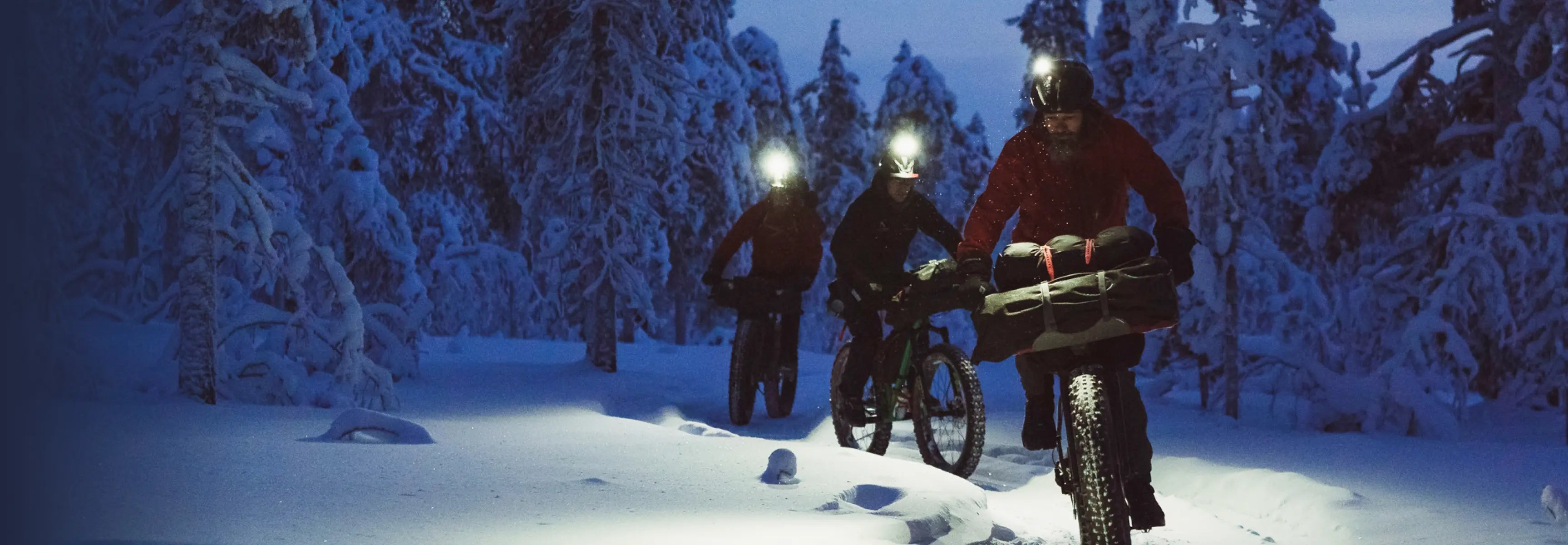
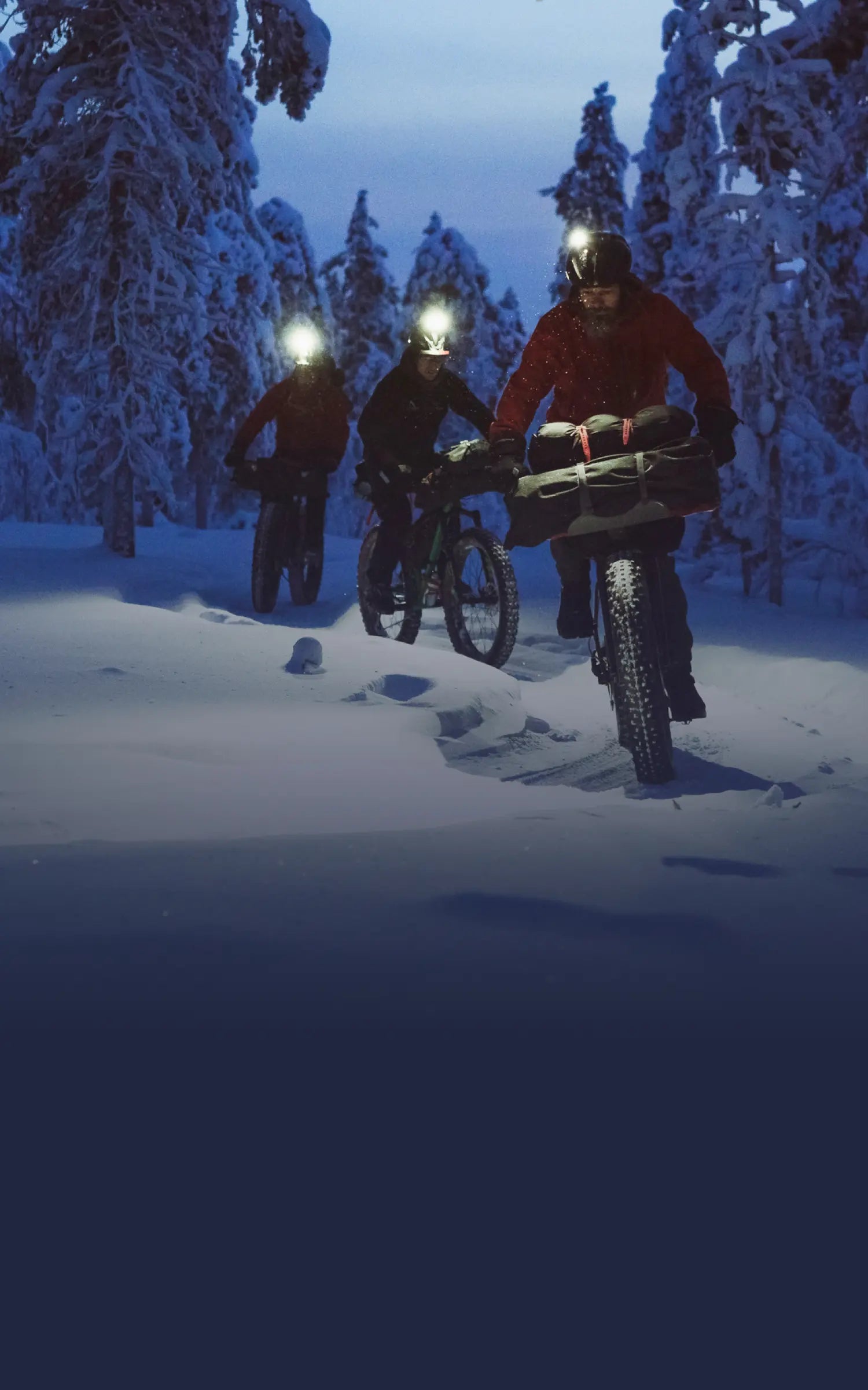
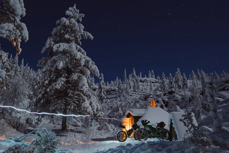
Just watching this will make you shiver. Our very own bike lover Antti Laiho and his buddies Timo Veijalainen and Erkki Punttila went on an overnight bikepacking tour in the Finnish Lapland in the middle of winter. The landscapes look like something from a fairytale. Truly magical.
Rails to Trails from Kona Bikes on Vimeo.
Peak creators
Since forever there’s been a connection between creativity and the great outdoors. In this series of films we talk to an artist, a photographer, an architect and a trail builder about their creative process and how the outdoors inspires them.
Canary in the coalmine
Decorated technical diver, explorer and filmmaker Jill Heinerth explores the veins of the Earth. She sees close up how the impacts of humanity are affecting our planet so considers herself a canary in the coalmine.
How fast can Kilian run a vertical k?
This film shows just how much the Kilian pushes himself during his lightning fast ascents. He might be the GOAT mountain athlete, but that doesn’t mean it’s a walk in the park for him. Watch him attempt to break the fastest vertical k record and push his lungs to their limit.
Immersed
Swedish slopestyle mountain biker Emil Johansson won the 2021 world championship and is now the most successive slopestyle rider in history. But it very nearly wasn’t to be. A mysterious autoimmune disease came close to derailing his dreams. This film is about his journey.
Finding myself
Suunto ambassador Sami Sauri fell in love with cycling as a teen and says it gave her a new purpose in life. Since then she has done epic bikepacking tours across the US, and elsewhere. When she’s not riding, she might be out surfing or trail running.
Arctic Lines season two
Finnish freerider Antti Autti has embarked on the second season of his Arctic Lines project, the goal of which is to ride 30 lines above the Arctic Circle. He and his team document each trip and release a film about the experience. Watch as they face brutal cold, the polar night and their physical limits in the pursuit of sweet, sweet rides.
Lead images by Jaakko Posti Photography
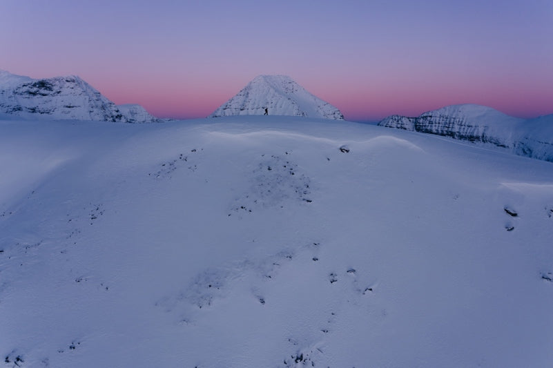

Calling winter sports fans: help researchers reduce avalanche fatalities
A first of its kind research project in Norway is inviting Suunto users to help them gain insights into how we make decisions in avalanche terrain, and what we can do to reduce avalanche accidents.
The Center for Avalanche Research and Education (CARE) at UiT the Arctic University of Norway wishes to follow 10 000 winter sports fans for 10 years to examine how we make decisions in avalanche terrain, and how we can all be safer.
To join the CAREpanel and help with this important, and first of its kind longitudinal study, you must be involved in a winter sport like skiing, snowboarding, ice-climbing, snowmobiling, hunting and so on.
Photo by Audun Hetland
How to contribute
You can contribute by joining the longitudinal study at www.carepanel.no and also by sharing your activity data with the avalanche researchers at CARE. To send your activity data to the researchers, go to the activity in Suunto app, tap the three dots on top right and select 'Export GPX workout'.
Why it’s important
Nine out of 10 fatal avalanche accidents are triggered by the victim or someone in their party. According to EAWS, the European Avalanche Warning Service, there were 130 avalanche related fatalities in Europe alone in 2020-2021. By understanding and improving decision making CARE aims to save lives.
Normal short term studies do not provide much in the way of insights into human factors and their impact in triggering avalanches. By following such a large number of people over time the CAREpanel research project will reveal how education or experience impact people’s perception of risk and their following decisions.
Photo by Audun Hetland
What’s involved
The carepanel consists of an introductory survey and a yearly survey. The surveys take about 15 minutes to complete. The CARE panelist will also be asked to join a GPS survey. If you share your GPS data you will get an offer to answer a few questions about the tour in avalanche terrain.
The researchers will run the GPS track through a terrain model and compare it with the current avalanche conditions from the warning service varsom.no. This will let them create a rough estimation of exposure risk under the current conditions. In the future the researchers also aim to provide feedback to the participants based on their GPS tracks.
Some participants may also be invited to join additional short studies. These are optional.
How to sign up
To become a CARE paneilist, first read important information for participants. Then complete the CARE panel recruitment survey.
Lead image: Jaakko Posti / Arctic Lines
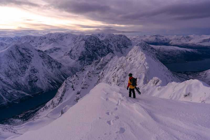

8 steps for planning trips in the mountains
Over the last few months Antti Autti has been doing one of his favorite things: pouring over maps of northern Norway, Sweden and Finland looking for contours that suggest there’s an incredible line there waiting for him to freeride.
After identifying a number of candidates, he developed a plan for the second season of his Arctic Lines project; the goal of which is to hike and ride 30 iconic backcountry lines north of the Arctic Circle. Each trip is carefully measured against the two guiding values of the project: safety and sustainability.
Antti will soon set off into the frigid Nordic north to try to get in a trip or two before the polar night descends, and the sun no longer rises above the horizon. We caught up with him just before he left and asked him to take us through his planning process and how he keeps he and his team safe while also trying to minimize the project’s carbon footprint.
Watch each episode of Arctic Lines as it drops here!
Route planning on the go with Suunto app.
Step 1: Study the maps
This is where it all begins. Antti uses Suunto app and FATMAP to study an area, become familiar with the terrain and to look for features that suggest there’s a line worth riding. Using 3D maps on Suunto app, he tries to find what might be aesthetically interesting or unique, and then looks at how to approach it safely, the nearest road end and town.
“I’ve been using Suunto app a lot, with the new satellite images, to get an idea of whether the line has potential or not,” Antti says. “We also use the heatmap to see how people have been moving in the area as this can help us to find the right route. Having a 3D map means we can think about what the line will look like and that’s an important part of the planning.”
Step 2: Selecting a line
“It’s a creative process,” Antti explains. “It really comes down to the feeling I get when I look at it on the map. If the line makes me curious about how it would feel to snowboard down it, then I know it might be interesting to do. It also has to have a sense of challenge. The exploration, steepness, length of tour, the lack of sunlight, lack of daylight, these are challenges you have to plan around and this makes it more interesting.”
Step 3: Getting feedback
On each trip of Arctic Lines, there’s a team of three or four who accompany Antti: a videographer, someone he rides with, and a safety person. Once Antti has selected a potential line he shares it with his team and asks for their feedback. How would we film this trip? Is it too remote? Does it look too gnarly? Would this be fun?
“We create a GPX file, based on maps in Suunto app, and send it to my crew for feedback,” Antti says. “They let me know what would be good for them.”
Learn how to import GPX files in Suunto app for iOS and for Android.
"Having a 3D map means we can think about what the line will look like and that’s an important part of the planning," Antti says.
Step 4: Evaluating snow and weather
Once Antti and his crew have decided on a line, the next step is determining what conditions they’d like to do it in.
“We have three options,” Antti says. “A stable snowpack with very good quality snow, but poor weather or, alternatively, sunny weather and an unstable snowpack or great weather and a stable snowpack. There are just a handful of days when everything is sort of perfect.”
With a stable snowpack we have the chance to try something with more risk, like a couloir. We can do that in grey weather or in a snowstorm. If we go in sunny weather, we might have a less stable snowpack, but because we can see risky pockets it’s easy to avoid them. But if the snow cover is really unstable - if there’s a chance of triggering a big avalanche - everything is off. But if we know we can avoid those locations then we can keep going. Route choice is super important.”
Step 5: Factoring in the crew
With a sense of the snow conditions, the route and the risk involved, Antti then factors in who he will be skiing with and who will be in the crew, and whether they all have the level of experience, skill and endurance fitness to pull it off.
“If we have a big mission in the interior, I can’t take a less experienced person with me,” he says. “It’s important to know everyone’s experience level, and their mental and physical condition.”
Once Antti has planned a route on Suunto app he shares it with his crew.
Step 6: Balancing safety and sustainability
These two guiding values are in tension with one another. What’s safer is often less sustainable and vice versa.
“If it’s a 30 to 50 km approach, then we have to have a super strong crew because that’s a 100 km round trip,” Antti says. “You have to be physically and mentally strong to do it. If there’s even the smallest chance one person isn’t fit for it, then we might have to use alternative options, like snowmobiles. Sustainability is hugely important, but sometimes we have to compromise for the sake of safety.”
Step 7: Deciding on Plan B
This involves considering the snow and weather conditions, the available time window, and deciding the best way in and to the top of the line. It’s smart to map out the Plan B route on Suunto app and share it with the rest of the team. “If there’s too much time pressure we might just cancel because that’s when mistakes can get made,” Antti says.
Step 8: Scout day
“To get a better idea about the situation, I don’t go straight into the line,” Antti says. “I will take my time to plan. Then we have the basic ideas, but we still have to take a look and build up the confidence by knowing the pack and understanding as much as we can.”
Check out Antti’s Arctic Lines adventures here!
All images by Jaakko Posti
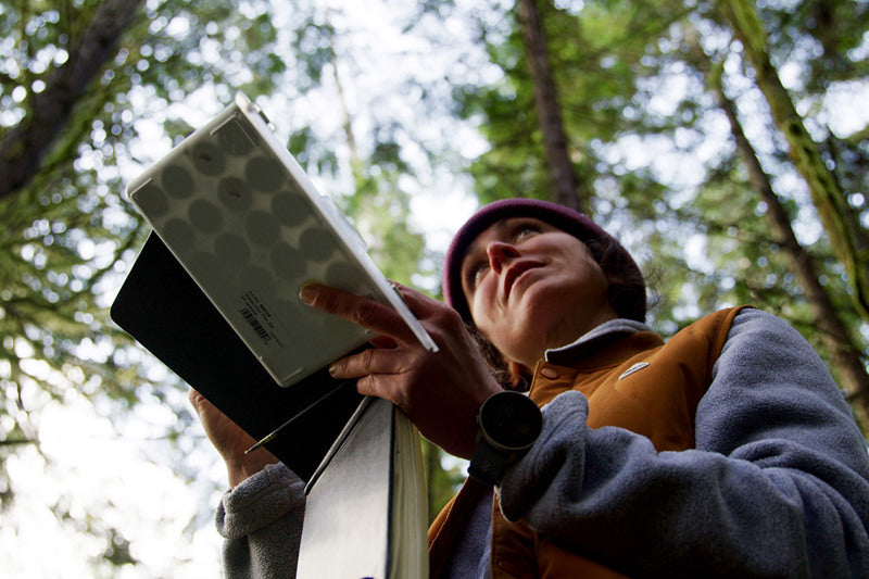

Peak Creator Series – The Artist
A snowboard guide by winter, and a passionate artist inspired by nature Jessa Gilbert lives to be in the outdoors.
This is the fourth in our Peak Creator film series, which celebrates creative people inspired by the great outdoors. We talk to four creators and find out what inspires their creative work.
As a teen, Jessa learned to snowboard on the Catamount in the Catskills in upstate New York and before she knew it she was competing in freestyle. She racked up five knee surgeries by the time she was 27 and was eventually told she could never run or board again.
She thought packing her painting kit might force her to slow down - it didn’t - but it did result in her capturing the stunning landscapes she shreds in and has led to her creating graphics for brands.
“We are in a time where we are starting to remember that public art is important,” Jessa says. “The beauty of public artwork is that you are creating artistic environments.”
Click play below and watch Jessa share her creative inspiration.
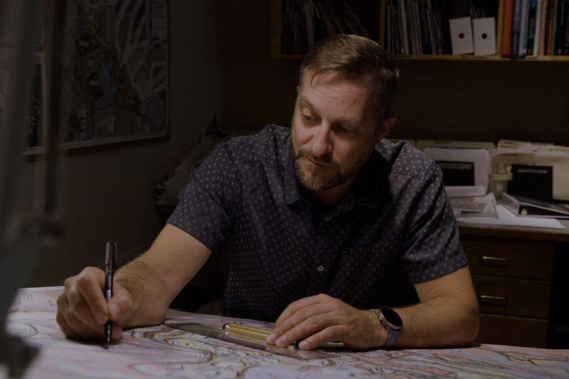

自然を楽しむために、自然を変えすぎない。山岳リゾートをつくる建築家の哲学|Suunto
山に道をつくる。建物を建てる。人が自然を楽しむための場所をつくる。
そのとき、私たちは自然にどこまで手を加えるべきなのでしょうか。
世界各地で山岳リゾートを手がけるランドスケープアーキテクト、ライリー・ティーセン(Ryley Thiessen)が大切にしているのは、「新しいものをつくる」ことだけではありません。
自然と向き合い、その土地にすでにあるものを生かしながら、人と自然の距離を近づけること。
アウトドアからインスピレーションを受けるクリエイターたちを紹介するSuuntoの「Peak Creator Series」。今回は、自然と人との関係をデザインする建築家の仕事を紹介します。
目次
自然から生まれるクリエイティビティ
自然と人をつなぐランドスケープアーキテクト
大切なのは「自然とのバランス」
自然をデザインするのではなく、体験をデザインする
自然を知るには、自分の足で歩いてみる
Suuntoとともに、まだ知らない場所へ
まとめ|自然の中にあるものを見つける
自然から生まれるクリエイティビティ
霧に包まれた森。遠くに連なる山々。岩肌がむき出しになったピーク。
自然は昔から、画家や写真家、音楽家、建築家など、多くのクリエイターにインスピレーションを与えてきました。
Suuntoの「Peak Creator Series」は、そんなアウトドアから刺激を受けながら活動するクリエイターたちを紹介するシリーズです。
トレイルビルダー、フォトグラファー、建築家、アーティスト。
仕事は違っても、彼らに共通しているのは、自然を単なる「背景」として見るのではなく、自然そのものからアイデアを受け取り、自分の仕事へとつなげていることです。
自然と人をつなぐランドスケープアーキテクト
シリーズ第3弾に登場するのは、ランドスケープアーキテクトのライリー・ティーセン。
彼は世界各地で、四季を通じて楽しめる山岳リゾートのデザインを手がけています。
ライリーは自然豊かな田園地域で育ち、幼い頃から「土や自然に関わる仕事がしたい」と考えていたといいます。
山岳リゾートの設計というと、大きな建物や施設を山の中につくる仕事を想像するかもしれません。
しかし、ライリーが目指しているのは、自然を人間の都合に合わせて大きく変えることではありません。
その土地の地形や景観を読み取り、そこにある自然をできるだけ生かしながら、人が自然とつながるための場所をつくることです。
大切なのは「自然とのバランス」
ライリーが仕事をするうえで、もっとも重要だと考えているものがあります。
それが「バランス」です。
自然とともに仕事をし、取りすぎないポイントを探すこと。
自然の中に何かをつくる以上、まったく手を加えずに済むわけではありません。
だからこそ、「何をつくるか」だけではなく、どこまで手を加えるのか、そして何をそのまま残すのかを考える必要があります。
新しいものを加えることと、そこにあるものを尊重すること。
ライリーの仕事は、その境界線を探す作業でもあります。
自然をデザインするのではなく、体験をデザインする
優れたアウトドア空間は、それ自体が主張しすぎる必要はありません。
歩いているうちに視界が開け、山が見える。
森の中を進んだ先に、その土地ならではの景色が現れる。
人が自然を「見る」のではなく、自分自身がその風景の中に入り込んでいく。
ライリーが手がける山岳リゾートのデザインは、そんな体験を生み出すためのものです。
建築やランドスケープは目的ではなく、人を自然へと導くためのきっかけ。
これは、アウトドアを楽しむ私たちにも通じる考え方かもしれません。
自然を知るには、自分の足で歩いてみる
地図で眺めているだけでは分からない景色があります。
実際に山を歩いてみると、地形の変化、森の匂い、風の向き、足元の路面、登った先に突然現れる景色など、その土地を身体で感じることができます。
初めての山やトレイルを探索するときは、事前にルートを準備しておくことも大切です。
Suuntoアプリでは、地図上でルートを作成したり、人気のルートやヒートマップを参考にしたりしながら、次のアドベンチャーを計画できます。
作成したルートを対応するSuuntoウォッチへ同期すれば、アウトドアでも手元でルートや現在地を確認できます。
▶︎ Suuntoアプリで地図やルートを使う方法
ウォッチに表示される地図やルート、ターン案内、ウェイポイントなどの見方はこちらの記事で詳しく紹介しています。
▶︎ SUUNTOの地図・ナビゲーション画面の見方|登山・トレイルのルート案内を解説
Suuntoとともに、まだ知らない場所へ
アウトドアで大切なのは、目的地にできるだけ早く到着することだけではありません。
どのルートを選ぶのか。
どこで立ち止まるのか。
そして、その途中で何を見つけるのか。
ライリーがその土地の地形を読みながら空間を設計するように、私たちも地図を眺め、ルートを考えるところから次の冒険を始めることができます。
山やトレイルを探索するためのSuunto Vertical 2
Suunto Vertical 2は、登山、トレイルランニング、ロングハイクなど、アウトドアアドベンチャーのために設計されたGPSスポーツウォッチです。
事前に地図をダウンロードしておけば、スマートフォンの電波が届きにくい場所でもオフラインマップを表示可能。登録したルートと現在地を手元で確認しながら進むことができます。
さらに、長時間のGPS記録に対応するバッテリー、デュアルバンドGNSS、内蔵LEDフラッシュライトなど、長時間フィールドで行動するときに役立つ機能を搭載しています。
自然をただ眺めるだけではなく、自分の足でその中へ入っていく。
そんな時間をサポートするためのアドベンチャーウォッチです。
Suunto Vertical 2を見る
Suunto Vertical / Vertical 2の登山での使い方や、オフラインマップ、GPS、バッテリーについて詳しく知りたい方はこちらもご覧ください。
▶︎ Suunto Vertical / Vertical 2が登山用GPSスマートウォッチに向いている理由
まとめ|自然の中にあるものを見つける
ランドスケープアーキテクト、ライリー・ティーセンが大切にしているのは、自然を自分たちの都合に合わせてつくり変えることではありません。
その土地にすでにあるものを理解し、人と自然が出会える場所をつくること。
それは建築だけでなく、アウトドアを楽しむときにも通じる考え方です。
地図を開いて、まだ歩いたことのないルートを探してみる。
自分の足で森へ入り、地形を感じ、山の景色を見る。
いつもと少し違う道を選ぶだけでも、新しい発見があるかもしれません。
次のルートを計画して、まだ知らない自然の中へ。
Suuntoとともに、自分だけの新しい景色を探しに行きましょう。


