




SUUNTOブログ

Five Adventure Starter Packs up for grabs!
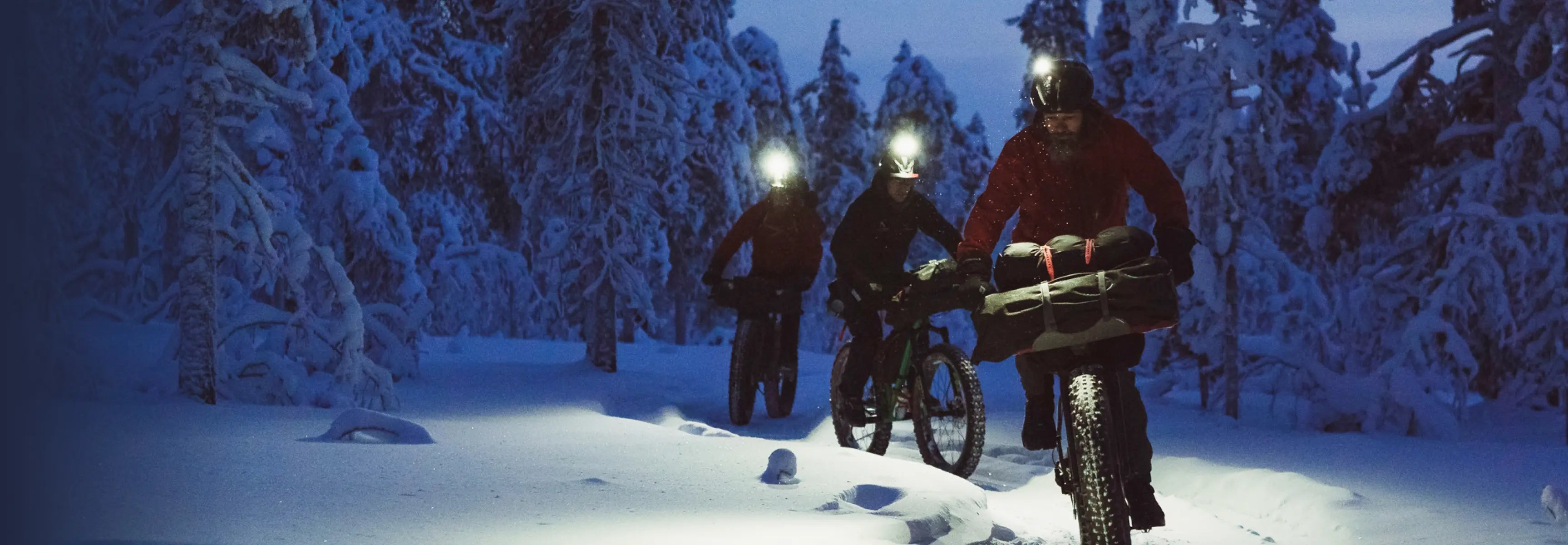
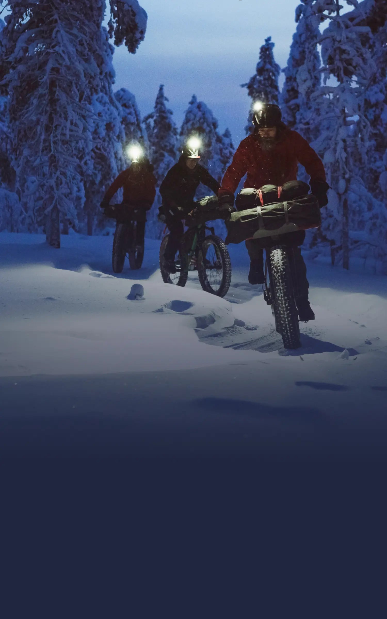
If you love adventure like we do we want you to show it by sharing an awesome image from one of your recent trips on Instagram. Share your adventure pride, and you have a chance to get kitted out for your next trip: we have five Adventure Starter Packs to give away, each worth over 1350 euros!
Each starter pack includes a Suunto 9 GPS watch, an Arcteryx Alpha AR 20 backpack, an Insta360 action camera, a Jetboil portable stove and Oakley Clifden sunglasses. You’ll be ready to hit the trail!
How to enter:
1. Post an adventure image with text explaining what your best outdoor adventure has been or what your dream outdoor adventure would be. 2. Tag #adventurestartshere and #suunto, #arcteryx, #insta360, #jetboil, #oakley in your copy text. 3. Follow @suunto We’ll choose the 5 most inspiring posts among those tagged with #adventurestartshere plus #suunto #arcteryx #insta360 #jetboil and #oakley, and send the adventure gear their way soon after. Contest ends on November 23 at 8 am GMT. The most inspiring posts will win. Good luck! Terms and conditions apply. Read them here.
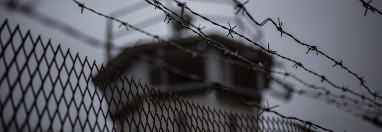

Watch this new adventure film about the folly of building walls
Local runners came and joined the team as they ran through different areas. © Philipp Reiter
To celebrate the 30th anniversary of the fall of the Berlin Wall, eight runners from Germany and Austria ran the 1400 km barrier that divided east and west Germany for 38 years.
The eight day relay run happened in November 2019 and now the team has released the documentary, which looks at both their journey, and the tragic history surrounding the wall.
They began in the south-east of Germany and ended in the north on the Baltic Sea. All along the way they encountered the still visible remains of the once militarised zone that west Germans once called “the death strip” because so many east Germans were killed while trying to escape across it.
All coming from Germany and Austria, the experience turned what was previously a vague sense of their own history into something real, moving and also rousing. Each runner felt the importance and urgency of defending democratic institutions, freedom and truth.
“There’s not a lot of the wall left, it was taken down,” says organizer, mountaineer, and film maker Philipp Reiter. “This really got me thinking that now it’s about taking down the walls that are in our heads, in everyone’s heads. It’s not about east or west anymore, it’s about all the things that get stuck in our minds and steal our personal freedom. All these things that stop us from being happy and being free.”
Watch their journey below.
Lead images:
© Philipp Reiter & Nicolas Holzmeyer
Read more articles
8 tools for tracking the weather with Suunto
Know your species of cloud
This relay run shows we are stronger together


登山やトレイルで天気を確認する方法|Suuntoウォッチで気圧・日没・ストームアラームを活用
登山やトレイルランニングでは、天気の変化が行動計画に大きく影響します。
出発時は晴れていても、山では急に雲が広がったり、風が強くなったり、雨に変わったりすることがあります。特に標高の高い場所、稜線、長時間のハイクでは、天気や気圧の変化を早めに把握することが大切です。
SuuntoのGPSウォッチには、アウトドアで天気の変化を確認するための機能があります。気圧傾向、ストームアラーム、日の出・日の入り、気温、高度、天気予報などを活用することで、山での判断をサポートできます。この記事では、登山やトレイルで天気を確認するために役立つSuuntoウォッチの機能と、実際の使い方を紹介します。
登山やトレイルで天気確認が重要な理由
山の天気は、平地よりも変わりやすいことがあります。
登り始めは晴れていても、標高が上がるにつれて気温が下がったり、風が強くなったり、ガスが出たりすることがあります。雨や雷、強風、日没の早さは、登山やトレイルランニングの安全に直結します。
山の天気は変わりやすい
登山やトレイルランでは、天気予報だけでなく、行動中の変化にも注意が必要です。
気圧が下がってきた。
風が強くなってきた。
雲が厚くなってきた。
気温が思ったより低い。
こうした変化に早めに気づくことで、休憩場所を変えたり、行動時間を短くしたり、引き返す判断をしやすくなります。
日没・気温・風も行動判断に影響する
山では、日没時間も大切な情報です。
特に秋冬や標高の高いエリアでは、日が落ちると一気に気温が下がることがあります。ヘッドライトを持っていても、暗くなってからの行動はリスクが高くなります。
天気、気圧、気温、高度、日の入り時間をあわせて確認しておくことで、無理のない行動計画を立てやすくなります。
Suuntoウォッチで確認できる天気・環境情報
Suuntoウォッチでは、モデルやソフトウェアの対応状況に応じて、アウトドアで役立つ天気・環境情報を確認できます。
対応するSuuntoウォッチでは、ウィジェットから現在の高度、気圧、気圧傾向、気温などを確認できます。山での行動中に気圧や高度の変化を手元で見られるため、天候変化やペース配分の判断に役立ちます。
気圧傾向
気圧傾向は、天気の変化を知るための参考になります。
一般的に、気圧が大きく下がると天候が崩れるサインになることがあります。登山中に気圧の変化を確認できると、雨や風の変化に早めに気づきやすくなります。
ストームアラーム
ストームアラームは、急な気圧低下を知らせる機能です。
Suunto RaceやSuunto Verticalでは、ストームアラームを有効にしている場合、3時間で気圧が4hPa以上低下するとアラームとストームシンボルで通知される仕様です。
日の出・日の入り
の出・日の入りの時刻を確認できると、登山やハイキングの行動時間を管理しやすくなります。
Suunto Verticalでは、日の出・日の入りアラームとストームアラームを設定でき、日の出・日の入り時刻とアラームにはGPS取得が必要とされています。
気温
気温の確認は、ウェアや防寒対策の判断に役立ちます。
ただし、腕に着けているウォッチで気温を測る場合、体温の影響を受けることがあります。正確に外気温を確認したい場合は、ウォッチを腕から外してしばらく置くなど、測定環境に注意しましょう。
高度・高度計
高度は、現在地の標高や登下降の目安として役立ちます。
登山では、地図上の標高やルートの高度差と照らし合わせることで、現在どのあたりまで登ってきたか、残りの登りがどれくらいあるかを把握しやすくなります。
天気予報
対応モデルでは、ウォッチ上で現在の天気や予報情報を確認できます。
対応するSuuntoウォッチでは、天気ウィジェットから現在の気温、風速・風向、天気の状態などを確認できます。さらに詳細な天気情報も手元で確認できるため、登山やトレイルランニング中の状況判断に役立ちます。
気圧傾向とストームアラームで天気の変化に備える
登山やトレイルランでは、天気予報だけでなく、行動中の気圧変化も確認しておくと安心です。
気圧が安定しているのか、下がり続けているのか、急に変化しているのかを見ることで、天候変化のサインに気づきやすくなります。
気圧が下がると天気が崩れるサインになることがある
気圧が下がると、雨や風など天気の変化につながることがあります。
もちろん、気圧だけで天気を完全に判断できるわけではありません。地形、季節、風向き、前線、標高など、さまざまな要因が関係します。
それでも、登山中に「気圧が下がり続けている」とわかれば、空の変化や風の強さにもより注意を向けやすくなります。
ストームアラームとは
ストームアラームは、急な気圧低下を検知したときに通知する機能です。
Suunto Race 2、Suunto Vertical 2をはじめ、対応するSuuntoウォッチでは、ストームアラームを有効にしておくことで、急な気圧低下を検知した際にアラームとストームシンボルで通知します。3時間で4hPa以上の気圧低下があった場合に通知されるため、登山やトレイルランニング中に天候変化のサインへ早めに気づきやすくなります。
急な天候悪化の可能性に早めに気づけるため、登山、ハイキング、キャンプ、トレイルランニングなどのアウトドアで役立ちます。
アラームが鳴ったときに考えたいこと
ストームアラームが鳴った場合は、まず周囲の状況を確認しましょう。
空が暗くなっていないか。
風が強くなっていないか。
遠くで雷鳴が聞こえないか。
稜線や開けた場所にいないか。
安全に下山・撤退できるルートがあるか。
アラームは「必ず嵐が来る」という断定ではありませんが、行動を見直すきっかけになります。特に雷や強風のリスクがある場合は、早めに安全な場所へ移動する判断が大切です。
日の出・日の入りを確認して行動時間を管理する
登山では、日没までに安全な場所へ戻ることが基本です。
特に初めて歩くルート、標高差の大きいルート、天気が不安定な日、秋冬の登山では、日の入り時間を早めに確認しておくことが重要です。
日没前に下山・撤退判断をしやすくする
Suuntoウォッチで日の入り時間を確認できると、行動中に「あとどれくらい明るい時間が残っているか」を把握しやすくなります。
予定よりもペースが遅い。
休憩に時間がかかっている。
天気が崩れてきた。
ルート上にまだ大きな登りが残っている。
こうした状況では、日没時間を見ながら早めに判断することが大切です。
朝駆け登山や写真撮影にも役立つ
日の出・日の入り情報は、安全管理だけでなく、楽しみ方にも役立ちます。
朝日を見に行く登山、夕景を狙う写真撮影、キャンプ場での行動計画などでは、日の出・日の入り時間を手元で確認できると便利です。
特に写真撮影では、光の向きや時間帯が仕上がりに大きく影響します。日の出前後や日没前後の時間を把握しておくことで、撮影ポイントへの到着時間や撤収タイミングを考えやすくなります。
登山やアウトドアでの写真撮影にSuuntoウォッチを活用する方法は、こちらの記事でも紹介しています。
▶︎関連記事:Suuntoウォッチがアウトドア写真撮影に役立つ理由
ストームアラームと日の出・日の入りアラームの設定方法
ストームアラームや日の出・日の入りアラームは、対応するSuuntoウォッチの設定メニューからオン/オフできます。
ウォッチフェイス画面で中央ボタンを長押しして設定メニューを開き、システム通知 > アラート から ストーム や 日の出・日の入り に関するアラートを設定できます。
ストームアラームをオンにすると、気圧の急な低下を検知した際にウォッチ上で通知されます。日の出・日の入りアラームを設定しておくと、行動開始や下山、撮影、キャンプでの準備時間を考えやすくなります。
*モデルによってメニュー名や表示位置が異なる場合があります。使用しているウォッチの設定画面、またはユーザーガイドもあわせて確認してください。
気温と高度を確認して装備やペースを調整する
山では、標高が上がるにつれて気温が下がりやすくなります。
天気予報では暖かく見えても、稜線や風の強い場所では体感温度が大きく下がることがあります。ウォッチで気温や高度を確認することで、ウェアの調整やペース配分を考えやすくなります。
ウォッチで気温を測るときの注意点
ウォッチを腕に着けたまま気温を見ると、体温の影響を受ける場合があります。
外気温をより正確に知りたい場合は、ウォッチを腕から外してしばらく外気に触れさせると、参考にしやすくなります。気温表示は、行動中の体感や天気予報とあわせて判断するのがおすすめです。
高度変化から負荷を把握する
登山やトレイルランでは、距離だけでなく高度差も負荷に大きく影響します。
同じ5kmでも、平坦な道と標高差の大きいルートでは疲労感が異なります。高度を確認しながら進むことで、今どのくらい登っているのか、残りの登りをどう進むかを考えやすくなります。
ルート上の登り下りを詳しく把握したい方は、クライムガイダンスの記事も参考にしてください。
▶︎関連記事:登山・トレイルランのルートナビゲーション|Suuntoクライムガイダンスの便利な使い方
天気予報とウォッチの情報を組み合わせて使う
Suuntoウォッチの天気・環境情報は、アウトドアでの判断をサポートするものです。
ただし、登山やトレイルランでは、出発前の天気予報、雨雲レーダー、登山天気サービス、現地の情報とあわせて確認することが大切です。
出発前は天気予報・雨雲レーダーを確認する
出発前には、目的地周辺の天気予報を確認しましょう。
見るポイントは、天気だけではありません。
降水確率
風速
気温
雷の可能性
雨雲の動き
日の出・日の入り
標高による気温差
山では、ふもとの天気と山頂付近の天気が違うことがあります。長時間の行動や標高の高いエリアでは、余裕を持った計画が必要です。
行動中はウォッチで変化を見る
行動中は、ウォッチで気圧傾向、気温、高度、日の入り時間などを確認します。
たとえば、出発前の予報では晴れでも、行動中に気圧が下がり続けている場合は、空の変化や風に注意する。予定より遅れている場合は、日の入り時間を見ながらルート短縮や撤退を考える。
このように、出発前の予報と行動中の変化を組み合わせることで、より安全に判断しやすくなります。
Suuntoウォッチが役立つアウトドアシーン
Suuntoウォッチの天気・環境情報は、登山だけでなく、さまざまなアウトドアで役立ちます。
登山・ハイキング
登山やハイキングでは、気圧、気温、高度、日の入り時間の確認が行動判断に役立ちます。
天気が崩れそうなとき、予定より時間がかかっているとき、稜線に出る前など、ウォッチで情報を確認することで、次の判断をしやすくなります。
登山用GPSウォッチの選び方を知りたい方は、以下の記事も参考にしてください。
▶︎関連記事:登山におすすめのGPSスマートウォッチとは?地図・バッテリー・選び方を解説
トレイルランニング
トレイルランニングでは、天候の変化がペースや安全に影響します。
長い登り、稜線、山間部のルートでは、雨や風、気温低下に備えることが大切です。気圧傾向や日の入り時間を確認できると、レースやロングランの行動計画にも役立ちます。
キャンプ・縦走
キャンプや縦走では、夜間の気温や天気の変化も重要です。
テントを張る場所、行動を終える時間、翌朝の出発時間を考えるときに、天気や日の出・日の入り情報が役立ちます。ストームアラームや気圧傾向を確認できると、天候悪化への備えもしやすくなります。
釣り・写真撮影
釣りや写真撮影では、日の出・日の入り、気圧、天気の変化が大切な要素になります。
朝夕の光を狙う撮影や、長時間屋外にいるアクティビティでは、手元で環境情報を確認できると便利です。
天気確認に役立つSuuntoウォッチを選ぶポイント
登山やアウトドアで使うウォッチを選ぶときは、天気情報だけでなく、ナビゲーション、バッテリー、使いたいアクティビティに合っているかも確認しましょう。
Suuntoには、オフラインマップやルートナビゲーションに対応したGPSスポーツウォッチだけでなく、気圧計・高度計・コンパスを備えたアウトドアウォッチもあります。登山やトレイルランニングでルート確認まで行いたいのか、気圧や高度、方角をシンプルに確認したいのかによって、選ぶモデルが変わります。
気圧計・高度計・コンパス
山で使うなら、気圧計、高度計、コンパスは確認しておきたい機能です。
気圧は天候変化のサインを知るために、高度は現在地や登下降の把握に、コンパスは方向確認に役立ちます。
Suunto Coreは、気圧計、高度計、コンパスを備えたアウトドアウォッチです。GPSやオフラインマップは搭載していませんが、天気や気圧、高度、方角をシンプルに確認したい方におすすめです。
▶︎Suunto Coreを見る
オフラインマップ・ルートナビゲーション
登山やトレイルでは、天気だけでなく現在地やルート確認も重要です。
Suunto Vertical / Vertical 2など、オフラインマップやルートナビゲーションに対応したモデルなら、スマートフォンを頻繁に取り出さなくても手元でルートを確認しやすくなります。
Suunto Vertical / Vertical 2が登山に向いている理由は、こちらの記事で詳しく紹介しています。
▶︎関連記事:Suunto Vertical / Vertical 2が登山用GPSスマートウォッチに向いている理由
バッテリー持ち
長時間の登山や縦走では、バッテリー持ちも重要です。
GPS記録、地図確認、ナビゲーション、天気情報の確認を行う場合、バッテリーに余裕があると安心です。日帰り登山だけでなく、長時間のハイクや山小屋泊を想定するなら、バッテリー性能もチェックしましょう。
Suuntoウォッチで天気を確認する前に準備しておきたいこと
アウトドアでウォッチを使う前に、基本的な準備をしておくと安心です。
ウォッチとSuuntoアプリを最新にする
出発前に、ウォッチとSuuntoアプリを最新バージョンに更新しておきましょう。
天気ウィジェットやナビゲーション機能、マップ機能は、ソフトウェアアップデートによって改善されることがあります。山に入る前に同期や設定を済ませておくと、現地で慌てにくくなります。
GPS取得と位置情報を確認する
日の出・日の入り時刻や位置に応じた情報を使う場合は、GPS取得が必要になることがあります。
登山口や開けた場所でGPSを取得し、ルートやマップ、アクティビティ記録の準備ができているか確認しましょう。
予備の安全対策も忘れない
ウォッチは便利なサポートツールですが、天気判断をウォッチだけに頼るのは避けましょう。
登山地図、スマートフォン、モバイルバッテリー、レインウェア、防寒具、ヘッドライト、水分、非常食など、基本装備もあわせて準備することが大切です。
Suuntoのアウトドアウォッチで、天気とルートを手元で確認しよう
登山やトレイルランでは、天気の変化、現在地、ルート、標高差、日没時間をまとめて確認できると、行動中の判断がしやすくなります。
Suuntoのスポーツウォッチは、アウトドアでのルートナビゲーションやアクティビティ記録に対応したモデルを展開しています。天気や気圧、標高、ルート確認を活用したい方は、自分のスタイルに合うモデルをチェックしてみてください。
▶︎Suuntoのアウトドア向けスポーツウォッチを見る
まとめ|天気の変化を早めに知ることが、安全なアウトドアにつながる
登山やトレイルランニングでは、天気の変化を早めに把握することが大切です。
Suuntoウォッチを使えば、気圧傾向、ストームアラーム、日の出・日の入り、気温、高度、天気予報などを手元で確認できます。出発前の天気予報と、行動中のウォッチ情報を組み合わせることで、山での判断をサポートできます。
天気が変わりやすい山では、「まだ大丈夫」ではなく、「早めに気づいて、早めに判断する」ことが安心につながります。
登山、トレイルラン、キャンプ、縦走をより安全に楽しむために、Suuntoウォッチの天気・環境情報を活用してみてください。
▶︎Suuntoの登山・ハイキング向けGPSスポーツウォッチを見る


Impressions from the AlpFrontTrail relay
After eight days of running, covering a distance of 850 km and 55,000 m of elevation gain, the AlpFrontTrail relay team of 10 athletes made it to Stelvio Pass in northern Italy. On October 6, they had begun in Grado, an Italian seaside town, and finished in Stelvio Pass in northern Italy.
“It was very challenging!” says Philipp Reiter, co-organizer of the adventure. “All the organizational work, the challenging and always changing weather, the deep historical stories, and the fact we were 10 top athletes with one common goal, but a lot of individual wishes!”
Fom Germany, Austria and Italy, the passionate band of runners took turns to cover stages of the historic 850 km frontline in the European Alps where Italian and Austrian troops fought during the First World War. The goal of the epic adventure run was to observe Italy’s annexation of South Tyrol 100 years ago and to celebrate how far Europe has come since the hostilities and wars of the 20th century. While each pair ran, the rest of the athletes visited historic sites and talked to local people about the history.
In this photo story, we share action and impressions from the adventure. For video action of the adventure click here.
Day one
“The AlpFrontTrail was hence a running adventure with a deeper sense,” says Caroline Gredler, one the field organizers. “It should remind us, that it´s not a given that we can nowadays run along or cross borders in freedom and peace. We should value what we have and respect one other.”
© Philipp Reiter
Day two
“The challenge was to find the way on the borderline – even with my Suunto Baro 9 it was sometimes hard,” says Austrian ski mountaineer Jakob Hermann. “And the conditions were sometimes tricky; snow in altitude, destroyed forests (so there was no track), darkness and the physical stress with less sleep was also a challenge. The good thing was we had an awesome and strong team! So all were super helpful and we grew together!”
© wisthaler.com
Day three
“A border, be it a wall, barbwires or trenches is never a solution,” says ultra runner Tom Wagner. “It is actually nonsense. Running along a former front was an intense way of learning from the past to potentially help us shape the future.”
© wisthaler.com
Day four
“I had the opportunity to run a stage of the AlpFrontTrail together with Italian athlete Martina Valmassoi,” says Caroline. “It was the going over the Mountain Col Di Lana – a mountain which was fiercely contested in the Alp Front war – that had the biggest impact on me. Austrians and Italians stood facing each other within shouting distance and tried three times to blow each up with explosives. More than 8000 soldiers died and hence the mountain is nowadays also named Col di Sangue – the Blood-Mountain. There are still many tunnels and trenches which remind us of this horrible fight, as well as a memorial church on the top of the summit. It was a special feeling to run through this place, esspecially as Italian and Austrian friends here in peace together!”
© wisthaler.com
Day five
“Seeing these beautiful place, but being reminded what happened here before is hard to grasp,” says Tom . “The places we visited should be walked, hiked, or run by so many more people to learn about the past and be aware that something like this should never happen again. Unfortunately it can happen more quickly than we want to acknowledge.”
© Philipp Reiter
Day six
“It was so great to share this special project with different runners, from fast vertical runners to strong ultra runners,” Jakob says. “I learned a lot from all of them!”
© wisthaler.com
Day seven
“At the beginning of WW1 at the alpine front it was not really a war as soldiers on either side often knew one other and were working colleagues, friends or relatives,” says German trail runner and fil maker Philipp Reiter. “They shot into the water or in the air not to hurt each other. The command had to exchange the soldiers and bring young men from other regions to make them shoot the other side.”
© wisthaler.com
Day eight
“We have to be thankful with what we have now!” says Jakob. "We complain too much – particularly about irrelevant things! We have to try to stay positive and help one another.”
© wisthaler.com
© wisthaler.com
To find out more about the AlpsFrontTrail relay, visit: www.alpsfronttrail.com
Lead images:
© wisthaler.com
© Philipp Reiter


Running movies: Running the Roof adventure film selected by Banff Film Festival
Gabe found his ultra legs deep into the adventure.
It all started at a party when buddies Jody Bragger and Gabriel (Gabe) Ghiglione – both bored of their deskjobs and craving adventure – made a drunken bet; they’d spin a globe and wherever Gabe’s finger landed they’d go and run there. It landed on Tajikistan.
Neither of them had the faintest idea about the landlocked Central Asian country with a population of 9.5 million or of its history as part of the ancient Silk Road. Neither of them had any idea what they were getting themselves into. So they roped ultra runner Jodie Gauld into joining them, and hopped on a plane.
The Running the Roof feature film, made by film company Sourcy and sponsored by Suunto, is about the trio’s journey running 400 km, the equivalent of about 10 marathons, through eastern Tajikistan’s remote and desolate Bartang Valley. They faced intense heat and cold, 4500 m altitude, dust, Gabe’s constant antics, their own minds, and a lot of unknowns.
We caught up with Jody Bragger to talk about the adventure. Read on for our Q&A and watch the trailer below.
The virtual edition of the Banff Film Festival will show the film on 31 October 2020.
How does it feel having the film selected by Banff?
We never went into this pretending we were anything other than just three mates who like running. The premise of this whole expedition was to go and have a great time. When we told our friends about it they wanted to make a film about it, but we never went in with this idea of creating another big adventure film with super, deep meaning. We went away to have a really good time, to have a laugh, and see what we can do. There was no pressure to scale this mountain, or be the first or the fatest or reach some arbitrary goal. It was just about being there together as friends and exploring this beautiful, remote and wild place.
What were the most epic runs that each of you had done?
Jodie Gauld and I both come from the ultra running discipline. Jody has run TDS at UTMB, I’ve done CCC at UTMB. Jody has run 25 ultras, she’s done 100 milers, some tough races. I’ve run a few of the big races, like Ultra Trail Cape Town. We were both aware of the pitfalls of ultra running and knew what to expect.
Gabriel really was the archetypal North American university track athlete. He only started running distances further than 10 km in the last couple of years. He’s definitely a super strong, fit and fast runner. But he only ever ran one marathon previous to this and that was the Barcelona marathon and he had left a nightclub at 4am on the day. He really is someone who loves running, but never takes it too seriously.
Jody (left), Jodie and Gabe all faced adversity on the adventure.
What was the hardest part of the run?
It was definitely the elements, the valley itself, and an unknown aspect that played in the back of our minds. None of us had ever run at 4500 m altitude. The psychological aspect was a big factor. We didn’t know what it was going to be like running at elevation, we didn’t know how the film crew was going to work, we didn’t even know where we were going to stay. Running is all about mind over matter and really believing that you can push on when you feel like you can’t. The heat and the cold, the elevation, the dust, the unknown – that’s what we were up against.
What was the elevation gain?
In total it was somewhere around 5000 m, over 400 km distance. We started at 2500 m and the highest pass was around 4700 m. We were running consistently above what some people call the danger zone where you’re likely to get altitude sickness. The altitude not only affected our running, but also our sleep, eating, and hydration.
The Bartang Valley is located in the Pamir mountain range, the setting of the Great Game in the 19th century.
Did you train for the altitude?
We didn’t do any specific altitude training. Me and Jodie both ran TDS and CCC at UTMB around a month before we went. That was our way of training for the expedition. I remember on the first day there when we set off running thinking, “well, at least we can run, at least it’s working”. It sounds crazy, but when you’re planning something for so long, when there are so many unknowns, it’s the moment when you take the first step that you understand it’s really happening.
Were the local people there hospitable?
Yes. It was a lovely reminder of our shared humanity. We often go into these places as travelers feeling like we’re breaking new territory, but these places have a history for a millennia of hosting people on the move. Tajikistan and its culture has had people in transit ingrained into it. It was part of the route of the Silk Road. Hospitality for strangers just sort of shines through there. It really is the crossroads of the world. That culture of welcoming people in, allowing them to stay in your home, complete strangers who don't speak the language, and giving them a good meal and setting them off on the next day just seemed so natural. They also gave us so much knowledge about the route, the next village, where we could find lodgings, food and water.
How was the food?
I don’t think Tajikistan is known for its cuisine. But the food was always plentiful. It’s a place where resources are fairly scarce and completely based on self sustained agriculture. They grow what they eat, store what they don’t eat, and trade a little bit. Most places keep everything just for the community. They provided plentiful food for us.
The three friends never took the adventure too seriously.
What surprised you most there?
Probably the relationship people there have with nature. The valley is a microcosm of all the issues we face as a species. They really do live in equilibrium with the valley so it’s almost like you don’t want too many travellers there because then they’re going to have to push the limits of what the valley can support.
I spoke to one guy who told me he was really enjoying having tourists there because they pay in currency, which is something he hadn’t previously had much access to. He had a small self-sustaining farm and he occasionally traded with food at a market or occasionally sold a little bit for cash. Currency from tourists allowed him to buy some things for his family, like a mobile phone for communication.
He told me all the energy they get is from the forest, from the wood. He would chop down trees at a rate he knew was sustainable for the valley to replenish itself so the next year there would be enough wood. Even that little extra amount of tourists coming through required more wood. He noticed he was cutting more wood. He was interested in getting a small hydroelectric pump you can put on rivers to generate energy.
It was almost like going back in time and seeing how things were in many places not so long ago. It made me realise how unique that part of the world is. These sorts of wild, high mountain, desert areas are teetering on the edge of remaining that way or having to modernise.
Now that a year has passed since you finished it, what are your thoughts looking back?
As we all locked ourselves inside because of the pandemic, and as our horizons have closed and our expectations have shrunk, the film has come into its own, strangely. Our worlds have become smaller and often based around a laptop screen. The film is a nice reminder of the world we left behind. And maybe flying around the world and doing crazy things isn’t the most sustainable long term. But the film is a reminder of that freedom of being young, throwing some things into a bag, jumping on a bus, a train or a plane, and going out there and pushing yourself to your limit. I look back at that adventure with a heavy sense of nostalgia. I miss those days a bit.
Any other comments?
I guess I want to say to people watching it that these kinds of things are possible. Neither Jodie, myself or Gabriel are pro athletes, we aren’t sponsored by anyone, we aren’t paid to do this, we haven’t got a brief from a firm to create content around. We are none of these things. We literally got drunk, spun a globe and decided to do this. It shows what’s possible. And running through a landscape is an amazing way to connect with people. When you’re on two feet, you feel more connected to nature, the flow of the river, the way the sun rises, the plants and animals, and the connection with humans is more real than travelling by car.
Running the Roof will be screened at this year’s virtual edition of the Banff Mountain Film Festival on 31 October, 2020 and available to download online.
All images: © Alex Mundt


