One of the most memorable and hospitable cities to run in, Barcelona’s streets, parks and trails are as welcoming as her inhabitants. While Barcelona is the largest city on the Mediterranean Sea, it is also an intimate and intricate place with subtle beauty that seems to mix perfectly with its more audacious architecture.
To see Gaudi’s masterpiece, the fantastical Sagrada Família in person is one thing, but to gain a sense of the city by running amongst her streets and people is something that won’t fail to leave a lasting impression. We’ve found you three unforgettable runs in Barcelona; a short, wondrous route, a path that will want to make you want to become a local, and finally a trail with some climb, some wildness and some views! These runs are experiences of discovery, now all you have to do is choose one!
To follow these routes with your Suunto watch or mobile device, please follow these instructions:
1. Press download GPX.
2. Go to Suunto app and press + button in app map and press 'import route'.
3. Find the route, press it. The app opens the route, press 'Done'.
4. You can modify name and details. The route is saved. Keep the 'Use in Watch' toggle on to have the route in watch.
Note: If you are not reading this on a device with Suunto app installed, download the route file and save it in a location you can access on your mobile device. Then follow the guidance above.
VISUAL WONDERS (5,0 KM)

Download the GPX file here.
Description:
Up for some visual wonders? We hope so! You are now in the heart of the city. Follow Passeig de Gracia from the Metro station, warm up slow as you’ll begin to be spoiled with sights. Turn right on Av. Diagonal until Carrer de Provença, follow this until you see the Sagrada Família. We understand if you just want to take a few moments (or hours) here, the surrounding parks provide a brilliant perspective to Gaudi’s masterpiece. You can loop around behind it and back along Carrer de Mallorca. Left towards the sea at Passeig de Sant Joan, and straight to the Arc de Triomf. Boom! You’re done! (Hopefully you didn’t miss La Pedrera, Casa Batlló, Casa de les Puntxes!)
Starting Point Note:
This route is easily accessed by Metro as it starts at the Passeig de Gracia station. Begin northwest (away from the sea).
Finishing Point Note:
Your end point is the Arc de Triomf, sublime. Your après-run is well-situated, continue past the arc to the Parc de la Ciutadella. Its beautiful grounds and fountains are the perfect place to relax, do some stretching, and wonder amongst the sculptures and monuments. Also, if you happen to be into comics, a block before the end of the route, along the Passeig Sant Joan @ Carrer Ali Bei, you’ll find a number of shops dedicated only to comics. Grab a coffee and enjoy!
BARCELONA BEACH RUN (9,0 KM)

Download the GPX file here.
Description:
This is truly the local’s route, Barcelona Beach is one of best you’ll see in a city anywhere in the world. This track is well-lit, safe and runnable throughout the year. It can get busy (because it's beautiful) with non-runners in the afternoon, especially in summer so get out there early in the morning to have your path, and your view of the Mediterranean Sea, clear.
The route is an out and back, running parallel to the shoreline, the track is smooth, flat and fast. With an invigorating breeze off the sea, you might be inclined to do some impromptu tempo work. The turn-around is at El Parc del Forum, the city’s most popular spot for outdoor concerts and events. As you’re headed back, run a little past your starting point and you’ll find that this straight-forward run has a sweet ending. You’ll see a main-stay of the beach’s skyline, “the Sail” as the locals call it (W Hotel Barcelona). You are now in one of the most fascinating parts of the city, La Barceloneta, a neighbourhood which was first inhabited by solely by fisherman, is today full of renewed energy and home to countless restaurants and charming little bars.
Starting Point Note:
Taking the Metro to Cuitadella/Vila Olimpica station will place you within a block of the track (Av. del Litoral) which runs along Barcelona Beach (Passeig Maritim del Port Olimpic). You can begin your route anywhere along this path, but we’ve started near Parc del Port Olimpic, so head left as you walk from the Metro station.
Finishing Point Note/Alternative:
On the route we’ve shown you how to return to the start after a short visit of La Barceloneta, another option is to end here, as it is home to all sorts of activities, entertainment and fun you can find rentals for SUP, and the best paella in town, head to Kaiku (Placa del Mar 1, open for lunch and dinner), then stroll back to the start/finish.
EL TIBIDABO (13,2 KM)

Download the GPX file here.
Description:
Now you’re in for a treat. While the other routes were in the heart of the city, this one will make you earn the best views of the city! This route climbs to the top of el Tibidabo (512 m), starting from a famous trail called "Carretera de les Aigues" – this is also the name of the train station (FGC not Metro) that will bring you to the starting point from the city centre in only 15 minutes. The path starts as gravel and some pavement, and eases you into the run with the first 3–4 km relatively flat. Then you climb. The part of the trail that goes up and and down the mountain is in a loop. Syncing this route and tracking your progress on your Suunto GPS watch is important as the twists and turns are significant.
At the top you’ll find one of the oldest amusement parks in the world, with a classic old ferris wheel and carousel, as well as the beautiful Sacred Heart church. The best views of the city and the sea are from here, whether you’re on of the rides or not. If your quads want to stop here, its possible to have a meal a catch a bus back down, then grab a train back to the centre.
Run during the week for the smallest crowds on the trails and at the top!
Starting Point Note:
Take an FGC (schedules at fgc.cat) train from the centre (Catalunya Station) to the Carretera de les Aigues stop. The trail begins immediately from there heading east (or left as you face the sea). It is generally safe to run at all hours, but if you’re going out early in the morning or later in the evening, bring a headlamp with you as it will be dark on the trails.
Finishing Point Note:
Your finish is at Av. Tibidabo (@Paaseig de la Bonanova). The train can take you right back to Catalunya Station.
Discover new routes with heatmaps. Heatmaps show the tracks frequently used by the Suunto App community all over the globe, based on millions of moves. You can plan your own route with the help of rich, topographic maps, transfer it to your compatible Suunto watch and start exploring.
With Suunto 5 and Suunto 9 watches, you can add these routes directly to your device and track your progress.
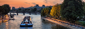
Main image: © Senai Aksoi/Shutterstock.com
SEE ALSO MUST-RUN ROUTES IN HELSINKI, LONDON, NEW YORK CITY, PARIS AND STOCKHOLM