


Suunto Blog

Don't miss a turn!
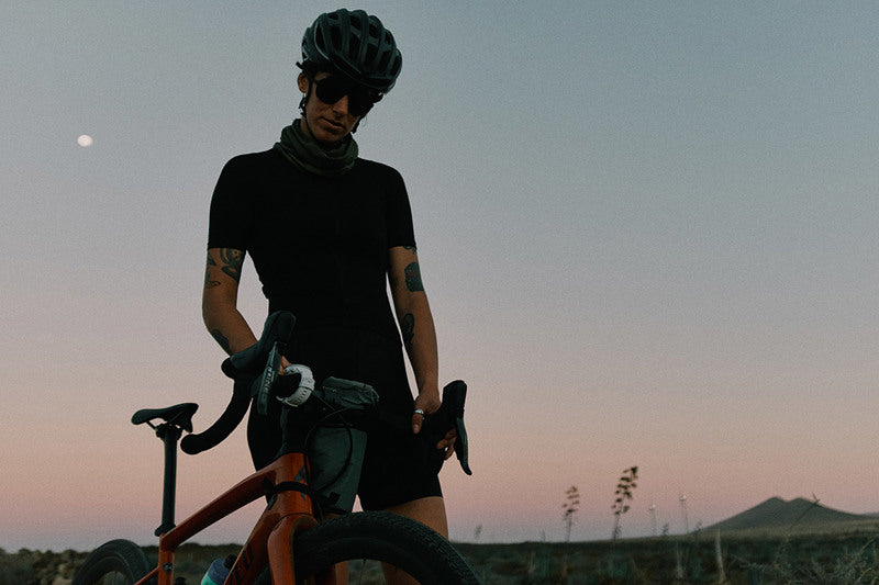
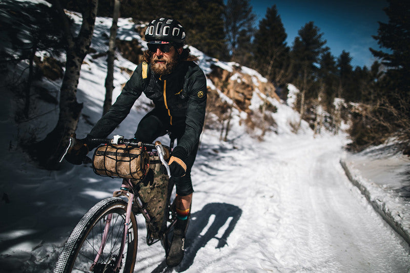
Bike adventurer Sami Sauri is no stranger to navigating on her bike. Currently she is working on guidebooks on gravel rides on the Spanish island of Fuerteventura. She is using komoot to plan the routes and her Suunto 9 to navigate and track them.
”I have several favorite features on komoot. For all users the highlights, that show community generated points of interest, and the way types, that show different surfaces, are some of the main things for planning routes,” Sami says. “And for the premium users the multi-day planner, dynamic weather forecasts and the collections are so good!”
With komoot you can choose and plan where to go either on a desktop or at the trailhead on your mobile device – and sync the planned route to your Suunto for navigation. Read on to learn more!
First things first: establish the connection
To get set up, simply connect your komoot profile with the Suunto app: Go to your profile on Suunto app and select ‘komoot’ under ‘Partner services’. Select ‘Connect with komoot’ and sign into your komoot account and allow requested permissions to connect.
As soon as you have connected the two accounts the sync is automatic both ways: your activities that are tracked with your Suunto are synced to komoot and the routes created on komoot are available on your route library on Suunto app.
Find routes on komoot
You can find a huge collection of pre-planned routes on komoot. You can search activity specific routes in a preferred location, use the routes your friends have shared or check out curated collections of routes for different themes or locations. Some examples of location and activity specific collections are “Best mountain hikes in Haute-Savoie” and Sami's own "Fuerteventura Gravel Route Guide". The themed collections can cover topics like “Long-distance hiking trails”.
Plan your own routes on komoot
First of all, komoot’s route planning is sport specific. When you are planning a route from point A to point B, you are likely to get different results depending on the activity type you choose. For example, for a bike tour you can select between road cycling, bike touring, gravel riding, mountain biking and enduro mountain biking. As the type of riding changes, so does the route it follows.
While planning a route you can view user generated, sport specific highlights on the map that you can include on your route when planning. You can also select POIs, like campgrounds, restaurants etc., to be visible on the map when planning.
Additional nice details include topics like a surface type overview, altitude profile and a dynamic weather forecast: Simply select the time when you want to start your tour and the weather forecast is updated accordingly. That’s quite useful with temperatures in the mountains and wind for a road cycling tour, for example.
Other useful features include sharing route plans with friends, planning multi day itineraries and creating your own route collections.
Navigate with your Suunto
Once you have created a route (called a ‘tour’ in komoot language) it will automatically be synced to your Suunto account. To use it for navigation switch the ‘use in watch’ toggle on and sync your watch with the Suunto app.
A key benefit for creating routes for your Suunto on komoot is turn-by-turn navigation: When navigating, the watch will alert you about an upcoming turn. This makes the navigation experience more enjoyable, as you don’t need to keep an eye on the navigation screen to see which way to take. There is one alert 100 meters before a turn and one at the turn. (komoot's turn alerts are shown on Suunto 9, Suunto 7 and Suunto 5 watches. With Spartan family no direction is shown, there is only an alert that you need to turn.)
You will get a free map region on komoot when you connect your accounts and can start using the turn-by-turn navigation for routes in that region. When buying a new Suunto watch you will get additional two free map regions from komoot as part of Suunto Valuepack!
Learn more about komoot at komoot.com. Multi-day planner, personal collections, on-tour weather, sport-specific maps and worldwide offline maps are komoot premium features.
Action images by Sergio Villalba
Watch now: Getting started with komoot
Read more
Six ways to plan a route for your next adventure

9 training tips for the Wings for Life World Run
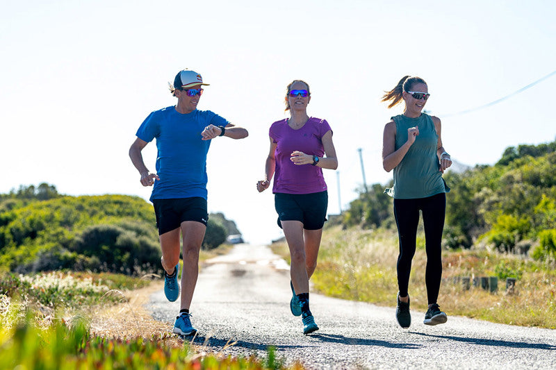
One race you can definitely count on happening this year is the Wings for Life World Run. To be held on May 9, it will be a virtual race with app-based events happening in more than 70 locations around the world. Lock it into your race calendar because it’s going to be fun and for an awesome cause – 100% of the entry fees goes to finding a cure for spinal injury.
Suunto ambassador Ryan Sandes is also ambassador for the race and the captain of Team Suunto in the event. Every year, when he’s not off racing somewhere hardcore, he’s pumped to run it because of the fun atmosphere, the thrill of being chased by the Catcher Car, and because he feels passionate about running for those who can’t due to spinal injuries.
Who better to ask then about how to prepare for the unique race? We caught up with Ryan and asked how he approaches it. “The cool thing with this race is the finish line is constantly moving according to the speed you’re running,” Ryan says. “Whereas with a marathon, you know you will run 42.2 km. Preparation wise this does change things a little.”
Read on for Ryan’s nine tips!
Choose a goal
With that moving finish line it’s helpful to choose a distance you aim to run in the race. Maybe that’s a 10k, a 30 km, a marathon, or going ultra distance. “Make that distance the focus of your training,” Ryan says.
Use the official race Goal Calculator to determine how long, in terms of duration, you’ll run to achieve your desired distance, as well as the pace you’ll need to maintain.
Go trail
As a passionate trail runner, and like all trail runners being wary of road running, Ryan says preparing for the race shouldn’t stop you training off road if that’s more your schtick. With this year’s race being held virtually via the Wings for Life World Run App, it doesn’t matter where you run. But choose flatter, flowing trails so the Catcher Car doesn’t have too much of an advantage over you.
Get road ready
Wings for Life World Run races are usually held in urban locations that involve plenty of asphalt. If your goal is to stay ahead of the Catcher Car for as long as possible, then Ryan recommends getting used to running on the road and doing the race that way.
Two key sessions
When Ryan trains for the Wings for Life World Run he focuses on two key training runs a week: one interval or fartlek session and one long run with stride bursts. Let’s look at each more closely.
Interval or fartlek session: Fartlek is the Swedish word for “speed play”, and basically refers to a form of running training when you mix up the speeds you run at. Interval training is basically the same, but the focus is on running high intensity segments interspersed with a slower pace.
Ryan recommends, depending on your fitness level, doing one of the following:
– four eight-minute intervals
– four six-minute intervals
– four three-minute intervals
Each interval should be a notch or two faster than your usual long run pace. Make sure you warm up first before starting them and be careful not to overdo them. You should have a good level of running fitness before trying them because it’s not uncommon for runners to get injured while doing interval training.
The long run with stride bursts: Long runs can be anywhere from an hour, to three hours or longer, and the crucial point is to remember that to gain the physiological adaptations they can offer over time it’s essential to do them at an easy pace. Ryan recommends doing one long run a week and adding a little twist if you’re ready for an extra challenge – doing strides.
Stride bursts, commonly called strides, involve running at 90 or 95% of your max pace in short bursts. Try doing six to eight 10 to 15-second long strides in the middle of your long run. These are an excellent way to improve speed and coordination.
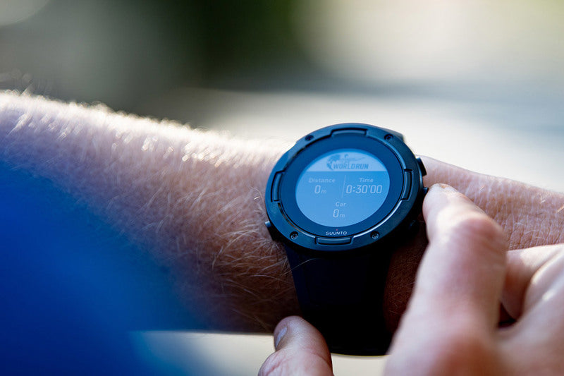
Use the Catcher Car training feature with your Suunto
Why wait to race day to know how you’ll do against the Catcher Car? Thanks to the partnership between Suunto and Wings for Life World Run you don’t have to. The partnership resulted in the Catcher Car training feature available on Suunto 5 and Suunto 9 watches.
It enables users to train against a digital version of the iconic Catcher Car, so you’re ready to take on the real thing come race day. You’ll see how far back the Catcher Car is, and the estimated distance and time duration left before it catches you.
Ryan also recommends using it on race day: “I use the Catcher Car feature on race day because it’s really cool to be able to look at your watch and see how far you are from the Catcher Car.”
Try barefoot running
“Something else I’d do is a little barefoot running on a rugby or soccer field, just 10 to 15 minutes once a week to strengthen your feet and lower legs,” Ryan says. “Because I find when I run on the road my calves get quite fatigued and tired.”
Stay mobile
If you’re like Ryan and more of a trail runner and mountain athlete, then the repetitive motion of road running can be tough on the body. Over time it’s easy to lose mobility in key joints, especially the hips, back and shoulders.
Ryan recommends doing dynamic stretching, mobility work or yoga to ensure you keep moving well.
Get people involved
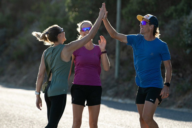
Wings for Life World Run, like Suunto, is all about community. It’s a run we do together for the benefit of others. So, Ryan suggests signing up as many friends and family members as possible, both for your training and the race, and to join Team Suunto to raise money for spinal cord injury research.
“It’s such an awesome cause,” Ryan says. “It’s a really fun and dynamic event so team up with some friends for some of your training and try to get people involved. Even if it’s just doing an easy run with a friend once a week.”
Be smart on race day
The race starts at 11:00 UTC, which is 11:00 AM in London, 12:00 PM in Berlin, 7 PM in Beijing, and 10 PM in Sydney. Depending on where you are in the world this means you’ll need to manage race day accordingly.
“Maybe where you are you’'ll be running at night so get used now to running with a headlamp,” Ryan says. “If you’re running in the afternoon sun make sure you stay hydrated. Plan your mealtimes relative to the race time; don’t race on a full stomach or when you’re hungry. When I ran it in Melbourne the race started in the evening so it’s important to stay hydrated throughout the day, to keep eating, and maybe do some mobility exercises to stay loose.”
Images by Craig Kolesky
READ MORE
5 reasons to run in the Wings for Life World Run
Race the Catcher Car with Suunto

Race the Catcher Car with Suunto
Training for the Wings for Life World Run is now fun and easy with the Catcher Car training feature available on Suunto 5 and Suunto 9 watches.
Wings for Life World Run is a unique race that raises funds to find a cure for spinal cord injury. There is no finish line. Instead, you start with thousands of people worldwide at the same time, running as far as you can before the Catcher Car passes you.
The training feature enables users to train against a digital version of the iconic Catcher Car, so you’re ready to take on the real thing come race day. You’ll see how far back the Catcher Car is, and the estimated distance and time duration left before it catches you.
Like Suunto ambassador Ryan Sandes,you can also use it on race day to know how far behind you the virtual Catcher Car is. “Being chased by the Catcher Car anywhere, anytime thanks to this new watch feature is going to add an exciting new dimension to training!” Ryan says.
How to use the Suunto training feature
The virtual Catcher Car begins pursuit 30 minutes after you start, gradually speeding up as it tries to catch you. As you run, you can see how far back it is, and the estimated distance and time duration you will run before it catches you.
To use the Wings for Life feature with your Suunto 5 or Suunto 9:
Select your preferred activity type and, before pressing the start button, scroll down for ‘options’.
Select ‘SuuntoPlus’ in the options.
Select ‘Wings for Life World Run’
Scroll back up to the start view and start your exercise as normal.
During your exercise, swipe left or press the middle button until you reach the Wings for Life World Run display.
After you have ended the exercise, you can find the Wings for Life World Run result as part of the summary.
Images by Craig Kolesky
READ MORE
9 training tips for the Wings for Life World Run

5 reasons to run in the Wings for Life World Run
The Wings for Life World Run is an annual fixture for many runners, including Suunto ambassador Ryan Sandes. “It’s an amazing event and it’s cool to be able to give back through the sport of running, which has given me so much,” he says.
Ryan will be competing in the 2021 virtual edition of the race, to be held on May 9, and is calling for his fellow trail and ultra runners to join him. “It’s a special race with a really cool vibe,” he says. If you need more convincing, read on for Ryan’s five reasons to run it.
Give back through running
“It’s a good feeling being able to run for those who can’t,” Ryan says. “One hundred percent of the entry fees go towards spinal cord injury research and trying to find a cure.”
Two-time motocross world champion Heinz Kinigadner and the Red Bull founder Dietrich Mateschitz established the Wings for Life foundation in 2004. Ever since, it’s been funding research and studies on spinal cord injury.
Your entry fee contributes to their goal of finding a cure.
The thrill of the chase
Held every year since 2014, the Wings for Life World Run offers an extra layer of fun and excitement compared to ordinary races. Rather than running to a finish line, a Catcher Car begins chasing the participants 30 minutes after the race starts. As it passes each participant, their race is over.
This means the race has no set distance. More experienced runners will run further, slower runners will run less. Last year’s winner, Michael Taylor of Great Britain, outpaced the Catcher Car for a distance of 69.92km, but the important thing is participation. Everyone sets their own goals, and everyone finishes the race.
You can count on it
With the pandemic still raging there is so much uncertainty about which races will happen in 2021. One race you can count on is the Wings for Life World Run. This year it will be a virtual race. Simply download the Wings for Life World Run App and decide how you want to run: on your own or with a virtual team. It doesn’t matter where you are living, you can start running with all the participants worldwide at the same time and you will be chased by the virtual Catcher Car.
So add the date, May 9 to your calendar now and join Suunto Wings for Life World Run Team!
There’s tools to help you train
In 2020, Suunto and the Wings for Life World Run partnered and created a new Catcher Car training feature for Suunto 5 and Suunto 9 watches. Designed to support runners training for the race, the feature enables them to train against a digital version of the Catcher Car, right on their wrist. They’ll see how far back the Catcher Car is, and the estimated distance and time duration left before it catches them.
Get that community vibe
Aside from the good cause and the fun of the chase, the community vibe is what draws runners back year after year to the race.
While 2021 is different, there are now more than 1,300 virtual teams and 70 Organized App Runs all over the world, and even those who run on their own are connected to the community through the App.
Visit the Wings for Life World Run website to learn more and sign up!
All images by Craig Kolesky

Anton Krupicka - Human powered, doorstep to doorstep
Once a pure runner, who won ultra races across the US, an injury in 2011 transformed Anton Krupicka into a passionate multisport athlete who thrives on human powered adventure.
“There is something special and empowering about doing everything yourself – not relying on a motor vehicle – and as a multi-sport athlete, I love combining sports into one big outing,” Anton says. “For instance, riding my bike to climb at the local crag, or riding my bike on a tour to link up a series of mountains on foot, or even riding my bike from my doorstep to climb and ski a local mountain. I like the logistical challenge and the need to refine my systems to be as functional and simple as possible.”
Anton’s passion for mixed sport adventure hasn’t diminished his love of racing, however. “Pushing your hardest is such a unique life experience, and I find that I’m only able to do that in a race environment,” he says. “Competition, at its essence, is everyone working together towards a common goal to bring out the best in each other. It’s a beautiful, painful, connecting experience. When it goes well, there’s euphoria. When it doesn’t go well, there is an unparalleled opportunity for learning and growth. I think racing is so valuable, no matter where you finish in the results. As such, I hope to do it my whole life.”
Anton, now 37, began racing early in life. Originally hailing from Nebraska, he became a runner at 11, and 18 months later ran his first marathon. The thrill of pushing his limits led from one challenge to another, and 10 years later he ran his first ultra marathon, the Leadville 100, and the experience changed his life. “It gave me a fundamental confidence I could do anything if I tried hard enough,” Anton says.
In 2011, at the height of his ultra powers, Anton broke his leg while running, putting his career on hold. But it was a blessing in disguise because it gave him the time and inspiration to explore sports he hadn’t had the opportunity to try before – climbing, cycling and skiing. “I never had the confidence to pursue these other sports when I was younger,” Anton says. “Now, for the past 10 years, I would say I have been as enthusiastic a climber as I am a runner (though not as successful, of course!), and for the last six years I’ve also devoted a lot of time to cycling and skiing, depending on if it’s summer or winter. These have grown to become as important and indispensable to me as an athlete and a human as running has been for the past 26 years.”
Now based in Boulder, Colorado, Anton is always cooking up new adventures. His favorite usually involves mixing cycling with mountaineering. He enjoys cycling from mountain to mountain and climbing them on foot. With his love of pushing hard, bikepacking races are also on the cards in the near future. “My ideal adventure probably has some element of speed included in it, I don’t think records are necessarily interesting in and of themselves. However, I do think trying your hardest puts a unique demand on you and shapes the experience in a positive way. Trying to go fast demands that you are focused and skilled and it puts me in a mindset I find very enjoyable and an enormous privilege. Trying my best – pushing towards my personal limits – is the best way for me to grow and learn new things. There has to be some chance of failure and challenge for growth to occur.”
Whatever Anton does, trail running, bikepacking, mountaineering, skiing, he keeps meticulous training logs, and has been doing so since 1995. He’s been using Suunto watches since 2015, which he says are fundamental to his athletic life. He started with a Suunto Core, switched to an Ambit3 Peak, and now uses a Suunto 9 Baro. “I use my Suunto 9 to take splits on regular training routes, check the altitude and elevation gain, track distance, and with the advanced GPS technology available now I even use it for navigation in unknown terrain. I always have my Suunto with me!”
All images by Joey Schusler


And the World Vertical Week 2021 winners are...
After a very complicated and challenging year, 2021 was perhaps one of Suunto’s most special editions of World Vertical Week. The results show how much athletes from every corner of the globe want to push themselves in the outdoors – the number of participants more than tripled to over 48,000 athletes joining the challenge in search of vertical glory this year.
The reigning champ
Austria has done it again: it’s the country with the highest average climb per activity, 421 m. The country of music and mountains has again retained the position that it’s accustomed to, number one, which it has held in four of the last five years. It only lost its crown in 2019, falling to fifth place. Austria is followed by Slovenia (2nd, 401 m), Italy (3rd, 378 m), Switzerland (4th, 348 m), and France (5th, 292 m). These nations have regularly featured in the World Vertical Week top 10. Special mention goes to Hong Kong athletes, with their 254 m average, taking eighth place.
Austria 421 m
Slovenia 401 m
Italy 378 m
Switzerland 348 m
France 292 m
Slovakia 280 m
Spain 275 m
Hong Kong 254 m
Norway 239 m
Canada 233 m
Spain, France and Italy always consistent
Add, add, add. Based on many diverse efforts, Spanish athletes made Spain the nation with the most climbed meters overall. Spain has snatched back the title, which landed in French hands last year. Italy comes in as third again. Suunto has been providing total data by country for three years, and these three countries have had a place on the podium each time.
Spain
France
Italy
Austria
Germany
Don't say vertical climb, say skimo
Once again, ski touring looms large as the sport with the most vertical meters clocked: up to 960 m on average per activity. And its companions also repeated on the podium: mountaineering (628 m) and trail running (434 m). The average accumulated climb in each sport increases year after year, but these three disciplines remain top dogs.
Ski touring 960 m
Mountaineering 628 m
Mountain biking 378 m
Trekking and hiking 241 m
Cycling 198 m
Nordic skiing 173 m
Running 92 m
10,000 m... in one week!
Each year, Suunto World Vertical Week generates unique stories of athletes who go above and beyond, surprising and inspiring the entire community. This time, the efforts of nine athletes stands out. Faced with an invitation to tally vertical meters, they managed to accumulate more than 10,000 meters in one week. That’s brutal!
In addition, 89 were able to tally 10,000 feet – or 3,500 meters – during a single activity! 1,000 meters of total ascent during an activity was broken 4,240 times during the week. Respect!
Top nations by sport
Italy is multiskilled
The transalpine country is ranked in third place for collecting the most average and overall vertical climb meters, and in addition it leads the mountain biking ranking and is among the top three countries in three more categories: ski touring, mountaineering and cycling. Italy is present in six of the seven classifications by discipline. Bravo!
Ski touring (avg. ascent by country)
Over 1,000 meters on average? Why not? The first four countries in the ranking, Germany, Italy, Switzerland and Austria, are all above the 1000 meter mark this year. The ranking offers surprises and changes compared to 2020, perhaps due to the constraints and limitations arising from the pandemic. Germany deserves special mention; last year it didn't make the top 5 and in 2021 it is on top! Spain, on the other hand, was first in 2020, but has disappeared from the 2021 top 10.
Germany 1076 m
Italy 1050 m
Switzerland 1043.3 m
Austria 1042.9 m
United States 957 m
France 940 m
Slovakia 927 m
Slovenia 926 m
Poland 876 m
Japan 844 m
Trail running (avg. ascent by country)
For years, Japan and Hong Kong have reflected the passion trail running inspires in Asia: they captured the top positions here once again, accompanied this time by Slovenia.
Japan 839 m
Hong Kong 628 m
Slovenia 626 m
Italy 594 m
Norway 502 m
Hungary 486 m
Portugal 485 m
Spain 476 m
Switzerland 472 m
Greece 464 m
Mountaineering / avg. ascent by country
Switzerland returns to the top five and comes out on top, showing that it is passionate about seeing the world from way up high. It is accompanied by Italy, France, Germany and Austria... forming a classification dominated by Central Europe, the territory of the Alps and high mountains.
Switzerland 1019 m
Italy 993 m
France 856 m
Germany 755 m
Austria 688 m
Mountain biking (avg. ascent by country)
Italy is synonymous with variety, but according to data from the Suunto World Vertical Week it tallied the most vertical meters of all on two wheels. There are few changes from 2020, with the main one being that Slovenia has entered the top 5.
Italy 547 m
Spain 475 m
Austria 473 m
Slovenia 471 m
Switzerland 440 m
Trekking and hiking (avg. ascent by country)
Thai athletes racked up the most vertical meters in trail running last year. This time, it would seem they have chosen to continue, only at a different pace.
Thailand 567 m
Japan 503 m
Slovenia 411 m
Italy 399 m
Slovakia 396 m
Cycling (avg. ascent by country)
It seems like climbing mountain passes by road bike in Portugal is close to becoming a tradition. The country won top position once again, and Colombia returns to the ranking after last year’s absence.
Portugal 432 m
Colombia 383 m
Italy 382 m
Spain 340 m
Greece 271 m
Running (avg. ascent by country)
Traditionally this is one of the closest categories, with just a few meters of difference separating countries. This time Slovenia, which regained the top position that it had back in 2018, has pulled away a little.
Slovenia 196 m
Norway 164 m
Switzerland 150 m
Hungary 143 m
France 129 m
Thank you to everyone for participating in Suunto World Vertical Week 2021. We’ll be back with another edition of Vertical Week!
READ ALSO
Three inspiring World Vertical Week moments


