


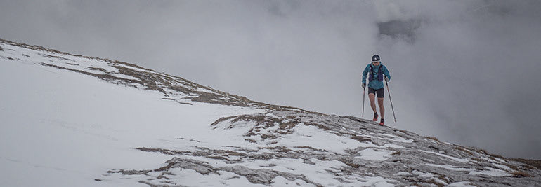
Suunto Blog


Start your path to mountain navigation mastery here
Becoming confident at navigating with a map in the mountains doesn’t happen overnight. You can’t read a book and develop the skills. They need practice in the field, in a variety of terrain and conditions. Then the theory becomes grounded in experience.
“Good navigation skills are a big booster for self-confidence,” says Suunto’s resident navigation pro, Terho Lahtinen. “When you know you’ll find your way back, it gives you the freedom to explore new surroundings without any fear of getting lost. That is pretty nice whenever you come to a new place.”
Photo by Jan-Niclas Aberle on Unsplash
Expand your horizons
This is the fifth and final article in our series on mountain navigation. In this one, we review the previous four articles, touch on the key takeaways from each of them, and bring them all together in one place so they are easy to review. It’s worth going through each of them a couple of times so it all sinks in.
“Wayfinding and map reading are absolutely useful for anyone regardless of age,” Terho says. “It’s a great way to develop three-dimensional thinking, foster curiosity, and to encourage the spirit of exploration!”
Learn the basics
In the first article, Terho explains how to get started. Developing good location awareness and topographical map reading ability go hand in hand. Each supports the other. You really need to cement these skills before leading trips into big, unfamiliar mountain terrain.
To become a confident wayfinder you need to fall in love with topo maps. Buy maps that illustrate outdoor recreation areas you know well and study them carefully. Investigate how land formations are depicted. Get a feeling for contour lines and how they communicate inclination. Take your map outdoors and compare what it tells you with the landscape you see around you. Doing this over time helps to develop location awareness.
“Map reading skills are the number one thing to learn,” Terho says. “Maps tell us how the world around us looks. If you know how to read one and correlate the information with the terrain, you can get wherever you want.”
Read how to find your way in the mountains.
Photo by Fabrizio Conti on Unsplash
Planning a trip
To plan a safe and challenging trip in the backcountry you need to have developed your map reading skills, location awareness and general outdoor experience. Otherwise your planning won’t be based on anything solid. Good planning is important to ensure your trip is a success.
This is why in the second article Terho recommends people new to map reading first plan a trip somewhere familiar. This will allow you to relax and to compare what you have seen before with what you see on the map. It makes recognition easier.
Once you have selected a destination, study the terrain features on the map. Look at potential start and end points, possible points of interest, handrails, the contour lines, and consider what is realistic for your group. Review this second article above for pacing information and factoring in break times.
Read 7 tips to plan a route in the mountains.
Staying on track
The planning is done, and now you have parked your car at the roadend and are heading out into the mountains. This third article is about how to stay on track when you’re out there.
Two things are particularly important now. Firstly, keep a schedule outlining what landmark or terrain feature you will reach and when, and monitor your travel time. Secondly, use handrails and landmarks to guide you.
Look at your map before you start each leg of your trip and try to memorize the upcoming terrain features.
Read our 9 tips for staying on track in the mountains.
Challenging conditions
The best laid plans can go awry. And that’s partly what makes us love adventure, right? If it was always easy and straightforward it would also be boring. Adversity helps us to find our inner strength. This is why we have always been drawn to adventure.
In this fourth article, we look at how to handle challenging conditions, specifically poor visibility. This is when following handrails, being flexible with your plan, and having supplementary technology, like a GPS device, makes all the difference.
Read 9 rules to follow when your trip in the mountain goes pear shape.
Practice makes perfect
As with any skills, practice makes perfect. “Reaching a master level is often a process of years,” Terho says. “But if you study maps regularly at home and every now and then spend a few hours practicing in the outdoors, you will make good progress in months. It’s something you try out once a year, you’ll start from scratch every time.”
Lead images:
Photo by Tim Tiedemann on Unsplash
Photo by Toomas Tartes on Unsplash
Read more articles
How to find your way in the mountains
7 tips to plan a route in the mountains
A veteran navigator's 9 tips for staying on track in the mountains
9 rules to follow when your trip in the mountains goes pear-shaped


Know your power source: the body’s three energy systems
Understanding how your energy is produced can aid training and improve your quality of life. Suunto partner PerfectPace explains your main power sources.
The human body has two main energy systems it gets its power from; the aerobic and the anaerobic system. Most of us have heard these terms, but how many of us really understand how they work?
All human cells use ATP to generate power. Adenosine triphosphate (ATP), is an energy-carrying molecule found in the cells of all living things. ATP captures chemical energy obtained from the breakdown of food molecules and releases it to fuel other cellular processes.
Phosphate, carbohydrate and fat are transformed into ATP which happens at different speeds.
Photo by Jonathan Chng on Unsplash
The anaerobic alactic system
No oxygen and no lactate. Sounds like this energy source is not very sustainable? Correct! The body has ATP reserves for about 7 seconds. During that short time it is possible to perform at your max power. Your body does not need to transform carbs or fats into ATP which takes time, but can directly access your ATP and phosphate storage. Afterwards the power output drops significantly. Purposed for fast and powerful movements, the anaerobic alactic energy system is the essential power source for sprinters and weightlifters.
Photo by Victoire Joncheray on Unsplash
The anaerobic lactic system
Above lactate threshold
No oxygen, but lactate instead. During the final dash when you are out of breath, your legs burn, and you need to give all you got, your body is operating above lactate threshold. Purposed for intense activity, the energy source of this system – also called the anaerobic glycolytic system – is glycogen and lactate.
Because of the lack of oxygen, metabolising fat isn’t really possible. But the body burns carbohydrates even without oxygen. This creates large quantities of lactate which make it impossible to perform for more than one to two minutes at this level. Lactate threshold means reaching the level of intensity where the body starts to create more lactate than it is able to metabolize.
Below lactate threshold
In this case, there is some oxygen in the body and the lactate can be broken down faster than it is created. A typical example of this might be a 10 km run. During those 30 to 60 minutes carbohydrate is the main energy source. The way ATP is created is the same as above lactate threshold. The difference is the lactate is being produced at a rate where it can still be broken down.
Photo by Jozsef Hocza on Unsplash
The aerobic energy system
This is the main power source for endurance athletes. Why? The aerobic system utilizes carbohydrates, fats and sometimes proteins to generate energy. Aerobic exercise can be sustained for longer periods of time.
At this level, our carbohydrate store lasts for about 90 minutes. After that point the only energy source is fat. Even the leanest athlete has almost unlimited fat resources, but transforming fat into ATP is relatively slow. For endurance athletes it is very important to improve performance in the aerobic zone.
One system
While we can conceptually separate the three systems, it’s important to understand that our body’s cells use all energy sources at all times. What changes is the share each fuel source has on the total energy production. Even at rest the anaerobic lactic system, for example, is working at a low level.
PerfectPace is the endurance training platform for triathletes that takes you a step ahead. For a steady performance gain you had to know a lot about training methodology to plan your training sessions. Especially in a sport like triathlon where three sports need to be planned correctly. This is where PerfectPace steps in. It offers not only unique statistics that up to now were only available in expensive desktop applications but it also helps to create a plan that boosts your performance with the help of artificial intelligence, big data and the latest advances in training science. PerfectPace considers not only your training activities but also rest days, tapering, even injury and your personal strengths and weaknesses.
Lead images:
Photo by Markus Spiske on Unsplash
Photo by John Cameron on Unsplash
Read more articles
Don't get sucked in the black hole
Know your resting and max heart rates

9 rules to follow when your trip in the mountains goes pear-shaped
Spend enough time in the mountains and you learn to expect the unexpected. You might start out in delightfully warm weather and then, surprise, a storm arrives and covers the landscape in snow. Didn’t see that coming!
In the second article in this series on wayfinding, we talked about how to plan a route in the mountains. In the third article, we explained how to stay on track when you’re out on a trip. In this article we look at how to react when conditions get difficult.
Thing is, even the best laid plans can and probably will go awry. It’s important to understand your plan is just a plan. The world around you marches to its own drumbeat.
Photo by Tim Tiedemann on Unsplash
3 general rules
Be responsive
Our resident navigator-in-chief Terho Lahtinen advises to expect the unexpected. You don’t want to get too vigilant and uptight, however, because then nothing is much fun. Just keep it in the back of your mind that things can change, and to be responsive when they do.
Terho says to cultivate this quality it’s good to go through different scenarios in advance of the trip and to have plans for each of them.
“In the mountains, you should always have a plan B for surprises: a shorter route, extra clothing, first aid kit, backup navigation device, and so on,” he says. “Having the right equipment and skills to use them properly is the best preparation.”
Stay calm
Goes without saying, but when things take a turn for the unexpected it’s important not to panic. Panic impairs our decision making ability, which can be a big deal in the backcountry. Instead, do something to help you relax.
“When you encounter an unwanted situation, make a stop, have a snack, find shelter if possible and put on an extra layer to keep warm,” Terho says. “It’s more important to make the right decision rather than a quick one that turns out wrong.”
Consider all options
Once you’ve settled down, consider all your options. Talk with your group and see how everyone is feeling. What options suit the skill level and comfort zone of your group?
“Sometimes the conditions are just not on your side and the only reasonable plan B is to postpone the trip,” Terho says. “This can be a very hard decision if it’s a long-awaited adventure, but it’s better to be safe than sorry.”
This is when a Suunto 9 comes in handy. The watch’s Find Back function guides you directly back to your starting point via a breadcrumb trail on the watch face. You can also store Points of Interest on the go and navigate back to them.
Photo by asoggetti on Unsplash
Specific rules for low visibility
One typical thing that can catch people out in the mountains is poor visibility, whether caused by fog, rain, snow or low light. You have to pay extra attention in any of these conditions, and really consider what options are the best for you and the group.
Easy does it
In low visibility always choose the easiest route to follow. Stay on a marked trail instead of taking an off track shortcut.
“If there are no trails, use obvious terrain features as checkpoints that you are sure to recognize,” Terho says.
Know your location
One of the ways people get into trouble in the mountains is by pushing on hastily without being sure about their location. In low visibility, take the time to regularly check in with your map.
“If you lose your location on the map, it is much more difficult to find it again if you can’t see your surroundings,” Terho says. “In practice, you will need to pay attention to all details in the terrain that you can identify on the map, and also work through the terrain features that you expect to see when moving on.”
Keep track of time
Monitoring your travel time is essential to estimate the distance you have traveled. This is important because in low visibility it will help you estimate where you likely are on the map.
“It’s worth noting that in poor visibility we tend to overestimate the distance traveled and the pace often gets slower when visibility drops,” Terho says. “When trying to spot yourself on the map, remembering this limits the radius of where to look on the map.”
A stream can act as a handrail to lead you to the next terrain feature. Photo by Hamed Alayoub on Unsplash
Follow handrails
We talked about using handrails as navigation aids in the previous article in this series. They can be particularly useful in low visibility, even as reassurance.
“A good handrail is a clear terrain feature that you can easily follow, such as a creek, river, hillside, a fence or the treeline,” Terho explains. “Sometimes you can also use the elevation of the handrail as an additional navigation aid.”
Use all your tools
When you’re way out in the backcountry far from help or above the treeline and exposed to the elements, time is of the essence. Cold is the enemy. Use all your tools to help you stay on track and safe. Your compass, watch, altimeter, GPS device – each one can help you.
“Use your compass to check the trail you’re on goes in the right direction,” Terho says. “Check the time every now and then; knowing your average pace and the time in the last known location helps to estimate how far you could have traveled. An altimeter is also a practical tool. For instance, working out your location on a trail that goes up or down a slope can be done with an altitude reading. As a backup, it’s also good to have a GPS like a Suunto 9 watch with the most important waypoints and the planned route stored.”
Wait it out
Sometimes the best thing you can do is to find shelter asap. Especially in cold conditions, staying warm is the priority. Hypothermia, when your body loses heat faster than it can produce it, can set in within minutes to hours, depending on the temperature.
“There are times when the best option is to pitch camp, sleep over and evaluate the options again next morning,” Terho says.
Lead image: Photo by Philipp Reiter
Read more articles
How to find your way in the mountains
7 tips to plan a route in the mountains
A veteran navigator's 9 tips to stay on track in the mountains


Don’t get sucked into the black hole
There’s a training pattern that eats away your improvements. Suunto partner PerfectPace explains the black hole and how to avoid it.
Many of us know this scenario: your training plan has you scheduled for an easy recovery run that mysteriously becomes faster and faster. Maybe it’s because you are motivated and feel good or because you don’t want to be overtaken by that runner just behind you. Sounds innocent enough, right? Thing is, running just a bit faster than you are supposed to can destroy your training program without you or your trainer even realizing it. You were just sucked into the training black hole.
For serious training blocks, don't fall into the middle of the black hole.
What is the black hole?
Stephen Seiler, an American sport scientist at the University of Adger in Kristianstad, Norway, researched this phenomenon in 2007 and gave it the name, “training in the black hole”. The black hole consists of an alluring, gratifying training intensity and sucks your training into it. Your easy runs become a bit faster and the hurtful high intensity intervals become a bit less intense. Instead you drift down the middle into the gaping maul of the black hole. You don’t train one or the other intensity you are supposed to. Training on recovery days becomes just a bit too intense to give your best on high intensity training days.
For non professionals training in the black hole might be somewhat ok. You go for a 30-60 minute run and you run a bit faster than you should. Until your next training two days might pass which is enough time to fully recover. The intensity will be high enough for adaptations. For serious training, however, it’s essential to train in low and high intensity zones and not in the black hole.
The black hole in elite sports
The reason for Seiler researching the phenomenon of the black hole arose out of an experience with Olaf Tufte, an elite Norwegian rower. After winning third place at the world championships in 2002 Olaf had mediocre results in races the year after. The cause of the disappointing results was a mystery, especially given his training schedule did not change. Eventually he and his trainers discovered the cause: the cool new boat he got after the championships in 2002 gave him the extra motivation to go faster than normal on his recovery days. This additional intensity was enough to sabotage his regeneration and his results. He’s been pulled into the black hole.
Avoiding the back hole: know your intensity
There is a simple way to avoid being pulled into the black hole; don’t train according to feeling and whim, but have a proper training plan and be mindful of which training zone you should be in on each workout and stay in it. To be precise about these training zones and the levels of intensity, you need to know your heart rate, pace or power zones. Click here to read more about understanding your training zones. And handily, Suunto watches display in real-time which training zone you are in on the watch face. They also show the duration you spent in each zone and allow you to set an intensity target for each workout.
PerfectPace is the endurance training platform for triathletes that takes you a step ahead. For a steady performance gain you had to know a lot about training methodology to plan your training sessions. Especially in a sport like triathlon where three sports need to be planned correctly. This is where PerfectPace steps in. It offers not only unique statistics that up to now were only available in expensive desktop applications but it also helps to create a plan that boosts your performance with the help of artificial intelligence, big data and the latest advances in training science. PerfectPace considers not only your training activities but also rest days, tapering, even injury and your personal strengths and weaknesses.
Lead images:
© Graeme Murray/Red Bull Content Pool
Read more articles
Know your resting and max heart rates
10 reasons to enjoy open water swimming with Suunto
The benefits of training to music and making your best playlist


Running books to read on your summer vacation
Summer holidays are a time to rest and recharge, and also an opportunity to reignite our inspiration. Whether you’re having a "staycation", on a multi-day hiking trip in the mountains, sunbathing at the beach or on a family road trip, take along one of these six books about running and you will get yourself motivated for your training in the second half of the year.
1. Above the Clouds: How I carved my own path to the top of the world.
Two-time National Geographic Adventurer of the Year and Suunto ambassador Kilian Jorney has broken mountaineering records all over the world. Kilian Jornet's new book, Above the Clouds, recounts his life of studying and ascending the greatest peaks on earth. Kilian reveals his process and on what he has found in nature—simplicity, freedom, and spiritual joy.
2. Sky Runner: Finding Strength, Happiness, And Balance In Your Running, by Emelie Forsberg
Suunto ambassador and four-time back-to-back Skyrunner World Series champion Emelie Forsberg lives for the outdoors. It’s part of everything the Swedish running phenomena does. In this book, she shares her passion for mountain running and expert insights into this demanding sport. Buy it here.
3. Trail Blazer: My Life as an Ultra-distance Runner, by Ryan Sandes
Ryan Sandes has run ultras in some incredible places: Antarctica, the Sahara and the Gobi deserts, and recently set a fastest known time record on the Great Himalayan Trail. In his usual easy-going and down-to-earth style, he tells his incredible story. Buy it here.
4. Training Essentials for Ultrarunning: How to Train Smarter, Race Faster, and Maximize Your Ultramarathon Performance, Jason Koop
If you’re looking for a challenge in the second half of your year, how about running an ultra marathon? If you’re called to the challenge, then this training book by ultra running coach to elite athletes Jason “Coach” Koop is a must have. Reading it will set up your training programme. But it here.
5. The Way of the Runner: A Journey into the Fabled World of Japanese Running, by Adharanand Finn
You might be as surprised as we were to discover that Japan is the most running obsessed nation on Earth. Author, journalist and runner, Adharanand Finn has followed up on his first book – Running with the Kenyans: Discovering the Secrets of the Fastest People on Earth – with another book that delves into Japan’s one-of-a-kind running culture and what it might teach us about the sport and about Japan. Buy it here.
6. Run or Die, by Kilian Jornet
When it comes to running, Kilian Jornet is a different kind of beast; ski mountaineering, vertical races, ultra marathons, mountaineering, fastest known time records – he is king of all. In 2017, he made two lightning speed ascents of Everest in a single week, completing his Summits of my Life project. This is a classic written by a super athlete. Buy it here.
Lead image: © Photo by Toa Heftiba on Unsplash
Know your resting and max heart rate
Keeping track of your heart rate is vital for endurance athletes. In this article Suunto partner PerfectPace explains the ins and outs.
Knowing your max heart rate is an important guide for athletes. It gives you a roof for your training and indicates the level of intensity. On the other hand, one of the first signs of overtraining syndrome is an elevated resting heart rate. For endurance athletes doing high volume training this is essential to watch out for.
Identifying your maximum and resting heart rate is vital for the calculation of training zones. Particularly for endurance training these numbers are very important and they are not hard to come to. But there are a few things to consider.
Source: Age-predicted maximal heart rate in healthy subjects: The HUNT Fitness Study
How to find your maximum heart rate
You have probably heard of the formula 220 minus age to get your maximum heart rate. Some say that this formula is not too exact but all in all the results are ok. Unfortunately that is not the case. In most cases the result is way off.
A Norwegian study on more than 3300 healthy women and men has tested their maximum heart rate. The graphic below shows the result. What we can see is that the average values for the whole population is on a straight line. But for most individuals their maximum heart rate is far from that line. The conclusion is that the formula works for the average global population but not for an individual.
When looking at the graph it is also evident that no formula can calculate the individual maximum heart rate. The results are just too scattered. The only way to get to your max HR is via a test.
How to test your maximum heart rate
The maximum heart rate should be tested in your sport. Runners should run and swimmers swim. Triathletes should do a run test. The heart rate is the highest in running of all three sports.A max HR test is VERY demanding. You need to go to your limit and that will hurt.
A typical test for runners looks like this:
Warm up for at least 10 minutes. Now increase your tempo for 5 minutes until you get out of breath. This is the time to start a one minute spurt. It will hurt but you need to max out. Depending on your ability to push yourself you’ll get close to your maximum heart rate.
How to find your resting heart rate
Like for the maximum heart rate there is no formula to calculate your resting heart rate. The resting heart rate is even more individual than the maximum heart rate. Some sport watches can measure your pulse while sleeping. In the morning you will have your resting heart rate.
If you don’t have such a device you can simply measure your heart rate right after you woke up. Untrained have a resting heart rate between 60-80 bpm. Endurance athletes might have only 35 bpm. The reason for such differences are adaptations to the cardiovascular system. The heart gets stronger and more efficient when under high load but also when resting.
Changes of the maximum and resting heart rate
The heart rate changes during your lifetime. Simply by getting older. A new born baby has a resting heart rate of 130-140 and it drops with every year. This is the reason why the formula 220 minus age came up. But there are a lot more factors than just age that influence your heart rate all the time. Therefore you should test again from time to time to make sure your training zones match your physiology.
But there are also short term changes in your heart rate. You won’t be able to reach your max heart rate every day. Also the resting HR is changing from day to day up to 15 beats per minute. reasons can be a cold or over training. By checking your resting heart rate regularly you can spot abnormal stress levels early and adapt your training.
PerfectPace is the endurance training platform for triathletes that takes you a step ahead. For a steady performance gain you had to know a lot about training methodology to plan your training sessions. Especially in a sport like triathlon where three sports need to be planned correctly. This is where PerfectPace steps in. It offers not only unique statistics that up to now were only available in expensive desktop applications but it also helps to create a plan that boosts your performance with the help of artificial intelligence, big data and the latest advances in training science. PerfectPace considers not only your training activities but also rest days, tapering, even injury and your personal strengths and weaknesses.
Lead images:
Photo by Brian Erickson on Unsplash
© Kevin Scott Batchelor
Read more articles
10 reasons to enjoy open water swimming with Suunto
The benefits of training to music and making your best playlist


