


Suunto Blog


7 recovery tips for immune fitness
Spend more time taking it all in and savouring life. Photo by Simon Migaj on Unsplash
Recovery and training are like yin and yang. If you’re laying around too much, you won’t be making the necessary gains to reach your goals. If you’re training too much, you won’t give your body the downtime it needs to recover and adapt. The sweet spot is somewhere in the middle.
It’s not uncommon for athletes to lean more towards the overtraining end of the spectrum, and one of the risks of overtraining is a weakened immune system. Signs of overtraining include, for example, feeling tired or heavy all the time, feeling irritable, or having regular illnesses.
This is why our mantra should be, “recovery is as important as training”. These seven tips and articles will help you stay in balance and care for your immune system.
Avoid tunnel vision
It’s important, and sometimes challenging, with training not to get so focused on our goals that we develop tunnel vision; so locked into our training schedule that we lose sight of the big picture, and all the little cues we might need to rest. It’s important to step back once and while, consult your loved ones or people you trust, and consider how you’re doing and what your body and mind need.
Suunto athlete Ryan Sandes knows all about this. He battled a long period of illness and eventually returned to top form after allowing himself to rest and recover fully. We talked to him about the experience and he shared tell tale signs when you need to back off.
7 signs you're pushing too hard
Get more sleep
Working full time, it’s all too easy to burn the candle at both ends; early mornings, long working days, and late nights. It’s not uncommon to have a string of nights where we sleep for only six or seven hours. And on top of that we expect ourselves to train. It’s a lot!
Sleep doctor Henri Tuomilehto told us when we don’t get enough sleep our health will gradually deteriorate. He recommends trying to sleep an extra 30 to 60 minutes a night. “When times are tough you have to respect rest and recovery,” he says. “That is the only way you can stay balanced. Sleeping well is essential for this.”
Learn how sleep can make you a better runner
Breathe well
Science has shown how breathing well has many health benefits. And crucially, one of those benefits is it helps to reduce stress. Chronic stress takes a terrible toll on the immune system. Over time it weakens it, making us more susceptible to illness.
Mike Maric, a former pro freediver, teaches athletes how to breathe better. He says many people have no idea about their own breathing patterns and often breath from the chest, rather than more deeply. “We need to breathe not with the chest, but with the diaphragm,” he explains. “But you need to practice regularly – the basics, about eight minutes each day.”
Is the ultimate cross-training breathing?
Practice yoga
© Matti Bernitz / Suunto
A gentle yoga practice stimulates the parasympathetic nervous system – the rest and digest side of the nervous system – reducing the volume of stress hormones that weaken the immune system. It also feels amazing physically!
Suunto ambassador Emelie Forsberg practices yoga every morning because it helps her tune into her body. “It allows me to tune into how the muscles are feeling, where the tender spots are, what needs attention,” she says. “It gives me the sensitivity to be able to listen to the body.”
Emelie Forsberg’s top 7 yoga poses for runners
Eat well
© Craig Kolesky / Red Bull Content Pool
Our food choices are indicative of how we’re doing as individuals. When we feel stressed and hectic, it’s often the case that we make poor food choices. Eating nutritious food is essential for good health and a strong immune system. And once in a while it’s great to really examine how you are eating, and put a lot of love and time into preparing amazing meals.
We talked to our ambassador and athletes about how they eat, and found six principles they all share, despite having different approaches to food. “As an athlete it’s very easy to slip into taking lots of recovery shakes to try to get the goodness back into your body,” ultra runner Ryan Sandes says. “But I don’t think you can replace eating good whole foods.”
Fuelling the engine: six principles of nutrition for athletes
Walk regularly
Like with breathing and yoga, science has shown the many health benefits walking regularly gives us, including boosting immune function. Taking a leisurely stroll through a park is incredibly relaxing for body and mind. Relaxation is key for immune system health.
To build the walking habit, decide on a distance or amount of time that you can easily walk each day, and over time gradually increase it.
How to walk your way to good health
Find your ‘being mode’
One of the reasons for a weakened immune system is we are constantly in what the mindfulness tradition calls “doing mode”; trying to achieve, get things done, and problem solve. While this mode is natural to an extent, we also need to spend time in “being mode”; when we just enjoy being without any aims. Maybe for some of us that is reading a good book, listening to music, and for others lying around on the beach doing nothing.
Mindfulness can help us tune into our behavioural patterns so we can be more responsive and make better decisions that avoid overwhelm. “Listen to your body and really try to get a mind-body connection going because that’s the most important connection you can have,” says South African mindfulness coach and trail runner Meg MacKenzie. “Pushing through isn’t always the best option.”
How to bring mindfulness to the trail
Lead images:
Photo by Fezbot2000 on Unsplash
Photo by Tower Paddle Boards on Unsplash
Read more articles
The benefits of the long run and how to do it right
7 tips for running in hot weather
7 principles to help you find the flow
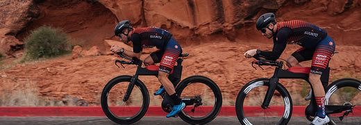

View TSS and other power-based cycling metrics in real-time
Together with TrainingPeaks we give you the tools and data to take command of your training. You track your workouts with your Suunto watch and TrainingPeaks gives you in-depth analysis and planning tools to achieve your full potential. After each activity, you can analyze your performance to determine where you are at. (Read more about benefits you get with Suunto & TrainingPeaks.)
On Suunto 9 and Suunto 5 watches you are also able to follow selected TrainingPeaks metrics in real-time. This lets you adjust the effort and duration of the exercise on the go, helping you reach your goal. TSS, IF and NP can be accessed in the SuuntoPlus section of Suunto 9 and Suunto 5 watches.
Read on to learn more about these metrics!
Normalized Power (NP)
In essence, Normalized Power is an estimate of the power that you could have maintained for the same physiological “cost” if your power output had been perfectly constant (e.g., as on a stationary cycle ergometer), rather than variable. Keeping track of normalized power is therefore a more accurate way of quantifying the actual intensity of training sessions, or even races.
For example, it is common for average power to be lower during criteriums than during equally-difficult road races, simply because of the time spent soft-pedaling or coasting through sharp turns during a criterium. Assuming that they are about the same duration, however, the normalized power for both types of events will generally be very similar, reflecting their equivalent intensity. In fact, normalized power during a hard ~1 hour long criterium or road race will often be similar to what a rider can average when pedaling continuously during flat 40k time trial – the normalized power from mass start races can therefore often be used to provide an initial estimate of a rider’s threshold power.
Intensity Factor (IF)
Although normalized power is a better measure of training intensity than average power, it does not take into account differences in fitness within or between individuals. TrainingPeaks therefore also calculates an Intensity Factor (IF) for every workout or time range analyzed. IF is simply the ratio of the normalized power as described above to your threshold power.
For example, if your normalized power for a long training ride done early in the year is 210 W and your threshold power at the time is 280 W, then the IF for that workout would be 0.75. However, if you did that same exact ride later in the year after your threshold power had risen to 300 W, then the IF would be lower, i.e., 0.70. IF therefore provides a valid and convenient way of comparing the relative intensity of a training session or race either within or between riders, taking into account changes or differences in threshold power.
In Suunto watches we use the threshold as limit between Zone 4 and Zone 5. This means that the effort you have been riding is a share from an-aerobic threshold level. Intensity factor gives you a simple info on how hard you are working out.
The intensity factor for recovery workouts should be under 0.75, for endurance rides 0.75-0.85, for tempo workouts 0.85-0.95 and for an-aerobic threshold intervals 0.95-1.05. The short timetrials I.e. 10km the intensity factor should be 1.05-1.15.
To get similar values with Suunto watch that you get from TrainingPeaks, make sure your Zone 4 | Zone 5 limit is same as functional threshold power in TrainingPeaks. You can find the zone setup on your watch settings: Training » Intensity zones » Advanced zones.
Training Stress Score (TSS)
Exercise intensity is clearly an important factor in determining the type and magnitude of physiological adaptations to training. Together, exercise frequency and duration determine the overall training volume are important factors as well. However, there is obviously an interaction between training intensity and volume. At some point as intensity goes up volume must come down, and vice-versa, or else you will become overtrained.
To quantify the overall training load and hopefully help avoid such a situation, TrainingPeaks uses your power data to calculate a Training Stress Score (TSS) for every workout, and provides a graphical summary of your recent TSS on your Athlete Home page.
Read more about Normalized Power, Intensity Factor and Training Stress Score at TrainingPeaks.com
READ MORE
Training with TSS and hrTSS
3 TrainingPeaks training metrics to adjust your running on the go
Lead image: Kevin Scott Batchelor


Training with TSS and hrTSS
One of the best ways runners and cyclists can constantly improve is by having a solid understanding of their training data. It’s trying to tell you something, but you can only understand if you speak its language.
Whether you are a triathlete, cyclist or a marathoner, TSS and hrTSS are two training languages well worth getting your head around. TSS is probably the most used training load algorithm amongst endurance athletes. It tells you how hard your training session was and the physical stress of your training over time. TSS is dependent on training with power, and ideal for cyclists, while hrTSS is an alternative for those training without power, and can be helpful for runners and other endurance athletes, such as cross-country skiers.
The partnership between Suunto and TrainingPeaks was formed to give you full command of your training data. You track your workouts with your Suunto watch and TrainingPeaks gives you in-depth analysis and planning tools to achieve your full potential. After each activity, you can analyze your heart rate, power, pace and other data to determine where you are at. (Read more about benefits you get with Suunto & TrainingPeaks.)
On Suunto 9 and Suunto 5 watches you are able to follow TSS and hrTSS in real-time. This lets you adjust the effort and duration of the exercise on the go, helping you reach your goal. TSS, hrTSS and other TrainingPeaks features can be accessed in the SuuntoPlus section of Suunto 9 and Suunto 5 watches.
You can have all the technology in the world, but to get the most of your training, your Suunto watch and TrainingPeaks, it’s worth the time getting a clear understanding of these two training metrics: TSS and hrTSS. So get yourself a coffee, sit back and read on.
Why bother with metric-based training?
The primary goal of a metrics-based approach to training is to understand what the body is undergoing from a physiological perspective, and how that ultimately influences training decisions. Understanding the stress that training puts on the body’s systems, and whether or not the desired response is being produced is integral to the modern training process. Understanding what both TSS and hrTSS are allows for a deeper discussion of the two and their merits.
What is TSS?
First things first, you need to understand TSS. Specially designed for cycling, the Training Stress Score metric tells you how much stress your body underwent on a ride. It’s a composite number that takes into account the duration and intensity of a workout to score the overall training load and physiological stress created by a training session.
By taking both intensity and duration into account, TSS allows for a better understanding of the “cost” of every individual effort and workout. TSS is calculated using the following formula:
TSS = (sec x NP x IF) / (FTP x 3600) x 100
Where “sec” is the duration of the workout in seconds, “NP” is Normalized Power, “IF” is Intensity Factor, “FTP” is Functional Threshold Power, and “3,600” is the number of seconds in an hour.
It’s worth defining and understanding this equation so you have an idea of why TSS is so accurate, and how the final score is derived. The components that comprise TSS are what make it so useful to athletes.
Normalized Power is calculated using an algorithm that is a little complex, but in a nutshell takes into account the variance between a steady workout and a fluctuating workout. It measures the true physiological demands of a training session. It considers both rapid changes in intensity, as well as critical responses in the body associated with those changes.
Unlike average power, Normalized Power is the power your body “thinks” it employed based on the variability of the workout. Intensity Factor (IF) is the ratio of Normalized Power to Functional Threshold Power (FTP). IF takes into account differences in fitness within or between individuals.
It’s a great way to track fitness over time for a given effort, for example the same ride with a lower IF indicates increased fitness. Using TSS provides a well-rounded look into both the physiological expenditure of an effort, as well as what that effort means for the fitness and progression of an athlete.
What is hrTSS?
More appropriate for those not training with power, the Heart Rate Training Stress Score (hrTSS) is based on time in heart rate training zones derived from an athlete’s lactate threshold heart rate. The calculation is made using an estimate of the amount of accumulated TSS in an hour given the level of exertion.
Suunto watches use intensity zones where HeartRate Zone 4 | Zone 5 limit equals the lactate threshold / an-aerobic threshold level. The hrTSS in Suunto watch uses this level to calculate the proper TSS value. You can find the heart rate zone setup on your watch settings: Training » Intensity zones.
It’s important to remember that Functional Threshold Power (FTP) is by definition 100 TSS per hour. This makes intense, or hypervariable efforts hard to account for given the limitations of the body’s cardiovascular system to respond rapidly enough to changes in intensity.
hrTSS is used as the default in TrainingPeaks when there is not enough data to calculate TSS, rTSS (Run Training Stress Score) or sTSS (Swim Training Stress Score). It can be accurate, depending on the effort, but doesn’t do as good of a job at incorporating intensity and duration into the equation.
Comparing the relative merits of TSS and hrTSS
If you’ve not yet taken the jump into training with power, there is some value in hrTSS. The best way to use hrTSS is with steady state efforts, such as long tempo and sub-threshold work.
These types of efforts suit the hrTSS formula because there are no abrupt changes in intensity. It’s easier to estimate hrTSS when the heart rate stays steady for longer periods of time. This metric begins to fall away when shorter and more intense efforts occur. The heart doesn’t respond rapidly enough to weight efforts above threshold.
This makes the “cost” of the workout seem much lower than it really is. While hrTSS may be recording a more moderate range, you’ll feel much more tired given that you’ve stressed systems in the body that hrTSS couldn’t pick up on.
TSS is the best way to ensure you have a good understanding of how taxing a particular effort or workout was. By incorporating Normalized Power into the equation, we get a much more accurate sense of the effort the body actually produced.
Picking up on these fluctuations in effort also allows for a much more accurate TSS reading. This not only is helpful in understanding a single workout, but influences core metrics such as Fitness, Form, Fatigue and ramp rate.
A more accurate Training Stress Score not only means you’ll have a better understanding of your workout, but you will likely also have a more productive approach to your planning, recovery, and execution.
The metrics that we have at our disposal help to inform our workouts, as well as help to execute them with a greater level of precision. Knowing how the metrics we rely on are calculated, and why it is we should trust one more than the other is important for any athlete.
TSS provides the most accurate picture of how both individual sessions and specific efforts impact the body. While hrTSS can help to quantify steady state efforts, it does not do a good job of highlighting the often stochastic nature of exercise. Using TSS will lead to more accurate planning and a better understanding of each workout.
READ MORE
View TSS and other power-based cycling metrics in real-time
3 TrainingPeaks training metrics to adjust your running on the go
Lead image: Kevin Scott Batchelor

3 TrainingPeaks training metrics to adjust your running on the go
The definition of insanity, they say, is doing the same thing over and over again and expecting a different result. This holds true for our training. It’s easy to get stuck in a groove, running on autopilot, and wondering why we’re not getting the results we hoped for. But if you turn off autopilot and start paying attention to the details with a metric-based approach then you’ll see how to tweak things so your performance starts tracking upwards.
This is what the partnership between Suunto and TrainingPeaks is all about; to give you the tools and data to take command of your training. You track your workouts with your Suunto watch and TrainingPeaks gives you in-depth analysis and planning tools to achieve your full potential. After each activity, you can analyze your heart rate, power, pace and other data to determine where you are at. (Read more about the benefits you get with Suunto & TrainingPeaks.)
On Suunto 9 and Suunto 5 watches you are able to follow selected TrainingPeaks metrics in real-time. This lets you adjust the effort and duration of the exercise on the go, helping you reach your goal. hrTSS, rTSS, NGP and other TrainingPeaks metrics can be accessed in the SuuntoPlus section of Suunto 9 and Suunto 5 watches.
Two phases of metrics-based training
You can learn from metrics in two phases, in real-time with your Suunto 9 or Suunto 5 while you’re training, or post workout back at home by analyzing the results on TrainingPeaks. Both are valuable and both can help you to refine and improve your training.
Running Training Stress Score (rTSS)
The most useful tools to quantify how hard you’re training are those metrics that account for both the volume and the intensity of your running. TSS in cycling uses power as the criterion measure of intensity, and this overcomes many of the limitations associated with the use of heart rate when quantifying intensity. Since running speed is a function of power, and for most runners, speed or pace is the measure of greatest interest, we can use the same principles applied in the TSS system to quantify training stress in running. In particular, the elements of the normalized graded pace (NGP; see below), relative to the functional threshold pace in conjunction with the duration of the workout we can determine an appropriate rTSS score for each workout.
The stressfulness of any given pace is determined in relation to your current functional threshold pace (that is, the fastest running pace you could sustain for one hour). The calculation makes adjustments for hills (for example, a hilly 40-minute run at a steady pace of 8:00/mile would generate a higher TSS than a flat version of the same run) and even for the fact that running at any given pace becomes more physiologically stressful the longer that pace is sustained. This can give us an apples to apples comparison for training stress incurred by a track workout versus a long steady run versus a fartlek run, or any other workout. It provides the framework by which we can see the big picture, or the forest despite the trees.
Learn more about Running Training Stress Score (rTSS) at TariningPeaks.com
Normalized Graded Pace (NGP)
Normalized Graded Pace (NGP) is the adjusted pace reported from a global positioning system (GPS), or other speed/distance device, that reflects the changes in grade and intensity that contribute to the physiological cost of running on varied terrain. We can derive NGP from flatland running, such as on a running track, but NGP really shines when applied to pace data obtained on undulating or even hilly terrain.
Some readers, who come from cycling backgrounds and have used power meters, may recognize the similarity in name of NGP with Normalized Power (NP) from cycling. The inspiration for NGP came from the work of Andrew Coggan, Ph.D. and his development of NP. For coaches and/or athletes who participate in multi-sports, and have used NP and Training Stress Scores (TSS) for cycling, there has been a great desire to extend the principles and utility of the NP/TSS system to other disciplines. The obvious first extension that comes to mind is running. The recent availability of downloadable GPS recording devices makes the adaptation of the NP/TSS system to running an attractive proposition. An in depth discussion of the concepts of NP and TSS can be found here.
The long and the short of it, however, is power is the cycling analog of pace in running. In fact, if we plotted power vs. pace at a constant speed, for a given runner, there would be a very close relationship; they change proportionally. So, if you are a runner, and you track training based on pace, you are indirectly tracking power. So, the underlying principles of NP in cycling hold for what can be termed Normalized Graded Pace (NGP) in running.
Learn more about Normalized Graded Pace (NGP) at TrainingPeaks.com
Intensity Factor® (IF®)
Intensity Factor gives you relative intensity in running by comparing Normalized Graded Pace to an-aerobic threshold pace. Therefore Intensity Factor is a valid and convenient way of compare the relative intensity of a training session or race either within or between runs, taking into account changes or differences in threshold pace.
In Suunto watches we use the threshold as limit between Zone 4 and Zone 5. This means that the effort you have been running is a share from an-aerobic threshold level. Intensity factor gives you a simple info on how hard you are working out. Suunto watches use a intensity zones where Pace Zone 4 | Zone 5 limit equals the lactate threshold / an-aerobic threshold level. The rTSS in Suunto watch uses this level to calculate the proper rTSS value. You can find the pace zone setup on your watch settings: Training » Intensity zones » Advanced zones.
The Intensity Factor for recovery workouts should be under 0.75, for endurance runs 0.75-0.85, for tempo workouts 0.85-0.95 and for an-aerobic threshold intervals 0.95-1.05.
Learn more about Intensity Factor at TrainingPeaks.com
READ MORE
View TSS and other power-based cycling metrics in real-time
Training with TSS and hrTSS
Lead image: Kevin Scott Batchelor

World Vertical Week 2020 Big Data: The nation that climbed the most is …
Well done to everyone who got out there and chased vertical meters over World Vertical Week 2020. We saw some inspiring efforts from people around the world.
Two firefighters, for example, donned their heavy protective clothing and gear, and powered up and down the best training hill in their hometown of Helsinki, Finland. That’s going above and beyond the call of duty! Read their and two other cool stories from the week here.
At Suunto HQ we are always excited to analyze the data and see how much our users have climbed over the week, and which nations and sports have sweated it out and gathered the most vertical meters. This year week has some exciting results.
Over time, World Vertical Week has gradually been becoming a tradition; more and more people are participating and sharing their love of moving uphill.
Return to the top
Last year, one of the surprise results was that Austria lost it’s top place as the nation that gains the most vertical meters by average after holding it for two years. This year, the alpine nation has retaken the throne. The average climb among Suunto users in Austria was 457 m. Sehr gut Österreich!
Notable mention to second place Switzerland (418 m) after dropping to eighth place last year. In the previous two years before that it was near the top. Italy (395 m) came third. These results prove once again that alpine nations know the best way to move is upwards!
The overall kick ass nations
Respect to our users in Italy, Spain, Austria, and France, all nations that came in the top five of five or more categories. Italy landed in the top five of 10 different categories, and Spain landed in the top five of seven.
Skimo the go
No surprises here; once again ski mountaineering accumulated the most vertical meters (838 m) on average out of all our activity types. Mountaineering (545 m) and trail running (466 m) came in second and third, as they did last year.
Race to the top
In the race for most total ascents per country, France beat out Spain to win the country that climbed the most. Last year, Spain came out on top. And, once again, Italy came in third.
Impressive individual efforts
There were 1772 participants who climbed more than a thousand meters during the week, and 1095 individual sessions that included more than 1000 meters of climbing. That’s some solid training, folks. Well done!
Top nations by sport
Ski touring
No nation cracked the 1000 m mark this year in the skimo stakes, but it’s clear many users are gunning for this. Keep pushing and nail it next time!
1. Spain 972m 2. Austria 948m 3. Italy 946m 4. Switzerland 921m 5. Slovakia 903m
Mountaineering
Kudos to Sweden, a small nation of 10 million, for coming out on top in the mountaineering category, and for breaking the 1000 m mark. Surprising given last year it didn’t even make the top five.
1. Sweden 1316m 2. Italy 1060m 3. Austria 666m 4. Spain 581m 5. Slovenia 494m
Trail running
People in Asia are crazy about trail running, and once again Asian nations won the podium this year and four were in the top five. Nice!
1. Japan 932m 2. Hong Kong 896m 3. Thailand 676m 4. Greece 649m 5. Malaysia 636m
Mountain biking
Austria won this one, followed by Spain and Italy; all nations in the top five last year, too.
1. Austria 582m 2. Spain 513m 3. Italy 469m4. Switzerland 375m 5. France 356m
Trekking
Notice anything? This time Italy wins and Spain and Austria follow.
1. Italy 559m 2. Spain 397m 3. Austria 375m 4. France 352m 5. Malaysia 316m
Hiking
Malaysia came out on top here, and, as a side note, also came in fifth place for both trekking and trail running. We can imagine exploring the incredible mountainous rainforests in Malaysia must be pretty motivating!
1. Malaysia 606m2. Italy 475m 3. New Zealand 453m4. Slovenia 352m5. Japan 343m
Nordic skiing
Go Canada! Last year Canada came second, behind France. This year they reversed positions.
1. Canada 438m2. France 268m3. Norway 233m4. Austria 218,0m5. Italy 217,6
Cycling
Portugal won after not even making the top five last year. Spain, Italy, Israel and South Africa once again filled the rest of the positions.
1. Portugal 460m 2. Spain 390m 3. Italy 345m 4. New Zealand 316m 5. South Africa 310m
Running
This category had very narrow margins between nations, and a slight reduction in average meters from last year. Last year New Zealand won it. Congrats Norway!
1. Norway 156m 2. Switzerland 151m 3. Czech Republic 142m 4. Italy 140m 5. France 139m
Lead images:
Photo by Klemen Tušar on Unsplash
Photo by Jamie Davies on Unsplash
Read more articles
On the rise: top stories from World Vertical Week 2020
How to find your way in the mountains
7 tips to accelerating your vertical speed

On the rise: top stories from World Vertical Week 2020
© Philipp Reiter
World Vertical Week has become an annual tradition, and many Suunto users are finding creative ways to get the most out of it.
The week is really an invitation to get outside, to push oneself, and find new resolve and strength. It’s also a chance to show that nearby hill or mountain who’s boss.
This year, we again ran a World Vertical Week photo competition with three lucky people winning a Suunto 7 or a Suunto 9. We asked our Instagram followers to share an image with a Suunto app data overlay from one of their ascents over the week and tag #verticalweek. We received so many inspiring entries. Thanks to everyone who participated. Check out the winners and their shots below. Congrats!
Firemen to the rescue!
Two firemen in Finland went above and beyond the call of duty for World Vertical Week. Henri-Aleksi Pietilainen, 29, and his room mate at the Rescue Academy showed their dedication by donning their protective fire gear and ascended the most popular training hill in Helsinki multiple times – and just after finishing a 24 hour shift. Respect guys!
“We thought it was going to be easier (considering my level of training in the mountains and my friend’s latest expedition through Greenland), but the extra 25 kg of weight and unforgettable clothing and gear gave a nice extra ‘touch’ and was really good training,” Henri says. “We did this in a pair because in real firefighting rescue missions it’s good to have a partner to help each other out.”
Cooking up a storm
It was Lukasz Bodaszewski’s first time participating in World Vertical Week. The 39-year old chef from Poland runs a catering company with his wife in the French Alps. He aimed to ascend 3000 m over the week, and managed 2300
“But I finished 1000 m in one day and I’m proud of that,” he says. “Vertical Week was good timing because I’m training for the 160 km Val d’Aran UTMB in the Pyrenees and for 145 km TDS at UTMB this year, so it was good to have a specific climbing week.”
Getting out there
Casey Sackett didn’t hold back for World Vertical Week. From Hurricane, Utah, Casey aimed to achieve a mile of vertical gain (1610 m) over the week. He notched up a total of 1631 over a series of awesome trips, including mountain biking the Gooseberry Mesa and the rest what he refers to as “desert alpinism” (alpine style lines in a desert ecosystem).
“Conditions were perfect all week out here and gave me the opportunity to get out every chance I had!” Casey says. “My favorite push was my last one, trekking/trail running up a mesa to the La Verkin Overlook. My eight-year-old daughter set the pace on the 4 km ascent with almost 243 m of gain. We did it in just 61 minutes! Her endurance blew me away, so proud!”
Thanks again to everyone who got out there and pushed their comfortzone for World Vertical Week. Keep it up!
Lead images: © Philipp Reiter
Read more articles
The nation that climbed the most in World Vertical Week is ...
7 tips to accelerating your vertical speed
How to find your way in the mountains


