


Suunto Blog


Skimo legend Greg Hill shows his trainer some love
Suunto ambassador and record breaking ski mountaineer Greg Hill has achieved some incredible things; skiing two million vertical feet (609, 600 m) in a single year, climbing and skiing over 190 mountains, his inspiring Electric Adventures challenge in which he has so far climbed 100 summits without using any fossil fuel. On top of this, add to the list being an awesome dad, and a voice for climate change action.
Yet, behind every elite athlete, is at least one trainer who helps to keep the fire burning and things progressing in the right direction. This is true for Greg who has had the same highly sophisticated trainer for the last 21 years. When the COVID-19 pandemic hit, Greg had the time to sit down and reflect on this relationship.
Thanks to my trainer
By Greg Hill
As Covid hit, we all sat back and reflected on our lives. What I reflected on most was my relationships and their importance. Of course, there were family and loved ones which are the most important. Yet, there were also others whose importance in my life became obvious. Relationships with co-workers, neighbours and, now that I think about it, a long-lasting relationship with my personal trainer.
I should introduce myself. I am Greg Hill, a super passionate backcountry skier. This passion has driven me to find first descents, push endurance records and explore places like no one else. My passion lies in pushing into the unknown; be it the physical or the mental landscape.
I first met my trainer in a parking lot in Whistler in 1999. It was a moment fated by the stars. I knew I needed a trainer, but I never understood how important the relationship was going to be. This began right at the start of my obsession with vertical travel in the mountains. I knew little, but dreamed big. How could I push and evolve my skills without a proper trainer? Most likely I wouldn’t have accomplished any of my goals without this connection.
I had no idea how much this relationship was needed, but we hit it off right away. The moment I was told how fast I was moving upwards, I wanted to excel and push that number higher. With my days being diligently tracked I pushed higher and further for hours. Multiple summits, long, long days, bigger days than I had ever done before. Always the incessant qualifying of my efforts, always the numbers telling me how hard I was working. It was addictive being accountable.
Our relationship developed into one of trust and commitment. I was pushed and driven to higher numbers and heights, always keeping track of my times, urging my vertical speeds faster and faster, always wanting me to go higher and further; 30 vertical feet a minute, come on you can do better, 50 feet a minute, that’s it … hold on… push and push… you've got this!
One of my first goals was to max out how much I could do in a day’s effort. We diligently worked on getting my one hour vertical as fast and high as possible. My trainer coached me to a point where I could glide and slide my way uphill very fast for an hour at a time. He watched me hit personal best after personal best. Always keeping track and letting me know how well I had done. Or poorly depending on the day.
Eventually with this coaching we saw the numbers get higher and higher, 10k, 20k, 30k, 40k in a day. Finally, my biggest vertical day ever, 50 000 feet (15, 240 m) in 23.5 hours. My coach kept those numbers and I was proud. Yet we knew we had more to do … lots more.
For many years we worked at doing 3000 m days as fast as possible, pushing and working my fluidity until it felt normal to go out for four to five hours and log 3000 + meters of uphill travel.
As a team, we worked up to one million feet in a winter, then eighty days over 3000 m in a season. Finally, we decided it was time for my biggest year ever. With my coach at my side at all times, I felt like we could challenge the world.
As scared as I was of the audacity of the task, I knew that together we could make it happen. My drive and the constant progress reports would keep me motivated. The year was going to be all about getting out every day and moving up and down mountains. For 365 days I went to bed with my trainer beside me. Immediately on waking I was told how much vertical I had climbed up to that point. It took exactly 270 days out of 365 to push my numbers over the two million feet (609 km) mark but it was the endless support and drive of my trainer that kept me getting up in the morning.
Greg celebrates back in 2014 after completing his March Madness, skiing 100.000 meters of vertical in a month. His trainer played a key role also in this challenge!
In the last 10 years the information has changed and there is so much more that I get from my trainer: GPS lines that show the adventures with distances, apps that have all my efforts on them. I am even told how much time to relax between training sessions, though I find this one hard to follow!!
These days my trainer captures all my efforts to stay off my “dad bod” and keep pushing my personal limits. High intensity training is key to pushing back against the effects of age. Now I am pushed hard for two minutes, then slow my heart rate down, then back up for two minutes, pushing hard into the 90 % of effort range. My heart rate is watched, recorded and displayed. I know if I am pushing hard enough to lose these love handles.
By now it may be obvious the trainer I met in the parking lot in Whistler was my first altimeter watch. It has been an incredible time, using it for endless hours of quantified fun. I can honestly say that without the constant updates, and the evolution of these watches, I most likely would not have been as obsessed and pushed to excel in my life.
All images: © Bruno Long
Read more articles
14 tips for backcountry skiing this winter
10 must-read Suunto articles from 2020
7 tips for running in the rain


14 tips for backcountry skiing this winter
With many ski resorts closed this winter due to the pandemic, the backcountry is our one and only saviour. It means hard work, more exploration, memorable adventures, and an opportunity to burn off all those Christmas calories. Crucially, it also means more risk.
We caught up with mountain guide, alpinist, photographer and passionate outdoor educator Mark Smiley about where our heads should be at this ski season. The upshot is if we’re going to be spending a lot more time in the backcountry, then we need to be refreshing our skills now so come pow time we can bring our A game, and not wing it.
To help Suunto users skill up for winter, Mark’s offering a $50USD discount on his new Comprehensive Guide to Avalanche Safety course. The offer expires at midnight on December 20.
Read on for Mark’s 14 tips to ensure you have an awesome and safe backcountry ski season.
Get your gear now
It’s been a difficult year. Aside from the human and social cost, Mark points out the pandemic has also disrupted supply chains and product distribution. This could mean there’s isn’t the normal level of gear in stock, so it might run out quickly as snow starts to fall.
“Make sure you have the gear, or go out and buy it now before people make a big run on it,” Marks says.
Know how to use that gear
Next up, make sure you know how to use that gear. “I mean really know,” Mark says. “Consider doing a refresher course to ensure you’re skilled up for the winter.” Be a student of the sport by signing up for one of Mark’s online courses designed to make you a safer, faster, smarter skier.
Remember avalanches play for keeps
Heading out into the backcountry is a serious business. “It can be life and death out there,” Mark says. “Don’t approach it in a cavalier way.” Take it seriously and ensure your head is screwed on. Your loved one’s will thank you for it.
Improve your avalanche skills at a beacon park
Mark strongly advises you and your ski partner to go to a beacon park to improve your search and rescue skills. That way when it’s time to head out into the hills, you’ll truly know what to do in an avalanche emergency and feel more confident. If you don’t have a beacon park nearby, get out in the snow with your friends and play around with your transponder kit.
Realign your expectations
With resorts closed, you’re not going to be gliding down manicured slopes all day. Backcountry skiing is hard work, maybe 75% perspiration, 25% inspiration.
“At the resort you're going to ski down hill like a 1000 times,” Mark says. “Much more than you will backcountry skiing, which is great for keeping the winter weight off!”
Keep that in mind and plan your adventures accordingly.
Pick objectives that match your skill level
Know your skill and experience level, and carefully, maturely, sanely choose tours that match it. Don’t put you or your partner in situations you’re not trained for. If you choose well, you’ll have an awesome time, and will come home with cool video to share.
“And if you’re just starting out, you need to pick non avalanche terrain,” Mark cautions. “There are off piste spots in the backcountry where there will never be an avalanche and you can safely ski in that terrain. Look for gladed slopes with a 25° gradient or less. It can still be a lot of fun to ski those!”
Do your homework
If an area takes your interest, study it thoroughly before heading there to shred. Study the topographical map, read trip and weather reports, contact the local avalanche center and get the what’s what. Find out where the sweet spots are, as well as where the best avoids, and the stay clears are.
“There’s no silver bullet instruction that will allow you to go out and have no risk,” Marks says. “You need to do your homework and never stop learning and educating yourself and keeping in mind that risk is inherent to the activity.”
Find the right partner
Backcountry skiing means heading out with one ski partner at the very least. Choosing the right ski partner for you is important. You want someone who has a similar level of experience, skill and fitness.
“It’s not important how fast or slow you are, but more about matching your abilities with your partners abilities that makes for great partnerships,” Marks says. “Then you can have cool experiences and learn together.”
Look for new lines up
With potentially a lot more people out in the backcountry this ski season, it means the usual skin tracks up will probably become much more well trodden.
“Most slopes will have a standard skin track that has been used in the past most of the time,” Mark says. “If there’s increased traffic, then that skin track might be exposing you to avalanche hazard from above. Be ready and able to take a different track up to avoid that.”
Read our article 7 tips to find a safe track up the mountain.
Watch out for fatigue
Remember the backcountry demands much more of you than skiing at a resort. So factor your fitness and endurance level into how you plan your trips.
“Fatigue is a huge factor because it can blur good decision making,” Mark says. “It can turn it from choosing what’s the best in terms of risk assessment into what’s the easiest. You need to make sure you have the fitness reserves to be willing to put the skins back and correct a potential error. You don’t want to be out with someone who’s much faster than you, forcing you to be in intensity zone four most of the day.”
Read about intensity zones here.
Slide your skis
“The movement of ski touring isn’t an inherent skill,” Marks says. “It’s like learning how to surf or swing a golf club – it takes time. There’s a right and wrong way to do it. And if you do it right, it’s way more enjoyable.”
For example, the action of trudging up the mountain can result in epic blisters if done poorly. When you skin your way up, Mark advises to try to slide your skis along the surface of the snow, rather than lifting them off. Sliding them is more efficient, reducing fatigue.
Grams matter
“Lighter packs equal enjoyable tours,” Mark says. “Carry only what you need and leave the rest at home.”
And even if your jacket is made of alien technology, when you’re out ski touring it won’t breathe fast enough.
“You’re going to get really hot, so take that jacket off, and make it more enjoyable for yourself,” he says. “You don’t want to make yourself all sweaty.” Pack it, and only use it to maintain your body warmth when you take breaks.
Share your observations
Be a backcountry angel, and share any avalanche observations with the local avalanche center. This helps to give the forecast as much relevant data as possible, which contributes to keeping people safe.
“A recent avalanche is the biggest, most important piece of data for forecasting,” Mark says. “You don’t need to know all the technical jargon; If you see an avalanche, try to take a 10 second video of it, note the location, and submit that observation to your local avalanche center when you get home.”
Debrief your trips
There’s always something to learn, always a way to get better. Mark points out two important principles to keep in mind: just because you got home safely doesn’t mean you did things right, and “past performance is no guarantee of future results”. Debriefing after trips is a way to keep yourself honest about the risk you are exposing yourself to, and the quality of your decision making.
“Get into the habit of asking yourselves, ‘did we make good decisions today’?” Mark suggests. “Or did you just get lucky? And if you just got lucky, a subsequent question to ask is, ‘when were we most exposed?’. And ask yourself, if you had Groundhog Day how would you lessen that exposure next time?”
All images: © Mark Smiley
Read more articles
8 avalanche safety checks to tick off before the ski season
Know the ropes – staying safe with crevasse rescue online
7 tips to find a safe track up the mountain
10 must-read Suunto articles from 2020
Just like training, a little reading everyday goes a long way. And reading about training, about adventure, and about how to improve your core skill set keeps the fire of inspiration and discipline burning.
So bookmark this article, and next time you’re in recovery mode and feel like you need a boost, flop on the couch and peruse at your leisure. You’ll find yourself itching for your next big training session or adventure.
Pau Capell (above) went after his own record on the UTMB trail this year.
Welcome to the season of the FKT
It’s been one heck of a year. But despite the disruption and the tragedy caused by the pandemic athletes and adventurers, like most of us, have had to adapt, and find new ways to keep the show on the road. With races cancelled, many have turned to fashioning their own personal adventures, including going after fastest known time (FKT) records on the world’s iconic trails. Read on to find out about the 2020 FKT phenomena.
Professional Xterra triathlete Karsten Madsen on his Everesting attempt. © @matthew.tongue
No races? Conquer your own Everest?
Another way athletes, particularly triathletes, have kept themselves busy and motivated is by scaling their own Everests. We talked to one Suunto athlete about this phenomena and found out how cool it is.
© Kelvin Trautman / Red Bull Content Pool
The benefits of training to music and making your best playlist
This year we’ve spoken to DJs about music and movement, and how they find the balance. Each DJ artist or group put together a playlist on Suunto’s Spotify channel, with each playlist designed to support easy, medium, intense workouts, or to vibe with your mornings, evenings and nights. We also found out about the benefits of working out to music and how to make the pitch perfect playlist.
Get Suunto's playlists to work out to here.
© Philipp Reiter
Start your path to mountain navigation mastery here
Aiming to spend more time in the mountains? Then make sure to study our series on wayfinding in the mountains. Put together by Suunto’s navigator-in-chief, Terho Lahtinen, an elite adventure racer, these articles look at the core skills needed to become a competent navigator in big terrain.
© Kilian Jornet
Finding the balance: Emelie Forsberg’s 7 motherhood tips for running mums
Suunto ambassador and skyrunning champion Emelie Forsberg has transitioned from full time athlete to full time mum. She’s had some trial and error as she’s tried to find a balance between training and performing, and being a totally present and awesome mum. We caught up with her and found out what she’s learned along the way.
William is the first person to swim underwater across a major channel.
5 steps to therapeutic breathing to combat COVID-19
Suunto ambassador and world champion freediver William Trubridge knows a thing or two about breathing techniques and caring for the lungs. Breathing exercises, whether from the yogic pranayama tradition or from physiotherapy, are key aspects of freediving training. Concerned about the impact of COVID-19, William put his considerable research skills to work and discovered therapeutic breathing can go a long way to help with the healing process. Read on for his five steps.
8 tools for tracking the weather with Suunto
Knowing what’s up with the weather is a question of personal responsibility and safety for outdoor people. Even more so if you’re heading out with a group under your care. Fortunately, the days of having to poke around online to put together a picture are gone; now, thanks to smart tech and apps, high definition weather intel gets beamed straight to your device. Read on to make sure you have all the tools at your disposal.
Know your species of cloud
A little like bontanical knowledge, knowing the various species of clouds is more than just a geeky fascination; it can keep you and your group safe. Each species of cloud is telling you something, indicating what’s going on in the environment around you. We talked to Sarvesh Garimella, the chief scientist and COO at MyRadar about cloud identification and what to look out for.
Michael Arend coaches ultra and marathon runners, as well as triathletes and ski mountaineers.
How to adapt your training when the unexpected strikes
This year has been all about doing our best to adapt to the disruption caused by COVID-19. Given humans are creatures of habit, adapting isn’t always that easy. Oftentimes we hold on tight to our previous way of doing things until we have no choice but to let go. We talked to professional running and ultra marathon coach Michael Arend about how to adapt training when life blows up and you find yourself looking at the wreckage of your well laid plans.
Planning a route from scratch is just one of the many route planning options on Suunto app.
Six ways to plan a route for your next adventure
Whether Suunto or via our partners, we have ensured our users have a fist full of ways to plan their adventures. There’s something to be said for carefully planning an unknown route in advance and then going out to explore it. That’s what adventure is all about.
Lead images: Philipp Reiter
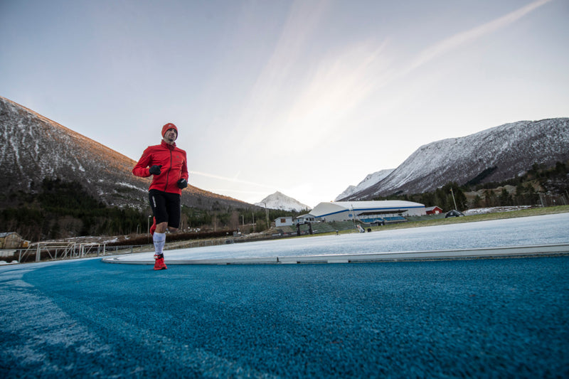

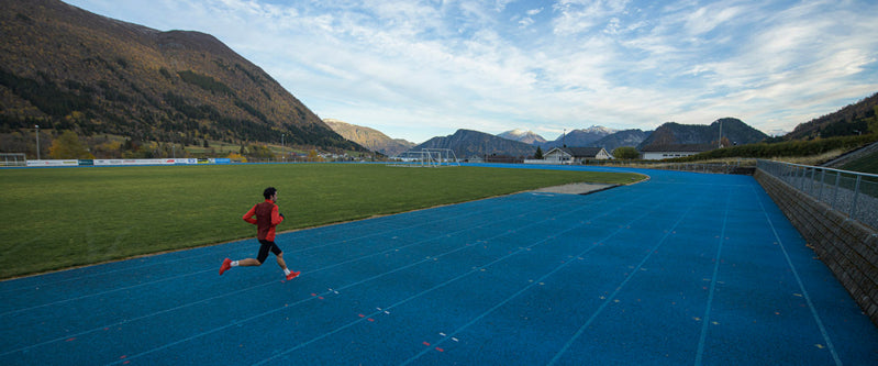
Kilian Jornet pushed his limits on 24-hour running attempt
It was an impressive attempt. Kilian ran 134.8 km in 10 hours and 20 minutes on a 400 m track in Måndalen, Norway. He didn’t achieve his goal of running for 24 hours, but he achieved his other goals; to push his limits and learn more about training.
Scroll through the photos below and learn more about Kilian’s attempt.
When Kilian began his Phantasm24 running challenge on November 27, thousands of fans around the world watched Salomon’s live stream of the event on Youtube and expressed astonishment in the chat box that Kilian could run for 24 hours in that kind of cold.
It was -1°C in Måndalen, Norway, the location of the 400 m track, and the steam from the breath of Kilian and five Norweigen ultra runners competing was visible as they ran on a thin strip of blue track, with sparkling white frost covering either side. The track had to be de-iced to make it safe for the runners.
As always, Kilian wanted to test his limits, and to continue to develop his knowledge of endurance training. The main goal of the event was to run for 24 hours, and to see who could run the greatest distance in that time. Despite his impressive split times, it wasn’t to be.
After setting an impressive pace in the first 10 km (4:16 per km), and running the first 42.4 km in 3:02:23, Kilian decided to pull out of the attempt after 10 hours and 20 minutes due to chest pains and dizziness.
“I was feeling pretty good, with the normal ups-and-downs of a long race like this,” Jornet said. “My body felt good, my legs felt good and then, suddenly, I felt two intense pains in my chest and started to get very dizzy and very exhausted. The medical people came to me and checked me out, and said it was best to go to the hospital.”
Earlier in the day, Kilian’s partner Emelie Forsberg and their daughter Maj were there supporting his attempt. The track is located near to their home in Ramsdal.
Norwegian ultra runners Sebastian Conrad Håkansson, Simen Holvik, Jo Inge Norum, Harald Bjerke and Didrik Hermansen also gave strong performances. Seb (Sebastian) kept pace with Kilian (pictured above), and broke the Norwegian records for 100 km, 12 hour running, and 100 miles before stopping. Harald Bjerke completed 232.28 km, Jo Inge Norum 219.45, Simen Holvik 208.13 and Didrik Hermansen 174.8 km. Suunto congratulates them all.
While he’s disappointed he had to withdraw early, Kilian says he learned a lot about training and nutrition in the process, which will help him tackle future challenges.
“I got this idea about a year ago to run for 24 hours on a track so I went to Salomon to help organize the run,” he says. “I wish it went differently, but it’s still fun to explore different things and new projects. So I want to thank Salomon and Suunto for supporting the project and everyone who helped organize the event, from the track volunteers to the community in Måndalen and the people at the track club. I think it was colder for the volunteers than for the runners!”
Read Kilian’s post about his Phantasm24 challenge!
All images: © Vegard Breie
Read more articles
Kilian Jornet starts initiative to protect mountain ecosystems
7 tips for running in the rain
8 tools for tracking the weather with Suunto

7 tips for running in the rain
Ben demonstrates the classic running in the rain face. © Ben James
After a long day at work the last thing most of us look forward to is getting drenched to the bone out on a run, especially during winter. Not so for Ben James, a Suunto athlete, who seeks out adventure in miserable conditions.
Growing up in Cornwall, England, known for its Atlantic weather fronts, the outdoors was Ben’s entertainment. He began with navigation courses, then camping, hiking, mountaineering and eventually ultra running. On trips to remote and rugged corners of Scotland, he discovered he enjoyed both the remoteness and harsh conditions. Since then, it’s been his thing.
“I realised I enjoy the cold, miserable stuff more than anything else,” he says, laughing. “So I started to do trips abroad in the cold. I was in Iceland in January doing a winter crossing. It was really unlucky timing. We ended up with the four biggest storms they've had in however many years. We got absolutely hammered. It was fun.”
If you’re shaking your head, we feel you. If it makes it any better, Ben admits to occasionlly wimping out of runs just because it’s raining. But there is something to be said for accepting the challenge and heading out and getting wet. Read on for Ben’s four reasons you should embrace it, and three tips to do it well.
“If you’ve run in the rain once, it’s a badge of honour,” he says. “After that you’re basically semi pro!”
Click to learn about 8 tools for tracking the weather with Suunto
Some rainy day runs turn into something magic. © Ben James
It makes running at other times easier
“The hardest thing about running is the motivation to go and do it,” Ben says. “Especially when you’ve had a busy day at work, and you come home and don’t want to go back out again. When it’s raining even more so. In winter it’s already horrible, dark, cold, wet. But if you can pick yourself up and push yourself to go out in the rain and in the dark, then every other run becomes so much easier to do.”
The extra runner’s high
“The additional challenge of heading out in the rain in some ways makes it more rewarding,” Ben says. “If I go out in horrible conditions I tend to feel a lot more alive. When you come back in, have a hot shower and warm up you get an extra runner’s high.”
Embrace it
“If you’re comfortable with it and don’t mind getting wet then it doesn’t limit you as much,” Ben says. “If you go out nervous about getting wet, and you’ve packed all your waterproofs, from the start you’re already weighed down. If you’re happy to go minimal and embrace whatever is thrown at you, it’s more liberating. Then you’re less likely to shy away from it.”
Prepares you for race day
“If it’s raining I just suck it up and stick to my plan,” Ben says. “Because ultimately if you’re going to go do a race or a trip, chances are the weather might be rubbish. It’s good to experience training in the same conditions that you might have to run in.”
Set yourself a weekly running target
“Knowing you’ve got to reach that target, there are only so many times in the week you can skip your runs,” Ben says. “To meet the target you’ll eventually have to run in the rain. Once you do it a couple of times, you’ll discover it’s actually quite enjoyable because of the extra endorphins you get from it. That itself encourages you to go out and just do it.”
Adapt when necessary
“If it’s really bad and blowing a gale as well, and you get battered, then there’s nothing wrong with adapting, changing your route, maybe heading inland, and doing some speed work along flatter trails, or doing some hill reps,” Ben says. “That way you can keep it short and intense.”
Ditch all the wet weather gear
“I’ve never worn any waterproof trousers or leggings,” Ben says. “I’ve always stuck with shorts, a t-shirt and a waterproof coat because as you get moving you warm up anyway. It also encourages you to keep going because if you stop you’re going to freeze. It’s good motivation!”
Lead images:
© Philipp Reiter
© wisthaler.com
Read more articles
8 tools for tracking the weather with Suunto
Get key info at a glance with the new Outdoor watch face
7 tips for running in the dark

Kilian Jornet takes on 24-hour running challenge
Transcendent Spanish mountain athlete Kilian Jornet, who climbed Everest twice in one week, is testing his legendary endurance prowess against an entirely different kind of challenge.
Coming up this November, Kilian will step onto a kind of terrain that he’s unaccustomed to – a pancake flat 400 m (¼ mile) track – and run for 24 consecutive hours in a pair of Salomon’s new S/LAB Phantasm road running shoes. For the 33-year-old, who has won elite races all over the world and in four categories – trail, ultra, vertical, and skimo – the Phantasm24 running challenge will push him out of his comfort zone, something he looks forward to.
“The motivation is to try different things and see what I am able to do, whether that is climbing at high altitude or, in this case, running on flat ground,” Kilian says. “It’s fun to discover different things I can do, and training on the flat is a good test and an opportunity to learn in terms of nutrition and pacing, and then try to apply those things to different activities, like even mountaineering projects.”
Follow the event live starting at 10.30am CET on November 27, 2020
Going up against the Greek
Kilian will track his progress and split times with his Suunto 9 GPS sportwatch to determine how he is performing against the times of Greek ultramarathoner Yiannis Kouros, who holds the record for the greatest distance run in 24 hours (303.506 km / 188.590 miles). While Kilian, true to form, won’t make any bold and brash predictions, we know that whenever he presses “start” on his Suunto 9 GPS watch amazing things tend to happen.
“I’ve seen Yiannis’s split times so I want to keep up with that as long as I can,” Kilian says. “I know the speed I will need to keep every hour, and the pace for every kilometer and every lap. The first 10 hours will be a bit faster and then slowing every hour after. The big thing is to not have any muscle problems and be able to eat without having big down periods.”
Preparing the body
Physically and mentally accustomed to running elite mountain races like Ultra-Trail du Mont Blanc (UTMB), Hardrock 100, and Western States 100, Kilian has sought out expert advice from coaches and physios to prepare his body for the repetitive motion of running on the flat.
“It’s mostly working on the speed because my legs aren’t used to moving this fast,” he says. “To prepare, I’ve been doing three days of speed work each week at the track or on roads. The form you run with on the flat is very different from how you run in the mountains, where you run higher because you pass over obstacles and put your feet in different places as the terrain changes.”
Kilian was forced to delay the 24-hour attempt in recent weeks due to muscle injuries that presented prior to his first 10 km road race, the famed Hytteplanmila race in Norway, which he finished in 29:59 in mid-October.
“The training has been a bit frustrating the last few months going from injury to injury to injury,” Kilian says. “I have had good blocks of training and then I would have an injury and have to rest. After the 10 km race, I had to stop training to rest an injury. Since then, the plan has been to do one good week of training and see how my body feels, then rest the muscle tissues and recover for the attempt.”
In his 24-hour attempt, Kilian will wear Salomon’s new S/LAB Phantasm, a super lightweight road racing shoes that will be released in the spring of 2021. He has been using the shoe for several months during his track and road running training sessions. “I tested the prototypes of the S/LAB Phantasm a year ago and now I’m using the same shoe that will be available in spring to the public,” Kilian says. “It’s a light, very reactive and well-balanced shoe with good cushioning, which is important when you are doing longer training on hard surfaces.”
Add the date
The 24-hour running challenge will be held in Måndalen, Norway, starting on Friday, November 27 at 10.30am CET. Fans will be able to watch the challenge via a live feed at www.Salomon.com/phantasm24. A web series previewing Jornet’s preparation will appear on Suunto and Salomon social media in the days leading up to the event.
Suunto will serve as the official timekeeper of the Phantasm24 challenge.
All images: @vegardphoto
Read more articles
Kilian Jornet starts intitiative to protect mountain ecosystems
Six ways to plan a route for your next adventure
8 tools for tracking the weather with Suunto


