Suunto Blog
Get the perfect shots - how Suunto watches help photographers
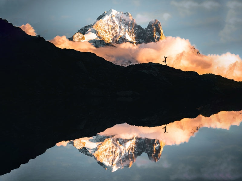
All photographers have been there: you’re heading up into the mountains to capture that long sought after moody landscape, but arrive just as the light gets that touch too low or too bright. It can be so frustrating, right? Pro adventure photographer Maximilian Gierl knows the feeling well. He says that’s why it’s so exhilarating to finally capture the perfect shot. It takes patience, time, often disappointment, which makes it that much sweeter when he nails it. Take for example the shot below of him jumping on a trail in Chamonix with Mont Blanc in the background. He had it in mind for years, but the conditions never played ball when he visited. And then finally he got the sweet taste of success.“This is a shot when everything just aligned,” Maximilian says. “I love being in Chamonix in autumn - the clouds, lakes and forest are so special. When we got to Chamonix, I saw I could finally get this mood I had been searching for for years. I ran up 1400 m as quickly as I could to get it.”
Climbing 4000ers and mastering timing
From Germany and living in Switzerland, Maximilian has recently finished an alpinism challenge he began in 2015: climbing all 48 of the alpine nation’s 4000 m mountains while documenting the adventure. “It’s pretty good for someone who didn’t grow up with mountaineering,” he says. “I started mountaineering in 2015 and climbed most of them in the last two years.”For Maximilian, the best outdoor shots are moody with a mix of cloud and light. “I love to shoot landscape scenes you can’t shoot one day later again,” he says. “It’s a challenge and hard to plan. If it happens and you nail the shot, it’s super crazy.”With timing being everything, Maximilian uses his Suunto 9 Peak to manage his photography adventures.His watch helps him get to his shot locations on time for the best light conditions. Here are four ways his Suunto helps him nail epic shots.
Navigate in the dark
The last of Switzerland’s 4000 m giants Maximilian climbed was Lenzspitze (4294 m), which is famous for its imposing north flank - a 50-55-degree ice wall. Maximilian and his climbing partner followed a route on their Suunto watches to climb the face and reached the summit before sunrise.
“When going to shoot in new places, I plan the route in Komoot and transfer it to my Suunto,” Maximilian says.” This is especially helpful when I’m ascending in the morning when it’s still dark out. Then I use the navigation and it’s super helpful and easy and means I get there on time.”
Read more:
How to find routes that rock
How to create your own routes
Set sunrise and sunset alarms
Maximilian uses his watch to make sure he’s on location for the golden hour (the last hour before sunset and the first hour after sunrise) and the blue hour (one hour before sunrise and one hour after sunset), when the light is best for photography. His watch also shows him how long the blue hour, his favorite time for photography, will last.
Maximilian sets sunrise and sunset alarms to help with time management so he’s in the right location at just the right time. “Knowing the time of sunrise at my location helps me to get as much sleep as possible while still being on time at the planned spot,” he says. “I time the alarm 10-15 minutes before I need to go.”
The sunrise/sunset alarms in Suunto 9 watches are adaptive alarms based on your location. Instead of setting a fixed time, you can set the alarm for how much in advance you want to be alerted before the actual sunrise or sunset.
Read more: how to set sunrise and sunset alarms.
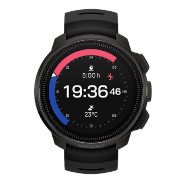
Get key info at a glance with Suunto’s Outdoor watch face
The Outdoor watch face for the Suunto 9 Peak, Baro, 9, 5 and 3 watches allows users to track conditions and daylight hours with just a quick glance. No need to press buttons or scroll – the essential info is presented on the main screen. Maximilian uses it to help him stay on time and to determine when is the best moment for a shoot.
“Just a quick look on my watch tells me all the important information like the current altitude, moon phase and time until sunrise or sunset”
The watch face features a sun gauge that displays the number of night and daylight hours before sunrise and sunset. Tap the screen once, and the watch face displays the number of hours until sunset or sunrise, plus the battery life remaining, or the moon phase, which is helpful because on a full moon night you know you’ll have extra light to stay out a little longer.
Read more about the Outdoor watch face here.
Following the moon phases
Maximilian uses the Outdoor watch face to track the moon phases on his watch so he knows when is a good night and time to shoot the night sky. “It tells me when the night sky will be at its darkest,” he says. “I can then plan when to shoot the Milky Way.”
Read more about tracking moon phases here.
All images: © Maximilian Gierl Photography
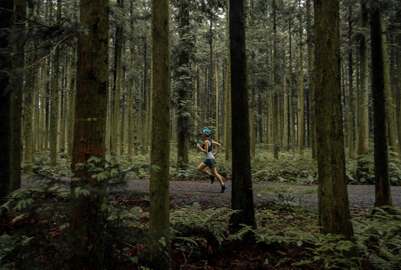
Celebrate Earth Day with us!
Starting this Earth Day, we have partnered with Hammerhead and Komoot to challenge you to #SeeTheAdventureAhead and share your natural wonder, however you explore.
Use the hashtag #SeeTheAdventureAhead when you share on Instagram, Facebook, and/or Komoot* before May 11th and we’ll plant a tree for every post, with the goal of planting 10,000 trees with Tree Nation.
Trees are key pillars of the world for both humans and the environment. They benefit us by purifying water, air and creating better social conditions. They benefit the environment by providing homes for various forms of life, cooling our climate and improving our soil.
To celebrate the wonders of our natural world, get out there and share your natural wonder. We'll plant trees through the VCS certified Eden project in Mozambique for each share!
*tag Suunto and Hammerhead when you share on Komoot
Find places to explore with Suunto heatmaps
Learn more about Tree Nation
Learn more about Suunto compatible cycling computer Hammerhead Karoo 2
Main image: @runningphotograph
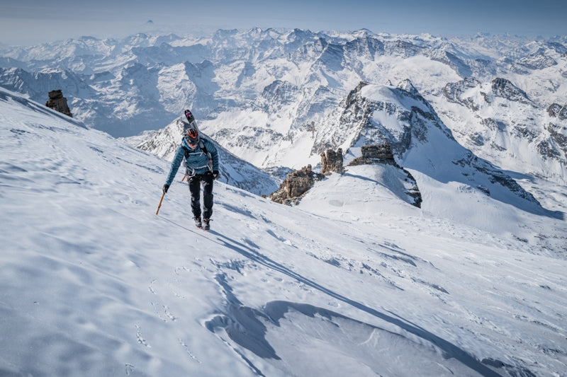
7 nations, 7 highest summits, 5 days
Watch how Philipp and Adrian's project unfolded!
Reaching the summit of Mont Blanc took everything Philipp and Adrian had in the tank. They began their climb of the highest mountain in the European Alps at 01:30 AM and, even though they had worked on acclimatization, they suffered on their way up and faced icy conditions. The ski down, involving crossing crevasses, took a brutal three hours.
“When we arrived back at the car 11 hours and 30 minutes after we had set out we were both super done,” Philipp says. “We both had headaches and had to travel by car for two and a half hours to Zermatt, sleep for two to three hours and get up at 2 AM to start over again to climb Dufourspitze.
“It was crazy, because for many mountaineers just doing one of the highest summits in the Alps is a big achievement, but we climbed seven in five days. For me, it’s still unbelievable because it happened so quickly that it hasn’t really sunk in yet.”
The 7 summits project
They started their adventure on March 26 at 06:00 AM, first climbing Italy’s Gran Paradiso. The goal was to climb the highest summit in each of the seven alpine nations - Italy, France, Switzerland, Liechtenstein, Germany, Austria and Slovenia - in seven days. However, weather forecasts predicted snow and harsh conditions on the last two peaks, leaving Philipp and Adrian no choice but to do all seven summits in five days, in this order:
March 26: Gran Paradiso (4061 m), Italy. March 27: Mont Blanc (4807 m), France.March 28: Dufourspitze (4634 m), Switzerland.March 29: Vorder Grauspitz (2599 m), Liechtenstein.March 29: Zugspitze (2962 m), Germany.March 30: Grossglockner (3798 m), Austria.March 30: Triglav (2864 m), Slovenia.
The project was a year in the making and originally involved a team of four, but a sickness and a death in one of the team’s families meant two of the four had to withdraw at the last minute, leaving Philipp and Adrian to scramble to keep the project from collapsing. To avoid piling pressure on themselves, they decided to keep their goal quiet until they reached the summit of Liechtenstein’s Vorderer Grauspitz.
Battling the conditions and sleep deprivation
They realized they needed to climb all seven summits in five days rather than seven after climbing Vorder Grauspitz and seeing a weather forecast predicting snow in the Alps. At that point, it was full steam ahead, with little time for rest and recovery. They only slept 14 hours over the five days, which included napping in the car - with damp clothes and cold bones - while driving from one mountain to the next.
“We had to be really focused because of the route navigation,” Philipp says. “We followed the tracks on our Suunto watches. This helped a lot because it gave us confidence and saved time.”
The stats
187 km17,001 m 111h40m
All images: © Philipp Reiter
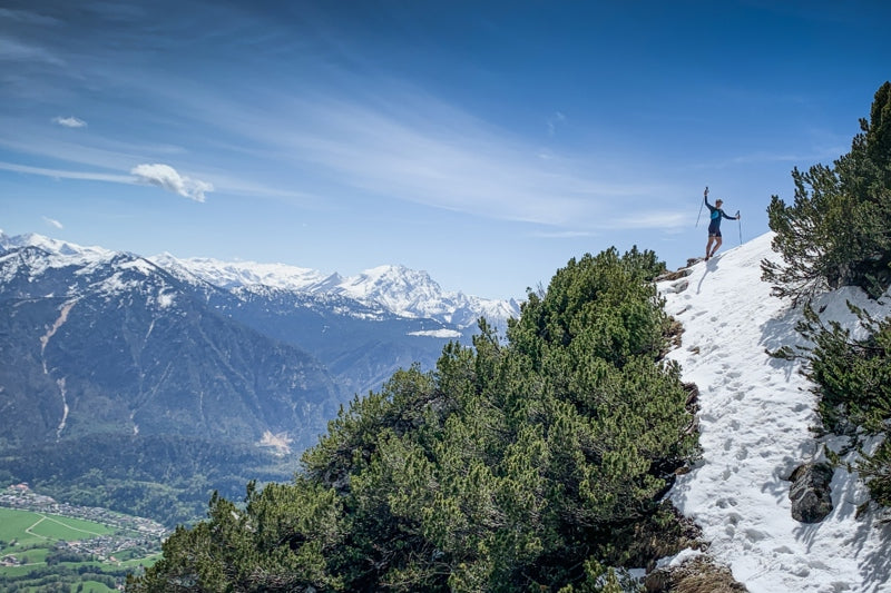
Vertical Week competition winners
One of the reasons we’ve continued pushing World Vertical Week every year since its inauguration in 2016 is because it brings out the best in our Suunto community. People get outside more and push themselves, and many do some truly big days.
The World Vertical Week competition captures some of the best of it. We look forward to scrolling through all the images the community shares and tags via #verticalweek. Thanks to everyone who participated in this spring 2022 edition.
As always, we selected three winners who will each receive a Suunto 9 Peak. Congratulations!
And the winners are …
Everesting the Bastille in Grenoble
You can’t get a much bigger day than what @danielott_atalps pulled off in Grenoble, France. He competed in the second edition of the Everstille 2022 and was one of four people who climbed the Bastille hill above the city 33 times, adding to 8848 m, the height of Mt Everest.
“I read about Suunto vertical week last year and was fascinated by the concept of trying to accumulate as much elevation as possible,” Daniel says. “I wanted to participate then, but it always fell on the week of my exams, so I couldn't participate. This year, I was thrilled that the Everstille, the everesting race I did, fell in the time frame of the vertical week, so I signed up immediately.
“Everestille is a race organized by Tri-Haut, an association based in Grenoble that aims to improve the waste management in the Khumbu Region below Everest. The goal of the race is to run the Bastille, as many times as possible.”
Love in the Swedish mountains
Mother Nature turned it on for @josefintrogen on a ski trip in the Sälen ski resort in Sweden. It was the first time she participated in World Vertical Week and probably won’t be her last.
“We went cross-country skiing and downhill-skiing and it was a perfect weekend with sunshine, snow and what we call ‘Sweden’s fifth season’ or ‘spring-winter’,” Josefin explains. “It basically means there’s still enough snow to go skiing without problems, but warm enough to ski in a base layer only (this weekend it was about +10°C). Every day we bought soup for lunch and made a couch in the snow to enjoy it out in the sun before continuing our tour.”
Passionate mum and daughter skimo team
Her first Vertical Week, @monivieregg took her six-year-old daughter out into the Bavarian mountains on a skimo tour. The ascent is always challenging because Monika has a small frame and pulling her 20 kg daughter up the mountain behind takes everything she’s got.
“We life very close to the Alps and the tour in the pic was at a former ski slope, called Blickner Alm at the Hochfelln,” Monika says. “My daughter really loves skiing uphill and she did a very, very good job downhill. At every carve she did I could hear a ‘hui’, ‘nice’ and ‘yipee’. She had a few falls, but after every one she got up and told me nothing happened, ‘keep going faster I want to ski on’. We both are really satisfied after a tour and we look forward to the next one.”
Big results from World Vertical Week 22
After the fall edition of World Vertical Week 2021, we were wowed by a 43% jump in participation, but now we are blown away again because we’ve had a 79% participation increase in this edition of World Vertical Week. That means there’s been a 155% increase over the last year. What’s going on people? Can’t get enough of those hills?
As we do after every edition of World Vertical Week, we have collected the data, drilled down into it, and looked at who climbed the most and what sports gained the most meters. Read on for the results!
Participation
This edition, 125,000 people participated. That’s up from 70,000 in the 2021 fall edition, and up from 49,000 in the 2021 spring edition. We’re really impressed by this and wonder if the big increase is because, post-pandemic, races are happening again and more of us have signed up and want to get back into focused training.
Big performances
We discovered 86 people in the Suunto community climbed more than 10,000 m of ascent over the week. That’s up from 59 in fall 2021, and only nine in spring 2022. Well done you hardcore vert chasers!
There were 301 activities recorded that involved more than 3,500 m of ascent. Those are big days out - nice work! During the 2021 fall edition there were only 218, and only 89 in spring 2021. The only way is up!
For activities with more than 2000 m of ascent there were 1,183 activities recorded and 7,287 activities recorded that involved more than 1000 m of ascent.
Number of activities with more than 1000 m of ascent by activity
Ski touring: 2197 (30%)Trail running: 1993 (27%)Cycling: 767 (11%)Running: 682 (9%)
Number of activities with over 2000m of ascent by activity
Trail running: 354 Ski touring: 290Running: 167Cycling: 134
Austria remains on the throne
Once again the alpine nation has come out on top for the highest average ascent per country. This time it’s average was slightly lower than previous edition, but still neck and shoulders above second place winner, Italy. Austria has held first place in this category for six of the last seven editions. It only lost its crown in 2019, falling to fifth place. It also deserves kudos for coming in the top five of five other categories!
Go Italy!
Italy deserves some love for coming in second place in seven different categories, including the highest average and total ascents per country. Ski touring, mountaineering, trail running, mountain biking, hiking and cycling - Italy recorded the second highest average ascent per country for all of these sports. Mama mia!
Average ascent per country
Total ascent per country
Spain
Italy
France
Austria
Average ascent by activity type
Top 5 nations in different activity types
Ski touring
The average ascent for all countries was 916 m.
Switzerland, 1102 m
Italy, 1015 m
France, 1003 m
Austria, 955 m
Germany, 950 m
Mountaineering
The average ascent for all countries was 645 m.
Austria, 839 m
Italy, 753 m
Germany, 734 m
Poland, 714 m
Japan, 676 m
Trail running
The average ascent for all countries was 437 m.
Japan, 978 m
Italy, 664 m
Portugal, 617 m
Malaysia, 590 m
Slovenia, 558 m
Mountain biking
The average ascent for all countries was 359 m.
Switzerland, 523,5 m
Italy, 523,1 m
Slovenia, 487 m
Austria, 476 m
Spain, 454 m
Hiking
The average ascent for all countries was 225 m.
Malaysia, 457 m
Italy, 434 m
Slovakia, 418 m
Croatia, 412 m
Japan, 382 m
Nordic skiing
The average ascent for all countries was 185 m.
Slovenia, 410 m
Czech Republic, 369 m
Austria, 291 m
Poland, 282 m
Germany, 264 m
Cycling
The average ascent for all countries was 181 m.
Spain, 406 m
Italy, 373 m
Portugal, 309 m
Switzerland, 276 m
Slovenia, 269 m
Running
The average ascent for all countries was 95 m.
Bulgaria, 202 m
Ireland, 180 m
New Zealand, 168 m
Switzerland, 154 m
Chile, 149 m
Lead image: © Philipp Reiter
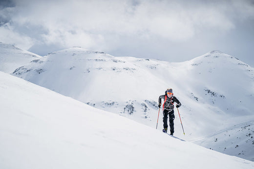
10 Suunto features for vertical gain
From cycling to mountaineering, whatever your favorite outdoor sport, one thing we all have in common is the love and loathing of long, grueling ascents. They are immensely satisfying, give us a sense of achievement - and the incredible views that make it all worthwhile - and also smash us to pieces.
Suunto GPS watches come packed with intelligent features designed to help you on your long, arduous climbs. Read on for 10 features to support your vertical efforts.
Know your altitude
Suunto Vertical, Suunto Race, Suunto 9 Peak Pro, Suunto 9 Peak and Suunto 9 Baro use barometric pressure to measure altitude. To get accurate readings, you need to define an altitude reference point. This can be your current elevation if you know the exact value. Set your reference point from the settings under ‘Outdoor’.
Alternatively, you can use FusedAlti to set your reference point automatically. The FusedAlti™ provides an altitude reading that is a combination of GPS and barometric altitude. It minimizes the effect of temporary and offset errors in the final altitude reading.
Suunto 5 Peak and other GPS watches that don’t have a barometer use GPS to measure altitude. Under optimal signal conditions, eliminating potential errors typical in calculating GPS position, the GPS altitude reading should give a pretty good indication of your elevation. If you need good elevation readings, ensure your GPS accuracy is set to Best during the recording.
Follow your route’s altitude profile
If you are navigating a route that has altitude information, you can also navigate based on ascent and descent using the altitude profile display. While in the main navigation display (where you see your route), press the middle button to switch to the altitude profile display.
The altitude profile display shows you the following information:top: your current altitudecenter: altitude profile showing your current positionbottom: remaining ascent or descent
See your vertical speed
Vertical speed is a great way to measure your pace in the mountains. Set vertical speed as one of the data fields in your preferred sport mode in Suunto app. (Here’s how to customize your sport modes.)
Comparable to running pace on a flat surface, vertical speed takes into account only the altitude as a means of measurement. It’s a really useful performance indicator because it’s a direct measurement of how fast you’re going uphill.
Vertical speed is a great way to pace an effort in an uphill lap. This also helps you estimate how long the climb will take for you – if you know the total ascent. The vertical speed is shown as meters per minute or meters per hour (or alternatively ft/min or ft/hr).
Monitor your Normalized Graded Pace
The Normalized Graded Pace (NGP) feature calculates your pace based on GPS location information that takes into account the changes in grade and intensity. NGP really shines as a feature when applied to calculating your pace on undulating or hilly terrain. Like a cycling power meter, NGP tells runners or speed hikers how much power is going into their workout.
Boost your hill training with SuuntoPlus Climb
Hill repeats are an essential part of an outdoor athlete’s workout repertoire. To make the hard work pay off, pacing is key. SuuntoPlus™ Climb feature does just that: it gives you real-time insights on your effort and motivates you to keep going.
The same goes for longer hikes, too: once you learn what kind of ascent speeds are sustainable for you, you can use this feature to pace your way up accordingly.
To use SuuntoPlus™ features on the Suunto watch, activate them before starting an activity: Select your preferred activity type and – before hitting start – go down to the options menu and select your preferred SuuntoPlus feature, like Climb. The SuuntoPlus feature you chose, will be added and available as an extra screen during the session.
Watch your intensity zones
Achieving faster ascents takes dedication and patience. As sports scientist Susi Kraft explains here, the challenging thing about improving vertical speed is hill training usually maxes out our heart rate, reducing oxygen supply and taking us from aerobic to anaerobic exercise.
With Suunto’s intensity zones, you can monitor how hard you’re exerting yourself on a climb and when you should slow it down or even take a breather. There are five different zones, numbered 1 (lowest) to 5 (highest), defined by default as percentage ranges based on your maximum heart rate (max HR).
Learn how to define your personal heart rate zones here!
Your watch screen shows you which zone you are in as your exercise. Blue represents zone one, green is zone two, then yellow, orange and red, for zones three, four and five, respectively. When you stay in the first three zones, particularly zones one and two, you are doing aerobic exercise and training your base fitness. While in zones four and five you are moving into anaerobic exercise.
Before you set out on a big climb, consider the distance and likely duration of your planned exercise, including any return trip back down. Monitor your intensity zones on the climb and make sure you don’t overdo it too soon. Ensure you have enough fuel in the tank to get back down in good form.
Review your elevation gain with Suunto app
To see a profile of the elevation you gained in a particular activity, open the activity in Suunto app and click on the map. A graph will appear that profiles the ascent and descent. You can then select your heart rate or pace, as examples, to layer over it.
To analyze your workouts on a bigger screen, give Suunto app a go on an iPad or an Android tablet.
Plan your route with 3D maps
To get a better sense of the sort of vertical challenge a route might be when you’re planning it Suunto app, switch from 2D maps to 3D maps. Zoom in and move around to get a lay of the land and to design a route with as much elevation gain as you can handle!
View and share 3D animations
With 3D video animations in Suunto app, you can watch an activity as a short animation that gives a better sense of the terrain. Proud of your effort? Then share a link to the activity with friends or family and they will be able to see the 3D animation as well – even on the big screen. To share an activity, tap the sharing icon and select ‘Share link to activity’. Add a description and photos to enhance the experience and to tell the full story.
Have a backup with SuuntoPlus Safe - My Location
If you’re heading out into alpine or mountainous terrain, safety is paramount. Weather in the mountains can change abruptly and a relatively minor injury at altitude can present a serious risk of exposure.In the event something goes wrong up there, the SuuntoPlus Safe - My Location feature provides crucial information to rescue teams. It provides location info and the direct distance and altitude from the starting place. Consider it a back up.
Images by Philipp Reiter


